Data acquisition unit, system and method for geophysical data
a geophysical data and data acquisition technology, applied in wave based measurement systems, instruments, reradiation, etc., can solve problems such as a large amount of noise in gathered survey data
- Summary
- Abstract
- Description
- Claims
- Application Information
AI Technical Summary
Benefits of technology
Problems solved by technology
Method used
Image
Examples
Embodiment Construction
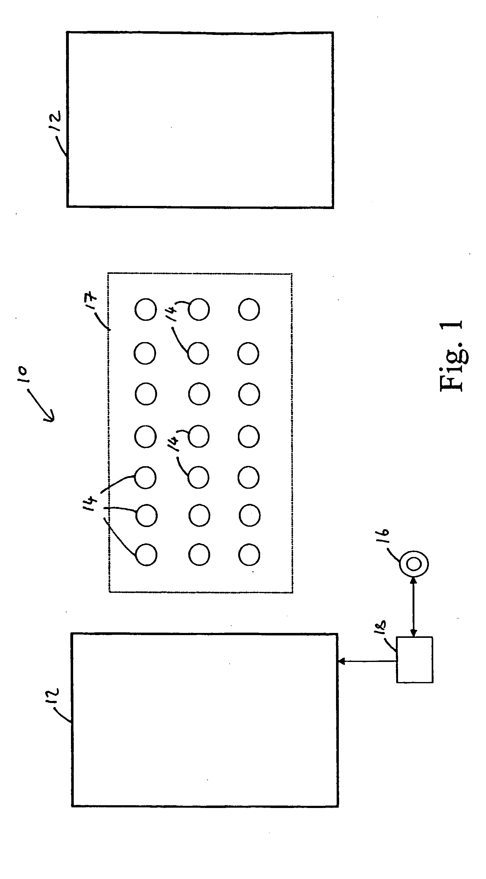
[0077] Referring to FIG. 1 of the drawings, there is shown a data acquisition system 10 for gathering geophysical data during a geophysical survey. In this example, the system 10 is a TEM (transient electromagnetics) type system arranged to generate and sense magnetic fields, although it will be understood that the invention is equally applicable to other geophysical surveys, such as geophysical surveys based on electric fields or seismic measurements, including MT (magneto-telluric) and IP (induced polarisation) type surveys.
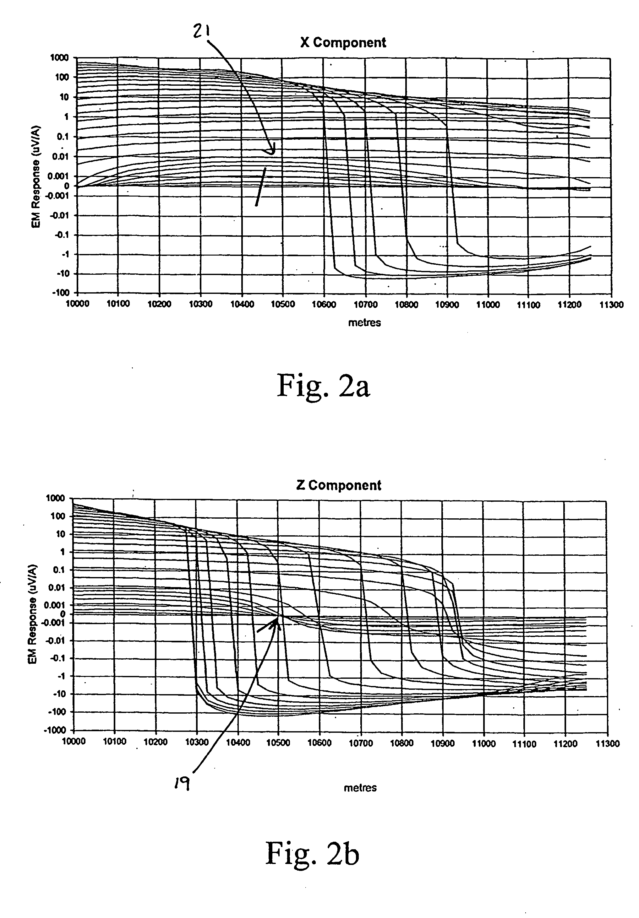
[0078] An example of responses obtained from a modelled fixed-loop TEM type survey for a conductive target disposed at a depth of the order of 500 m is shown in FIGS. 2a and 2b, where FIG. 2a shows a profile for an X component of a response and FIG. 2b shows a profile of a Z component of the response. The responses are displayed in units of microvolts per transmitter amp for coil sensors of effective area 10,000 sqm. At delay times greater than 250 mS, that is...
PUM
 Abstract
Description
Claims
Application Information
 - R&D
- Intellectual Property
- Life Sciences
- Materials
- Tech Scout
- Unparalleled Data Quality
- Higher Quality Content
- 60% Fewer Hallucinations
Browse by: Latest US Patents, China's latest patents, Technical Efficacy Thesaurus, Application Domain, Technology Topic, Popular Technical Reports.
© 2025 PatSnap. All rights reserved.Legal|Privacy policy|Modern Slavery Act Transparency Statement|Sitemap|About US| Contact US: help@patsnap.com


