Time correcting method by satellite positioning

A technology of satellite positioning and time correction, which is applied to beacon systems, instruments, and measuring devices using radio waves, and can solve problems such as troubles, misunderstandings, and troubles

Inactive Publication Date: 2006-11-01
MITAC COMP (SHUN DE) LTD +1
View PDF0 Cites 8 Cited by
  • Summary
  • Abstract
  • Description
  • Claims
  • Application Information

AI Technical Summary

Problems solved by technology

[0008] However, modern technology is changing with each passing day, and it is not uncommon to carry a mobile communication device with you. Because flying or traveling often travels to and from different time zones, the time on the mobile device often needs to be manually corrected to the local time, or other such as business activities. In different regions, if the time of the device still stays at the local time, it will cause confusion or misunderstanding, and the place of life is unfamiliar, and the customs and customs of different regions are different. It is a troublesome thing to ask people or check online
In a general PDA or other communication products, although a GPS device is installed, it is not used to update the system time, causing the user to use other methods to obtain the desired time

Method used


Image

  • Time correcting method by satellite positioning

Examples


Embodiment Construction

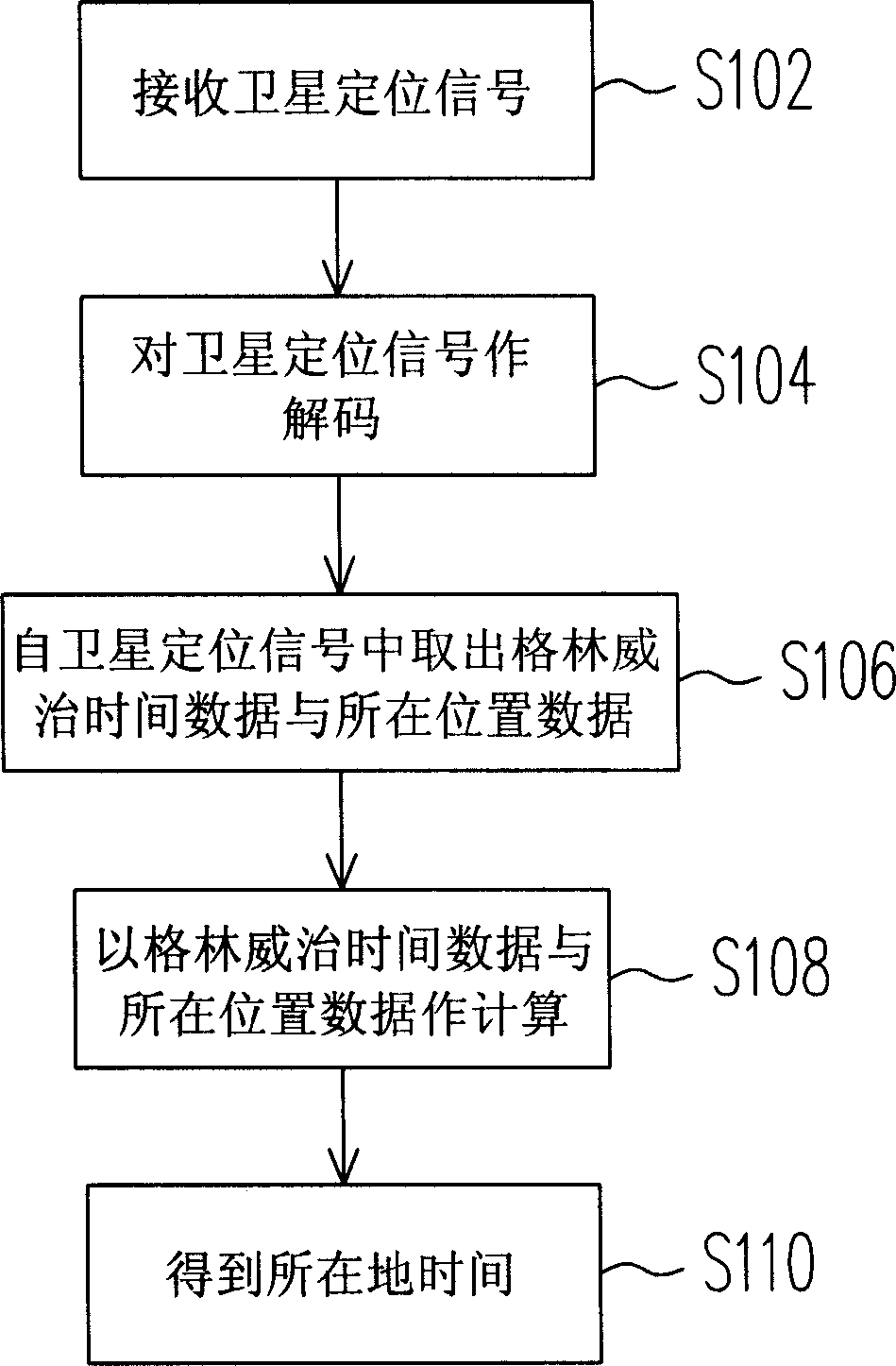
[0018] Please refer to figure 1 , which shows a flowchart of steps of a method for correcting time by satellite positioning according to a preferred embodiment of the present invention. The steps of this method are suitable for electronic devices with GPS, and this electronic device can be, for example, a notebook computer (Note Book, referred to as NB), a handheld palm computer (Handheld PC, referred to as HPC), a smart mobile phone (Smart Phone), Personal digital assistant (Personal Digital Assistant, PDA for short), pocket computer (Pocket PC), but not limited thereto.

[0019] In this embodiment, the steps of the method are that after the user activates the electronic device, since the electronic device is equipped with GPS, the electronic device will receive the satellite positioning signal from the GPS satellite (S102).

[0020] Next, the electronic device decodes the received satellite positioning signal ( S104 ). Wherein, the action of decoding the satellite position...


PUM


Abstract

A method for calibrating time by satellite positioning includes receiving a satellite positioning signal and decoding said signal by electronic unit then picking up Greenwich time data and local position data from satellite positioning signal, obtaining local time by calculating obtained Greenwich time and local position data to let electronic unit automatically update its time to be accurate local time.

Description

【Technical field】 [0001] The present invention relates to a method for correcting time, and more particularly relates to a method for automatically correcting the time of an electronic device by utilizing GMT and longitude and latitude data attached to satellite signals. 【Background technique】 [0002] The Global Positioning System (GPS) is developed by the U.S. government. The entire system is roughly divided into the following three parts: [0003] 1. Space satellite part: It is composed of 24 orbiting satellites, divided into six orbits, running at an altitude of about 20,200 kilometers, and orbiting the earth for about 12 hours. Each satellite continuously transmits radio waves carrying satellite orbit data and time, providing various receivers on the earth for application. [0004] 2. Ground control part: This is to track and control the operation of the above-mentioned satellites. The ground control station set up is mainly responsible for correcting and maintaining v...

Claims


Application Information

Patent Timeline
Patent Type & Authority Applications(China)
IPC IPC(8): G01S1/24G01S1/08
Inventor 彭弘裕
Owner MITAC COMP (SHUN DE) LTD
Why Eureka
Try Eureka