Marine intelligent navigational system based on MapX digital chart
An intelligent navigation and navigation system technology, applied in the field of navigation systems, can solve problems such as low precision, rough digital charts, professional defects in digital chart production and processing, and achieve the effect of improving efficiency
- Summary
- Abstract
- Description
- Claims
- Application Information
AI Technical Summary
Problems solved by technology
Method used
Image
Examples
Embodiment Construction
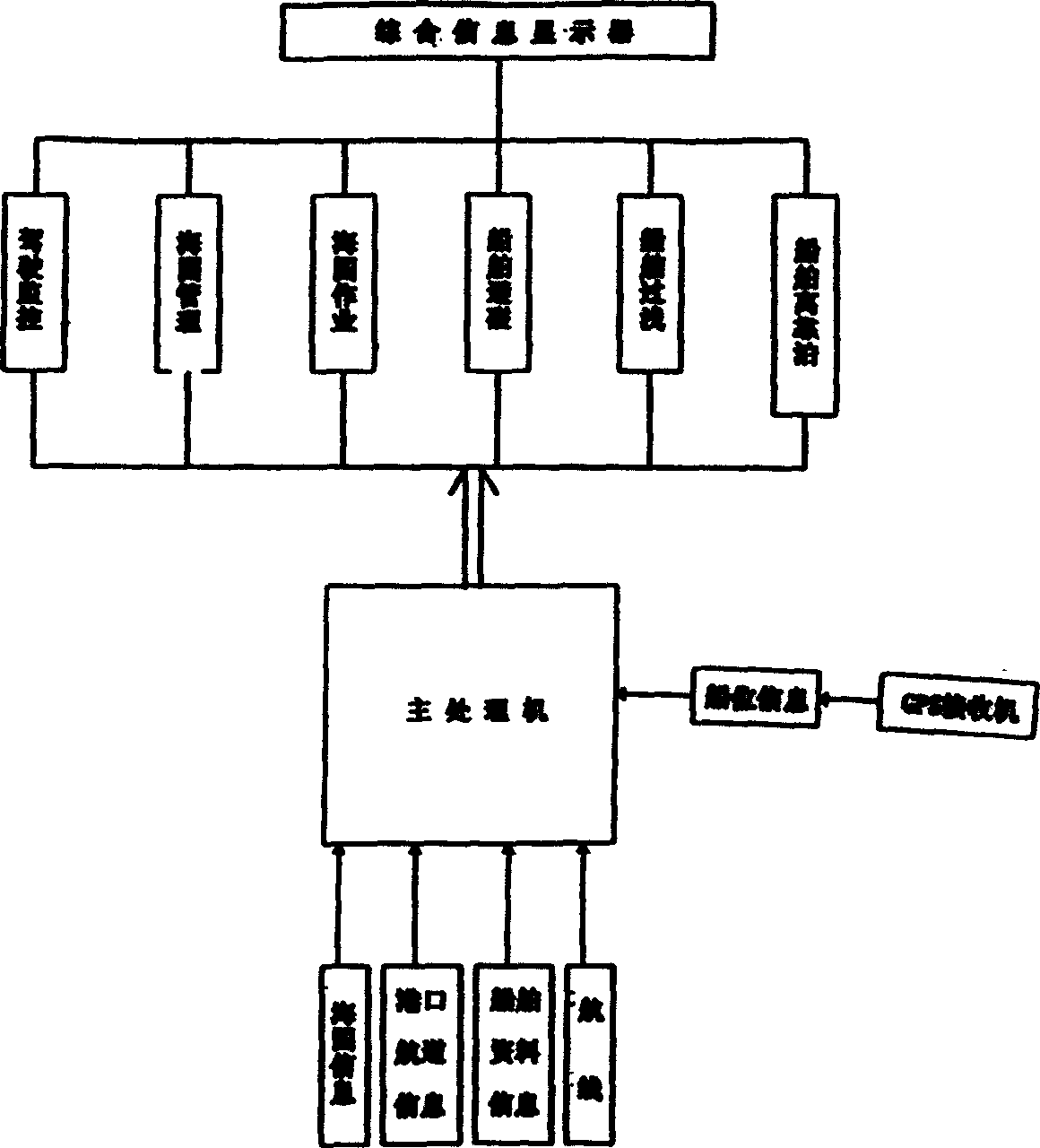
[0011] The hardware part of the present invention is mainly composed of an industrial control machine with a built-in GPS receiver. The industrial control machine is also provided with a display. In the host system, set a special program to communicate with the built-in GPS receiver, so that the output data of the GPS receiver can be input into the host system in time to participate in intelligent navigation. The built-in GPS is adopted and the volume is small and exquisite, thus ensuring that the whole guide mechanism is beautiful and compact. It also includes a water depth gauge data processing, which is used for real-time detection of water depth to ensure safe navigation. With the installation of AIS equipment on ships, the information of neighboring ships and command stations that can be obtained from the AIS system will be used in the navigation system. Based on this consideration, in this embodiment, the output data of the AIS system is used as an important data input...
PUM
 Abstract
Description
Claims
Application Information
 - R&D
- Intellectual Property
- Life Sciences
- Materials
- Tech Scout
- Unparalleled Data Quality
- Higher Quality Content
- 60% Fewer Hallucinations
Browse by: Latest US Patents, China's latest patents, Technical Efficacy Thesaurus, Application Domain, Technology Topic, Popular Technical Reports.
© 2025 PatSnap. All rights reserved.Legal|Privacy policy|Modern Slavery Act Transparency Statement|Sitemap|About US| Contact US: help@patsnap.com


