
Non-linear registration method for remote sensing image

A non-linear registration, remote sensing image technology, applied in image analysis, image data processing, graphic image conversion and other directions, can solve problems such as difficult to match, and achieve the effects of easy registration, reduced computing time, and fast registration.

Inactive Publication Date: 2004-09-22
SHANGHAI JIAOTONG UNIV
View PDF0 Cites 1 Cited by
  • Summary
  • Abstract
  • Description
  • Claims
  • Application Information

AI Technical Summary

Problems solved by technology

For images of the same area acquired by different acquisition devices, even after perfect calibration and geometric correction, it is often difficult to meet the conditions required for linear registration

Method used

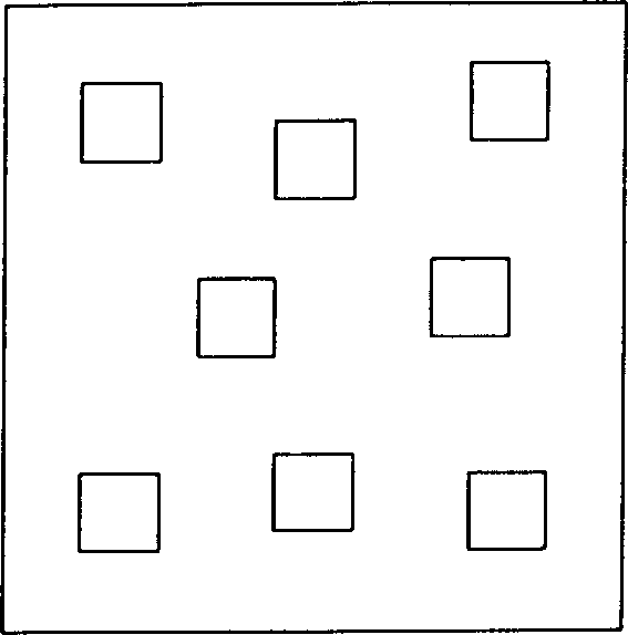
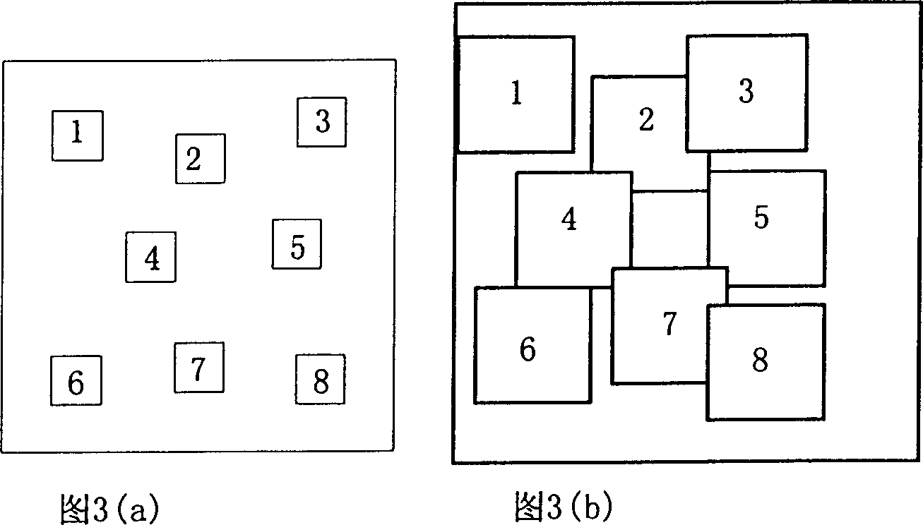

Image

  • Non-linear registration method for remote sensing image
  • Non-linear registration method for remote sensing image
  • Non-linear registration method for remote sensing image

Examples


Embodiment Construction

[0031] The technical solutions of the present invention will be further described below in conjunction with the accompanying drawings and specific embodiments.

[0032] The required input data of the present invention is the image data of following several satellites and aerial remote sensing imaging, and format is standard BSQ and TIFF: 1, IKONOS, Landsat, SPOT, FY-1C etc. different spatial resolutions and satellites of repetition period Satellite images of multi-channel remote sensors; 2. OMIS and PHI hyperspectral aerial remote sensing images; 3. 3K×2K color CCD camera imaging; 4. 6K panchromatic CCD high spatial resolution aerial remote sensing images. The output is in TIFF image format.

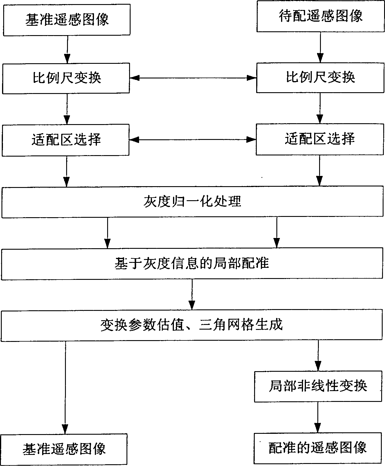
[0033] The present invention adopts such as figure 1 The non-linear registration scheme of remote sensing images shown, the specific implementation steps of triangular grid generation and non-linear transformation for registration and correction are as follows:

[0034] 1. Scale conver...


PUM


Abstract

The non-linear registration method for remote sensing image adopts local triangular match lattice non-linear conversion method. Geographic image with geometrical distortion and non-rigid distortion image are registered, positioned and corrected. The registration and geometrical correction are performed in every triangular local image area with net point as vertex. For fast registration, adapting area are selected via man-power interaction and homonymic characteristic points are searched automatically. The registration between basic image and registered image re registered through the registration between several son images. Position registration and geometrical correction are realized with the son image lattice and image transformation inside the lattice.

Description

Technical field: [0001] The invention relates to a non-linear registration method of remote sensing images, which uses a local triangular grid non-linear transformation registration method to realize registration, positioning and geometric correction for geographic images with geometric distortion and non-rigid distortion images, and belongs to computer information image processing technology field. Background technique: [0002] With the implementation and development of a series of geographic information systems such as digitized city and digitized earth, remote sensing images have received widespread attention because of their large amount of data information. Due to the influence of various factors such as sensors, irradiance, and atmospheric refraction, the original remote sensing image will cause various deformation errors, which cannot meet the requirements of measurement and positioning; When classifying, changing monitoring of feature features, or other application...

Claims


Application Information

Patent Timeline
Patent Type & Authority Patents(China)
IPC IPC(8): G06T3/00G06T7/60
Inventor 庹红娅刘允才
Owner SHANGHAI JIAOTONG UNIV
Learn More