Navigation signal enhancement method based on satellite communication signal

A navigation signal and satellite communication technology, which is applied in the field of satellite navigation, can solve problems such as the expansion of navigation performance without considering the integration of signals, and achieve the effect of improving the utilization rate of satellite resources and reducing system complexity

Pending Publication Date: 2022-06-21
CHINA ACADEMY OF SPACE TECHNOLOGY
View PDF5 Cites 0 Cited by
  • Summary
  • Abstract
  • Description
  • Claims
  • Application Information

AI Technical Summary

Problems solved by technology

Although the characteristics of communication signals have been considered, the design of navigation enhancement signals has not been fully integrated into the communication system, and the navigation performance scalability of fusion signals has not been considered.

Method used


Image

  • Navigation signal enhancement method based on satellite communication signal
  • Navigation signal enhancement method based on satellite communication signal
  • Navigation signal enhancement method based on satellite communication signal

Examples


Embodiment Construction

[0029] Exemplary embodiments of the present disclosure will be described in more detail below with reference to the accompanying drawings. While exemplary embodiments of the present disclosure are shown in the drawings, it should be understood that the present disclosure may be embodied in various forms and should not be limited by the embodiments set forth herein. Rather, these embodiments are provided so that the present disclosure will be more thoroughly understood, and will fully convey the scope of the present disclosure to those skilled in the art. It should be noted that the embodiments of the present invention and the features of the embodiments may be combined with each other under the condition of no conflict. The present invention will be described in detail below with reference to the accompanying drawings and in conjunction with the embodiments.

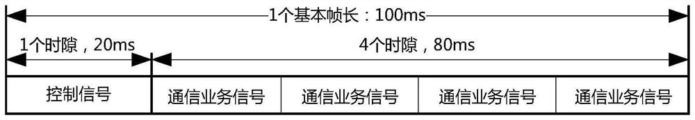
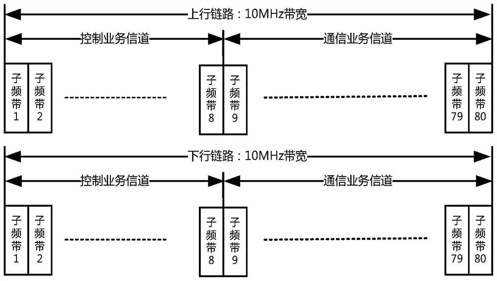
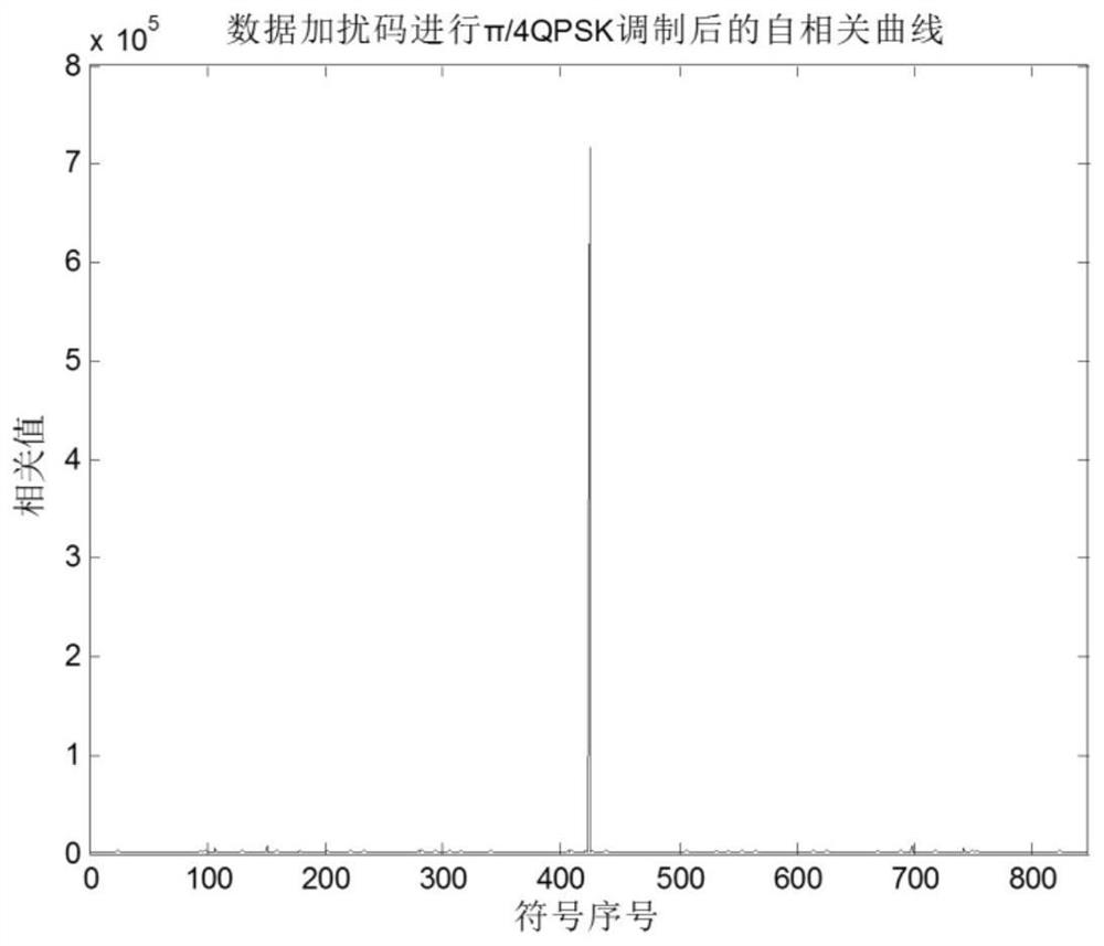
[0030] This embodiment provides a navigation signal enhancement method based on satellite communication signals, incl...


PUM


Abstract

The invention discloses a navigation signal enhancement method based on a satellite communication signal, and the method comprises the following steps: a satellite receives an access request of a user terminal in a service area, determines whether a navigation signal enhancement authorized user application exists in a certain beam coverage area, and determines a navigation signal wireless resource configuration mode; the satellite generates a navigation signal based on the satellite communication signal, and modulates and transmits the navigation signal based on the satellite communication signal by using an idle channel or a channel allocated according to the authorized user level; a user terminal acquires a pseudo-range measurement result and a satellite navigation message between the user terminal and a satellite by capturing, tracking and demodulating a navigation signal based on a satellite communication signal, and then determines the position and time information of the user terminal through a positioning algorithm. According to the invention, multi-level navigation positioning time service can be provided for users with different permissions as required through resource allocation.

Description

technical field [0001] The invention belongs to the technical field of satellite navigation, in particular to a navigation signal enhancement method based on satellite communication signals. Background technique [0002] Global Navigation Satellite System (GNSS), as an important space infrastructure, is playing a huge role in the application fields of national politics, economy, military, science and technology and culture. At present, the four major global satellite navigation systems, namely the GPS system in the United States, the GLONASS system in Russia, the Galileo system in Europe and the Beidou satellite navigation system in China, can provide basic navigation, positioning and timing services for global navigation users. Then, the GNSS signal landing power is limited, and the satellite position, signal frequency and structure are all easily obtainable information, which makes the GNSS system extremely vulnerable to electronic jamming, blocking and spoofing. In urban...

Claims


Application Information

Patent Timeline
IPC IPC(8): G01S19/24G01S19/30G01S19/42
CPCG01S19/24G01S19/30G01S19/42
Inventor 李平周鸿伟张旭康成斌陈秋丽赵旖旎崔小准李星姜坤周会超
Owner CHINA ACADEMY OF SPACE TECHNOLOGY
Why Eureka
Try Eureka