Slope surveying and mapping positioning calibration device and use method thereof
A calibration device and slope technology, applied in the field of surveying and mapping engineering, can solve the problems of long time-consuming, cumbersome operation, bending and deformation of excavation line, etc., and achieve the effect of improving excavation accuracy, convenient use and simple structure
- Summary
- Abstract
- Description
- Claims
- Application Information
AI Technical Summary
Problems solved by technology
Method used
Image
Examples
Embodiment Construction
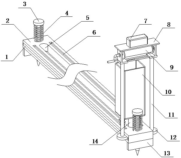
[0041] A slope mapping positioning calibration apparatus of the present invention is implemented as follows: comprising a guide component, a positioning component disposed on the guide assembly and a marking component disposed on the guide component,
[0042] It is characterized in that, the positioning component moves along the guide component to locate the excavation point, the marking component moves along the guide component to the excavation point determined by the positioning component to connect the lines, positioning the complete excavation line,
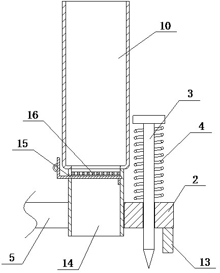
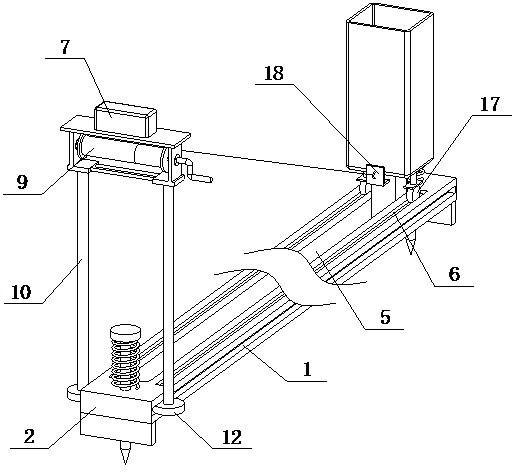
[0043] The guide assembly is composed of a side chute (1), a guide plate (2), an upper chute (6), a guide through groove (5), a fixed pile (3) and a supporting plate (13), the guide plate (2) is opened in the center of the top surface with a guide groove (5), the guide plate (2) is opened on the top surface with two upper chutes (6), the two upper chutes (6) are located on both sides of the guide groove (5), and the guide groove...
PUM
 Abstract
Description
Claims
Application Information
 - R&D
- Intellectual Property
- Life Sciences
- Materials
- Tech Scout
- Unparalleled Data Quality
- Higher Quality Content
- 60% Fewer Hallucinations
Browse by: Latest US Patents, China's latest patents, Technical Efficacy Thesaurus, Application Domain, Technology Topic, Popular Technical Reports.
© 2025 PatSnap. All rights reserved.Legal|Privacy policy|Modern Slavery Act Transparency Statement|Sitemap|About US| Contact US: help@patsnap.com


