GIS-based survey and management information system for aquatic organisms in Yangtze River
A management information system and aquatic organism technology, applied in the field of Yangtze River aquatic organism survey management information system, can solve the problems of inability to understand the ecological environment of the Yangtze River Basin, unsystematic, and lack of scientific protection methods
- Summary
- Abstract
- Description
- Claims
- Application Information
AI Technical Summary
Problems solved by technology
Method used
Image
Examples
Embodiment
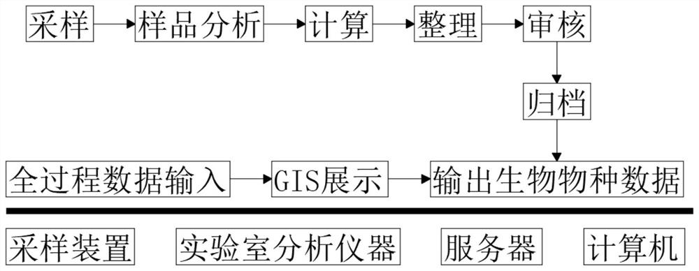
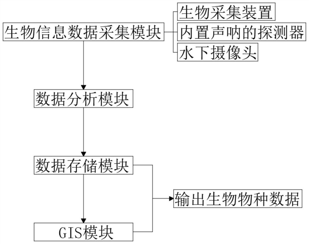
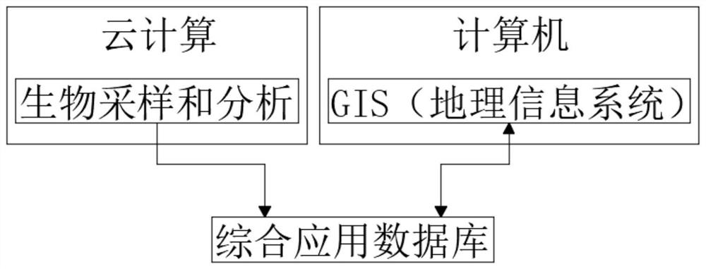
[0025] refer to Figure 1-3 , the present embodiment proposes a GIS-based Yangtze River aquatic organism survey management information system, including a biological information data collection module, a data analysis module, a data storage module and a GIS module:
[0026] The biological information data collection module is set in each monitoring target area of the Yangtze River. The biological information data collection module includes a biological collection device, a detector with built-in sonar and an underwater camera, which are used to collect data sample information of aquatic organisms in the Yangtze River. The biological collection device, built-in Sonar detectors and underwater cameras are mounted on manned or unmanned patrol boats, observation buoys, underwater robots, and underwater fixed observation base stations. Biological collection devices are used to collect samples of aquatic organisms in the Yangtze River, and built-in sonar detectors are used to detect...
PUM
 Abstract
Description
Claims
Application Information
 - Generate Ideas
- Intellectual Property
- Life Sciences
- Materials
- Tech Scout
- Unparalleled Data Quality
- Higher Quality Content
- 60% Fewer Hallucinations
Browse by: Latest US Patents, China's latest patents, Technical Efficacy Thesaurus, Application Domain, Technology Topic, Popular Technical Reports.
© 2025 PatSnap. All rights reserved.Legal|Privacy policy|Modern Slavery Act Transparency Statement|Sitemap|About US| Contact US: help@patsnap.com


