Spatial index processing method and device
A technology of spatial indexing and processing methods, which is applied in special data processing applications, geographic information databases, structured data retrieval, etc.
- Summary
- Abstract
- Description
- Claims
- Application Information
AI Technical Summary
Problems solved by technology
Method used
Image

Examples
Embodiment 1
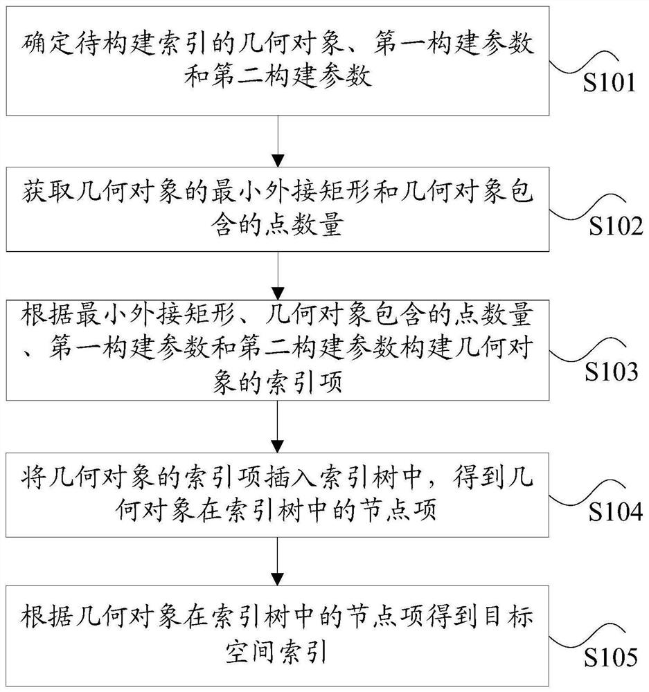
[0036] According to an embodiment of the present invention, an embodiment of a spatial index processing method is provided. It should be noted that the steps shown in the flow charts of the drawings can be executed in a computer system such as a set of computer-executable instructions, and, Although a logical order is shown in the flowcharts, in some cases the steps shown or described may be performed in an order different from that shown or described herein.
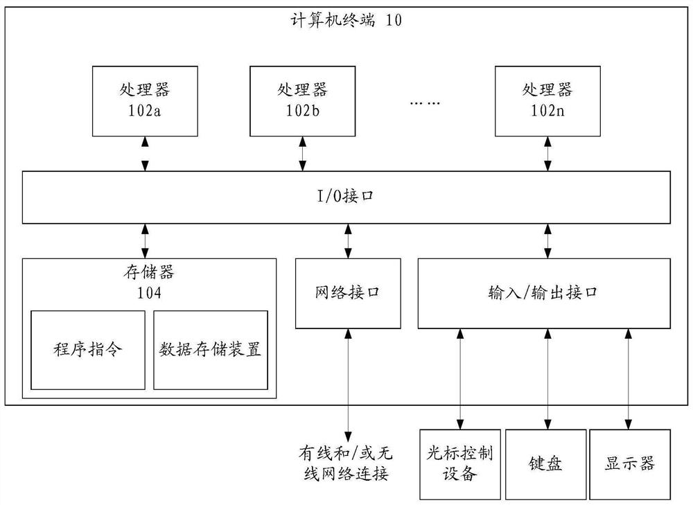
[0037] The method embodiment provided in Embodiment 1 of the present application may be executed in a mobile terminal, a computer terminal, or a similar computing device. figure 1 A block diagram of a hardware structure of a computer terminal (or mobile device) for realizing a spatial index processing method is shown. Such as figure 1 As shown, the computer terminal 10 (or mobile device 10) may include one or more ( figure 1 102a, 102b, ..., 102n are used to show) a processor 102 (the processor 102 may include but not...
Embodiment 2
[0079] According to an embodiment of the present invention, a device for implementing the above spatial index processing method is also provided, such as Figure 7 As shown, the apparatus includes: a first determination unit 701 , a first acquisition unit 702 , a construction unit 703 , a second acquisition unit 704 and a third acquisition unit 705 .
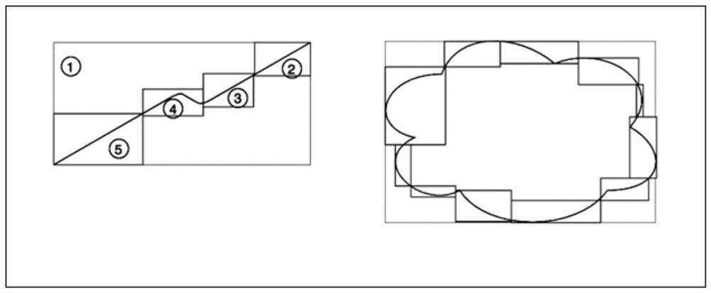
[0080] Specifically, the first determination unit 701 is configured to determine the geometric object to be indexed, the first construction parameter, and the second construction parameter, wherein the first construction parameter is the maximum number of sub-bounding rectangles that the geometric object can be split into, and the second The construction parameter is the maximum number of points contained in each sub-bounding rectangle;
[0081] The first acquisition unit 702 is configured to acquire the smallest circumscribed rectangle of the geometric object and the number of points contained in the geometric object;
[0082]...
Embodiment 3
[0097] Embodiments of the present invention may provide a computer terminal, and the computer terminal may be any computer terminal device in a group of computer terminals. Optionally, in this embodiment, the foregoing computer terminal may also be replaced with a terminal device such as a mobile terminal.
[0098] Optionally, in this embodiment, the foregoing computer terminal may be located in at least one network device among multiple network devices of the computer network.
[0099] In this embodiment, the above-mentioned computer terminal can execute the program code of the following steps in the spatial index processing method of the application program: determine the geometric object to be indexed, the first construction parameter and the second construction parameter, wherein the first The construction parameter is the maximum number of sub-enclosed rectangles that the geometric object can be split into, and the second construction parameter is the maximum number of po...
PUM
 Abstract
Description
Claims
Application Information
 - Generate Ideas
- Intellectual Property
- Life Sciences
- Materials
- Tech Scout
- Unparalleled Data Quality
- Higher Quality Content
- 60% Fewer Hallucinations
Browse by: Latest US Patents, China's latest patents, Technical Efficacy Thesaurus, Application Domain, Technology Topic, Popular Technical Reports.
© 2025 PatSnap. All rights reserved.Legal|Privacy policy|Modern Slavery Act Transparency Statement|Sitemap|About US| Contact US: help@patsnap.com