Geothermal abnormal region extraction method based on multi-scale information fusion
An extraction method and technology of anomalous areas, applied in the field of remote sensing, can solve problems such as missing geothermal anomalies, lack of thermal infrared data verification, etc.
- Summary
- Abstract
- Description
- Claims
- Application Information
AI Technical Summary
Problems solved by technology
Method used
Image
Examples
Embodiment Construction
[0040] The technical solutions of the present invention will be further described below in conjunction with the accompanying drawings and embodiments.
[0041] In this example, the Landsat-8 satellite data obtained in two periods were selected for experimentation. The research area is the entire Qingdao city. The spatial resolution of the multispectral image is 30 meters, and the spatial resolution of the thermal infrared band is 100 meters. The acquisition time is 2017. February 11, 2019 and August 28, 2019.
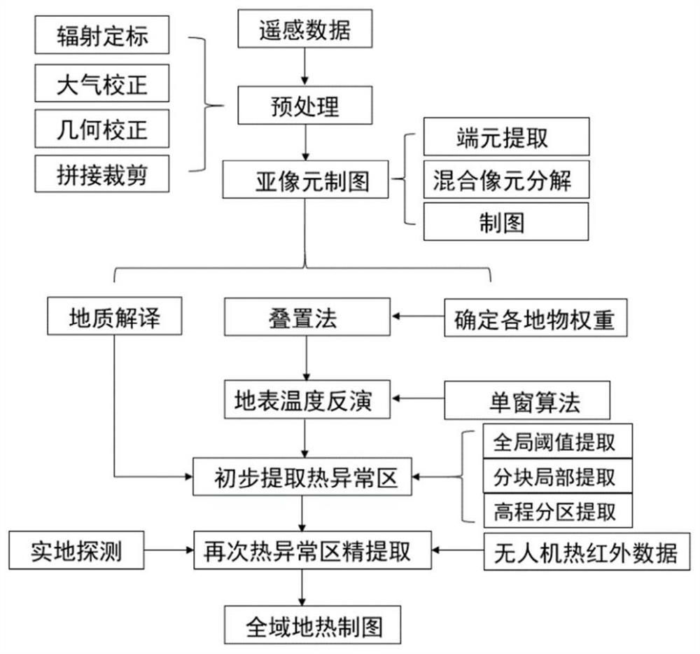
[0042] The geothermal anomaly area extraction method of multi-scale information fusion described in the present invention, such as figure 1 As shown, the steps are as follows:
[0043] Step 1: Acquire images and image preprocessing. In order to reduce the influence of the relative results at different times, firstly, the remote sensing images of the study area in different periods (Qingdao City in summer and winter) were obtained and radiometric calibration, atmospher...
PUM
 Abstract
Description
Claims
Application Information
 - R&D Engineer
- R&D Manager
- IP Professional
- Industry Leading Data Capabilities
- Powerful AI technology
- Patent DNA Extraction
Browse by: Latest US Patents, China's latest patents, Technical Efficacy Thesaurus, Application Domain, Technology Topic, Popular Technical Reports.
© 2024 PatSnap. All rights reserved.Legal|Privacy policy|Modern Slavery Act Transparency Statement|Sitemap|About US| Contact US: help@patsnap.com


