
Portable land area measuring instrument for land planning and design

A technology of planning and design, land area, applied in the direction of measuring devices, instruments, etc., can solve problems such as large measurement errors

Active Publication Date: 2021-06-29
安徽中汇规划勘测设计研究院股份有限公司
View PDF11 Cites 3 Cited by
  • Summary
  • Abstract
  • Description
  • Claims
  • Application Information

AI Technical Summary

Problems solved by technology

[0003]The traditional land area measuring instrument only measures and calculates the area based on longitude and latitude. The measurement error is larger when the land is

Method used


Image

  • Portable land area measuring instrument for land planning and design
  • Portable land area measuring instrument for land planning and design
  • Portable land area measuring instrument for land planning and design

Examples


Embodiment Construction

[0026] The following will clearly and completely describe the technical solutions in the embodiments of the present invention with reference to the accompanying drawings in the embodiments of the present invention. Obviously, the described embodiments are only some, not all, embodiments of the present invention.

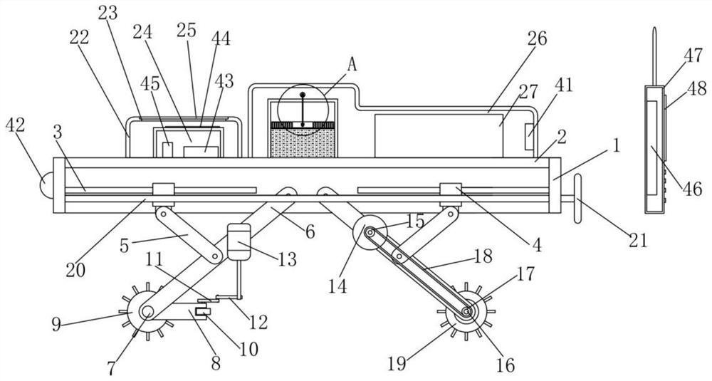
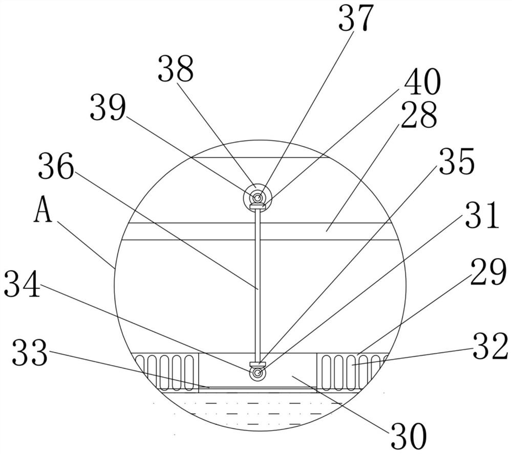
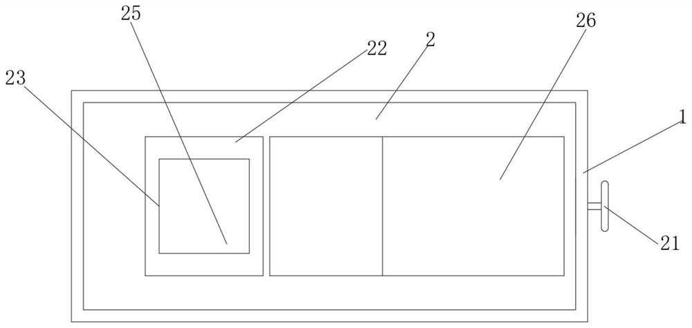
[0027] refer to Figure 1-7, a portable land area measuring instrument for land planning and design, comprising a fixed frame 1, the two sides of the inner cavity of the fixed frame 1 are symmetrically rotated and installed with roller mounting rods 6, and the two sets of roller mounting rods 6 on the left side are far away from the end of the fixed frame 1 A fixed rod 7 is fixedly installed, and the two ends of the fixed rod 7 are all rotatably equipped with an adjusting rod 8, and the ends of two groups of adjusting rods 8 away from the fixed rod 7 are all rotated and installed with a rotating roller 9, and the right side between the two groups of rotating rollers 9...


PUM


Abstract

The invention relates to the technical field of land planning, in particular to a portable land area measuring instrument for land planning design, which comprises a fixed frame, roller mounting rods are symmetrically and rotatably mounted on two side walls of an inner cavity of the fixed frame, and fixed rods are fixedly mounted at one ends, far away from the fixed frame, of the two groups of roller mounting rods on the left side. Adjusting rods are rotatably mounted at the two ends of the fixing rod correspondingly, rotating rollers are rotatably mounted at the ends, away from the fixing rod, of the two adjusting rods correspondingly, a first traction rod is rotatably mounted on the right side between the two rotating rollers, and a steering mechanism is arranged on one side of each adjusting rod. Wheel shafts are rotationally mounted at the ends, away from the fixed frame, of the two groups of roller mounting rods on the right side. Compared with the prior art, the problem that a traditional land area measuring instrument only carries out area measurement calculation according to the longitude and the latitude, and the measurement error is large when the land with the gradient is handled is solved.

Description

technical field [0001] The invention relates to the technical field of land planning, in particular to a portable land area measuring instrument for land planning and design. Background technique [0002] The land area measuring instrument is a field area measuring instrument developed by advanced technologies such as GPS positioning system and embedded single-chip microcomputer. It can quickly measure and map the area, distance, perimeter and other data of land of any shape. It is suitable for farmland, green space, forest, water area It provides a convenient measurement tool for agriculture, forestry, water conservancy, soil management, taxation and other departments and agricultural machinery operation charges. [0003] Traditional land area measuring instruments only measure and calculate the area based on longitude and latitude. The measurement results are more accurate when facing flat land, but the measurement error is larger when dealing with sloped land. Contents ...

Claims


Application Information

Patent Timeline
Patent Type & Authority Applications(China)
IPC IPC(8): G01B21/28
CPCG01B21/28
Inventor 黄天奇
Owner 安徽中汇规划勘测设计研究院股份有限公司
Learn More