Map rendering method and device, equipment and storage medium

A map and rendering technology, applied in the field of image rendering, can solve the problems of many rendering resources and low rendering efficiency, and achieve the effect of reducing rendering resources and improving rendering efficiency

Pending Publication Date: 2021-05-28
GUANGZHOU SOUTH SATELLITE NAVIGATION INSTR
View PDF0 Cites 1 Cited by
  • Summary
  • Abstract
  • Description
  • Claims
  • Application Information

AI Technical Summary

Problems solved by technology

[0004] The present invention provides a map rendering method, device, equipment and storage medium, which solves the problem of large rendering resources and low rendering efficiency in the prior art due to the need to re-render each layer for each data update technical issues

Method used


Image

  • Map rendering method and device, equipment and storage medium
  • Map rendering method and device, equipment and storage medium
  • Map rendering method and device, equipment and storage medium

Examples


Embodiment Construction

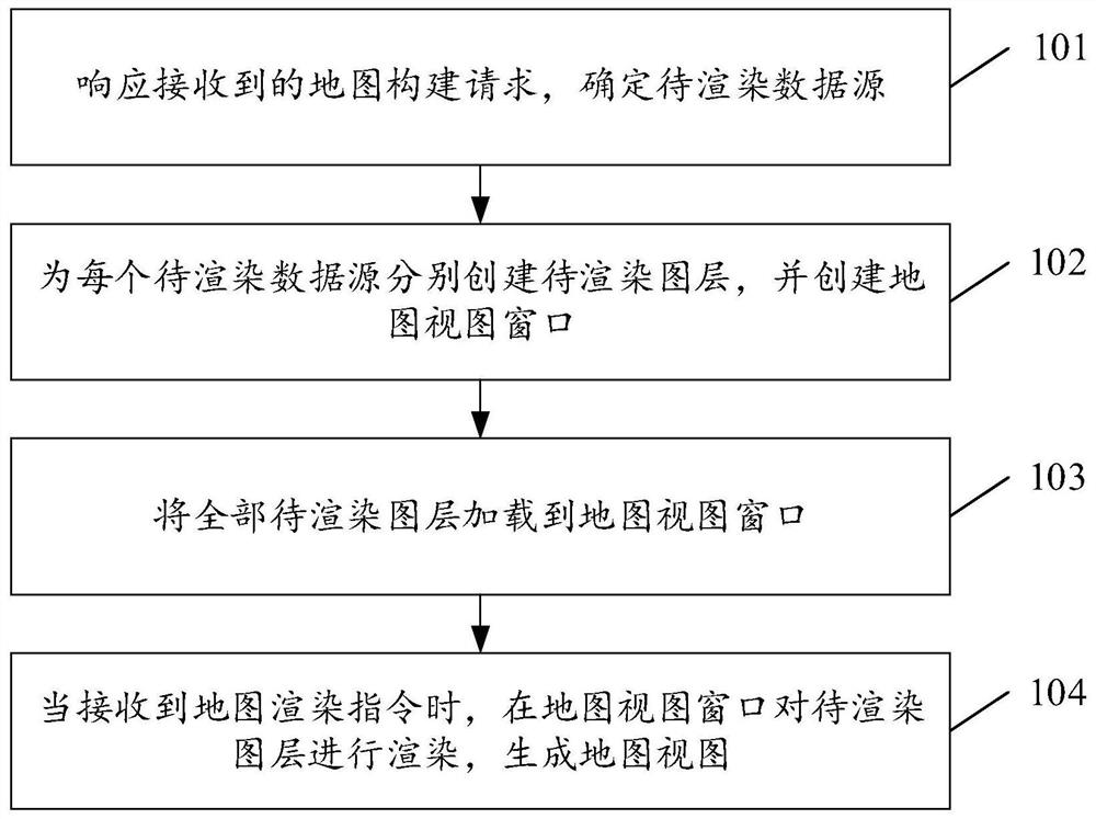
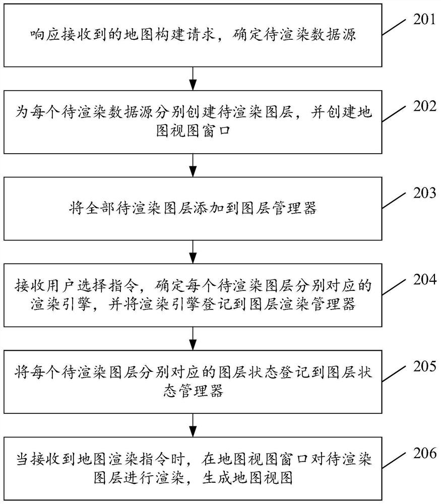
[0054] Embodiments of the present invention provide a map rendering method, device, device, and storage medium, which are used to solve the problems in the prior art due to the need to re-render each layer for each data update. Less efficient technical issues.

[0055]In order to make the purpose, features and advantages of the present invention more obvious and understandable, the technical solutions in the embodiments of the present invention will be clearly and completely described below in conjunction with the accompanying drawings in the embodiments of the present invention. Obviously, the following The described embodiments are only some, not all, embodiments of the present invention. Based on the embodiments of the present invention, all other embodiments obtained by persons of ordinary skill in the art without making creative efforts belong to the protection scope of the present invention.

[0056] see figure 1 , figure 1 It is a flow chart of steps of a map renderi...


PUM


Abstract

The invention discloses a map rendering method and device, equipment and a storage medium, and the method comprises the steps: responding to a received map construction request, and determining a to-be-rendered data source; creating a to-be-rendered layer for each to-be-rendered data source, and creating a map view window; loading all the layers to be rendered to a map view window; and when the map rendering instruction is received, rendering the to-be-rendered layer in the map view window, and generating the map view, so that the used rendering resources are more effectively reduced, and the rendering efficiency is improved.

Description

technical field [0001] The present invention relates to the technical field of image rendering, in particular to a map rendering method, device, equipment and storage medium. Background technique [0002] In GIS, surveying and mapping and other related fields, in addition to loading various online maps, it is also necessary to load various raster data and vector data, such as shp data, tif data, etc. In addition, there are a lot of data that can be abstracted into layers for management, such as ship type during water survey, aircraft for aerial survey, compass, scale, etc. Then how to quickly manage and efficiently render these online maps and data will become a problem that must be solved in the development of such application software. [0003] In the prior art, image rendering is usually performed layer by layer directly every time the map data changes, so as to obtain the target map data. However, the above method needs to re-render each layer every time the data is up...

Claims


Application Information

Patent Timeline
IPC IPC(8): G06T15/00G06T17/05
CPCG06T15/005G06T17/05
Inventor 郝志刚王江林文述生李宁肖浩威马原徐丹龙黄海锋邹盛开
Owner GUANGZHOU SOUTH SATELLITE NAVIGATION INSTR
Why Eureka
Try Eureka