Water and soil loss remote sensing dynamic monitoring method and system, intelligent terminal and storage medium
A dynamic monitoring and remote sensing technology, applied in altitude/level measurement, measuring device, mapping and navigation, etc., can solve problems such as small monitoring range
- Summary
- Abstract
- Description
- Claims
- Application Information
AI Technical Summary
Problems solved by technology
Method used
Image

Examples
Embodiment Construction
[0061] The present invention will be described in further detail below in conjunction with the accompanying drawings.
[0062] This specific embodiment is only an explanation of the present invention, and it is not a limitation of the present invention. Those skilled in the art can make modifications to this embodiment without creative contribution as required after reading this specification, but as long as they are within the rights of the present invention All claims are protected by patent law.
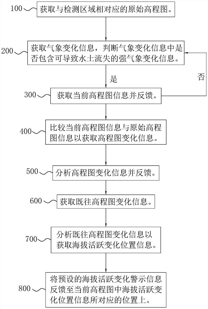
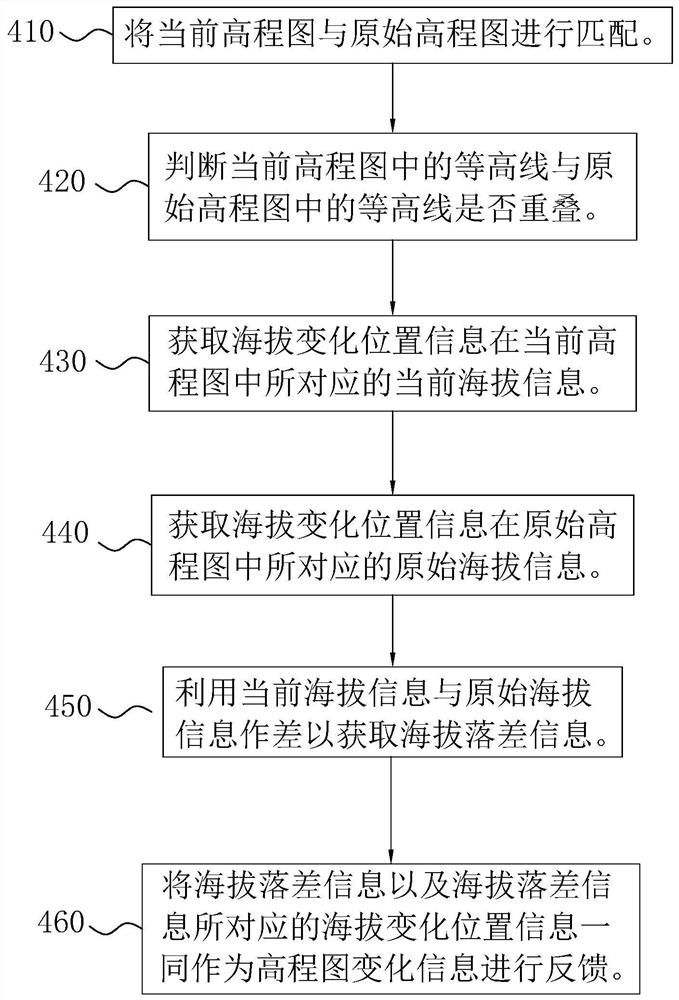
[0063] An embodiment of the present invention provides a remote sensing dynamic monitoring method for soil erosion, including: obtaining the original elevation map corresponding to the monitoring area; obtaining meteorological change information, and judging whether the meteorological change information contains strong meteorological change information that can cause soil erosion; if , then get the current elevation map information and give feedback.
[0064] In the embodiment of...
PUM
 Abstract
Description
Claims
Application Information
 - Generate Ideas
- Intellectual Property
- Life Sciences
- Materials
- Tech Scout
- Unparalleled Data Quality
- Higher Quality Content
- 60% Fewer Hallucinations
Browse by: Latest US Patents, China's latest patents, Technical Efficacy Thesaurus, Application Domain, Technology Topic, Popular Technical Reports.
© 2025 PatSnap. All rights reserved.Legal|Privacy policy|Modern Slavery Act Transparency Statement|Sitemap|About US| Contact US: help@patsnap.com