
Municipal engineering surveying and mapping method and supervision system

A municipal and engineering technology, applied in the field of surveying and mapping, can solve the problems of easy generation of dust, heavy workload in the later period, and reduced data accuracy of surveying and mapping instruments, etc., to achieve the effect of improving accuracy and improving the accuracy of error elimination.

Active Publication Date: 2021-01-05
南京捷鹰数码测绘有限公司
View PDF6 Cites 0 Cited by
  • Summary
  • Abstract
  • Description
  • Claims
  • Application Information

AI Technical Summary

Problems solved by technology

[0003] The method of using the principle of laser ranging in the current surveying and mapping instruments will be disturbed by the change of air refractive index, and dust and other particles are easy to be generated in the construction environment, which will work together with the change of environmental temperature and humidity, reducing the data accuracy of the surveying and mapping instruments , thus weakening the accuracy of municipal engineering surveying and mapping results, affecting the effect of municipal facilities construction according to plan
[0004] There are also some technical solutions on municipal engineering surveying and mapping methods in the prior art. For example, a Chinese patent with application number 2016109075996 discloses a municipal engineering-based surveying and mapping method to solve the problem of low accuracy of geological space measurement schemes in traditional geological surveying and mapping. , the defect of large workload in the later stage, especially the problem of difficult surveying and mapping under the complex geological environment, the surveying and mapping method based on municipal engineering includes the following steps: determining the datum level and datum point; drawing the distribution map of underground pipelines; ground static laser surveying and mapping ;Dynamic laser surveying and mapping on the ground; drawing the surveying and mapping model map of the surveying and mapping area; Reduce the error, simple operation and high efficiency; however, this technical solution does not solve the problem that the accuracy of the surveying and mapping data is weakened by the influence of the refractive index of the air in the use of surveying and mapping instruments, thereby reducing the construction accuracy of municipal engineering

Method used


Image

  • Municipal engineering surveying and mapping method and supervision system
  • Municipal engineering surveying and mapping method and supervision system
  • Municipal engineering surveying and mapping method and supervision system

Examples


Embodiment Construction

[0029] In order to make the technical means, creative features, goals and effects achieved by the present invention easy to understand, the present invention will be further described below in conjunction with specific embodiments.

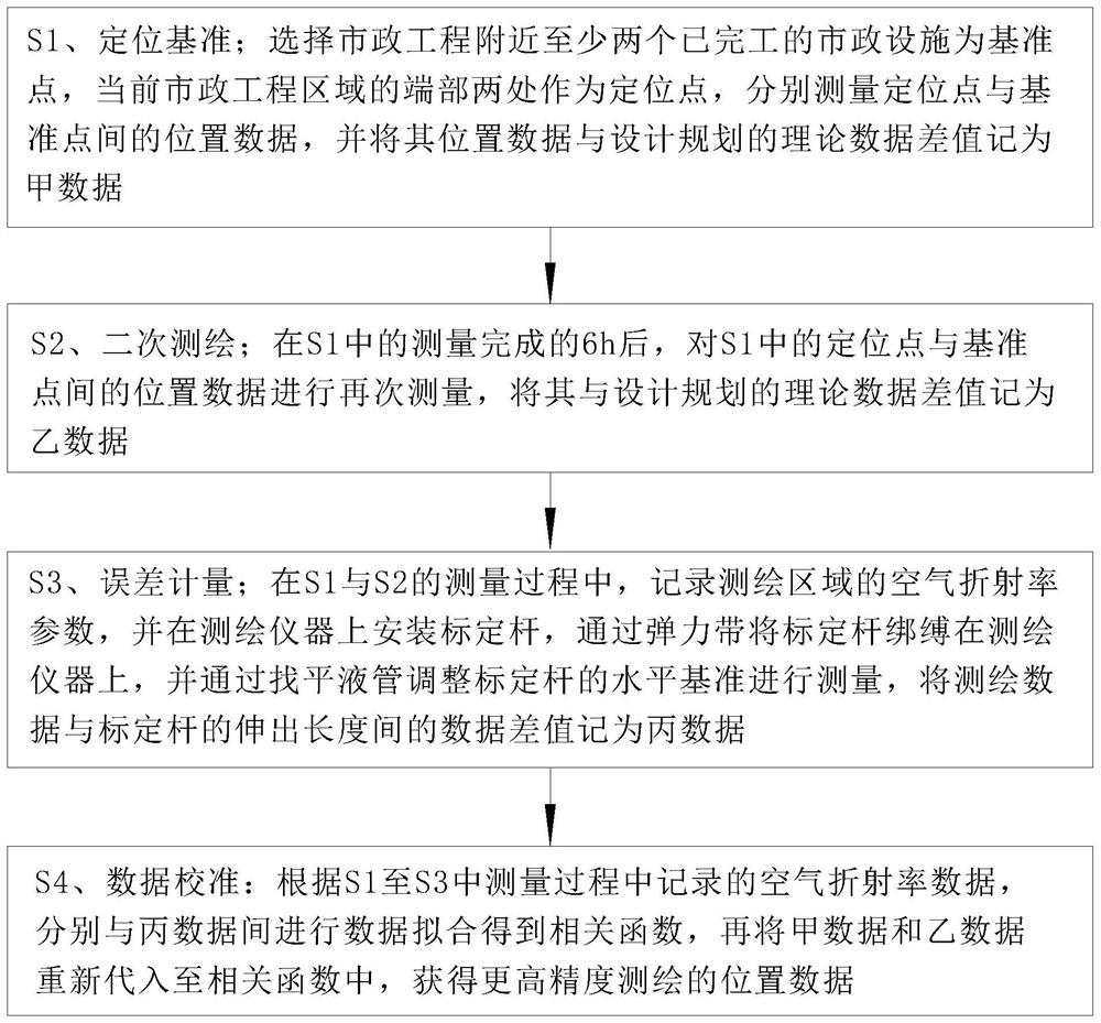
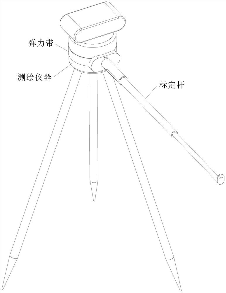
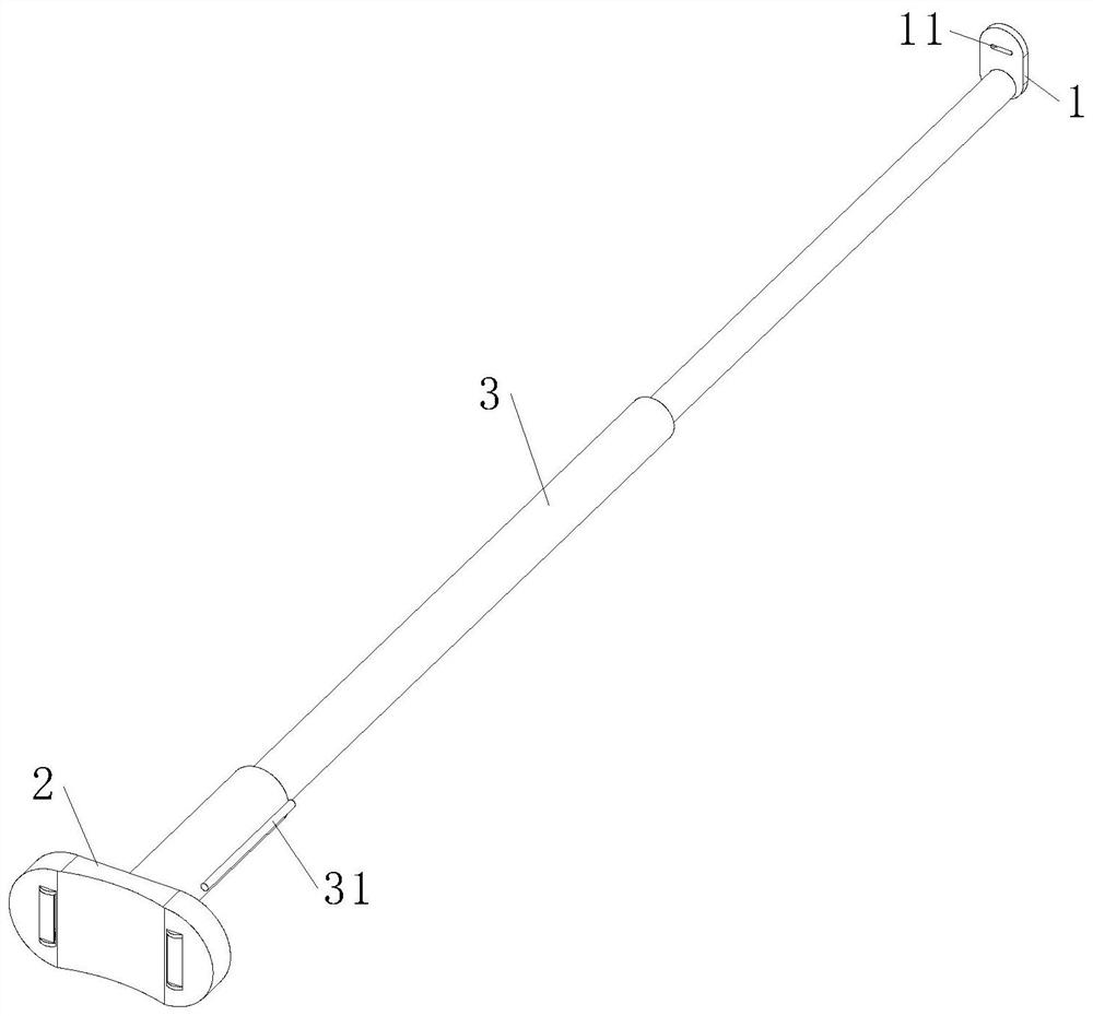
[0030] Such as Figure 1 to Figure 6 Shown, a kind of municipal engineering surveying and mapping method described in the present invention, the method steps are as follows:

[0031] S1. Positioning benchmarks; select at least two completed municipal facilities near the municipal engineering as reference points, and two ends of the current municipal engineering area as positioning points, respectively measure the position data between the positioning points and the reference points, and calculate their positions The difference between the data and the theoretical data of the design plan is recorded as A data; by using the completed municipal facilities as the reference point, the preliminary calibration steps required in the selection of positioni...


PUM


Abstract

The invention relates to the technical field of surveying and mapping, in particular to a municipal engineering surveying and mapping method and a supervision system, which comprise a surveying and mapping method of positioning reference, secondary surveying and mapping, error measurement and data calibration. A used calibration rod comprises a rod body, a light plate and an end block. Due to thefact that the mode of utilizing the laser ranging principle in the surveying and mapping instrument is interfered by the change of the air refractive index, the data precision of the surveying and mapping instrument is reduced, the accuracy of municipal engineering surveying and mapping results is further weakened, and the planning construction effect of municipal facilities is affected. Therefore, the actual length of the calibration rod arranged on the surveying and mapping instrument is compared with measured data, the actual length of the calibration rod and data in municipal engineering surveying and mapping jointly form a data set with correlation, a correlation function curve is fitted through the data, then the interference amount of the air refractive index on surveying and mapping numerical values is estimated, andsurveying and mapping data with higher precision are calculated. Therefore, the data accuracy of the municipal engineering surveying and mapping method is improved.

Description

technical field [0001] The invention relates to the technical field of surveying and mapping, in particular to a municipal engineering surveying and mapping method and a supervision system. Background technique [0002] Municipal engineering generally belongs to the country's infrastructure construction, which refers to the construction of various public infrastructure in urban construction. The surveying and mapping effect is related to the construction quality of municipal facilities, so that urban construction can be implemented steadily according to the plan, and the supervision controls the surveying and mapping production. The quality of each process in the process, so as to ensure the quality of the final surveying and mapping results; for the introduction of municipal engineering surveying and mapping and supervision, please refer to: Yang Shaoyu, Talking about the content and methods of surveying and mapping engineering supervision [J], Surveying and Mapping and Spat...

Claims


Application Information

Patent Timeline
Patent Type & Authority Applications(China)
IPC IPC(8): G01C15/00G01C3/00
CPCG01C3/00G01C15/002
Inventor 龚忠梅
Owner 南京捷鹰数码测绘有限公司
Learn More