High-flyability air route planning method based on air route tracking mapping network
A route planning and route technology, applied in navigation calculation tools, data processing applications, forecasting, etc., can solve problems such as low flyability, and achieve the effects of ensuring flight safety, high re-learning, and high planning efficiency.
- Summary
- Abstract
- Description
- Claims
- Application Information
AI Technical Summary
Problems solved by technology
Method used
Image
Examples
Embodiment Construction
[0058] The present invention will be further described in detail below in conjunction with accompanying drawings and examples.
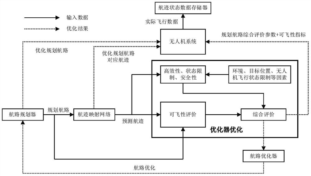
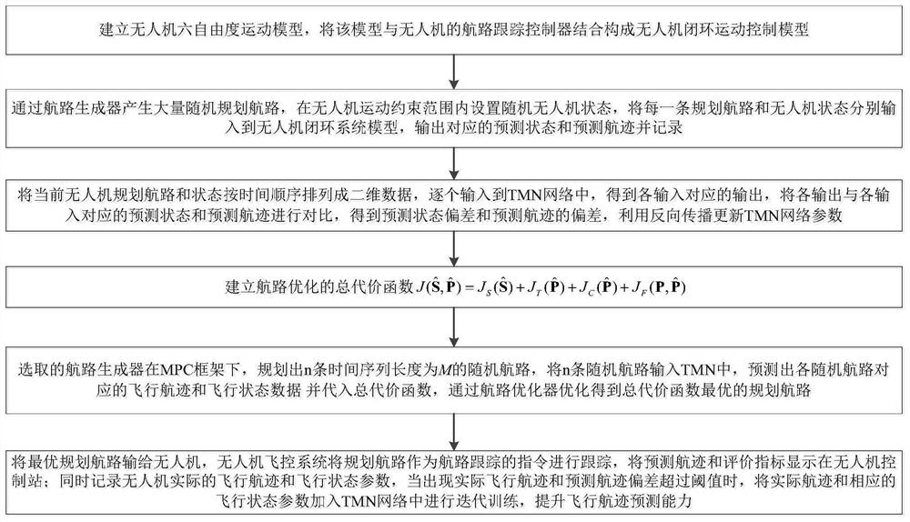
[0059] The present invention is a high-flyability route planning method based on the route tracking mapping network, which uses the deep learning network to fully characterize the characteristics of the closed-loop system composed of the six-degree-of-freedom motion model of the UAV and the route tracking controller through offline training. It is used online in the planner to accurately predict the flight track of the UAV when the planned route is used as a tracking command; when evaluating the route, the traditional evaluation of the planned route is replaced by the evaluation of the predicted flight track. Introduce the flightability index of route tracking to improve the flightability of the planned route as much as possible; then optimize the total evaluation index through the route optimizer to obtain the final planned route, predicted track and...
PUM
 Abstract
Description
Claims
Application Information
 - R&D Engineer
- R&D Manager
- IP Professional
- Industry Leading Data Capabilities
- Powerful AI technology
- Patent DNA Extraction
Browse by: Latest US Patents, China's latest patents, Technical Efficacy Thesaurus, Application Domain, Technology Topic, Popular Technical Reports.
© 2024 PatSnap. All rights reserved.Legal|Privacy policy|Modern Slavery Act Transparency Statement|Sitemap|About US| Contact US: help@patsnap.com


