Contracted city development boundary demarcation method
A city and boundary technology, applied in the field of boundary delineation of shrinking urban development, can solve problems such as threats to ecological environment protection, cities crossing boundaries, and sharp reduction in the amount of agricultural land resources
- Summary
- Abstract
- Description
- Claims
- Application Information
AI Technical Summary
Problems solved by technology
Method used
Image
Examples
Embodiment 1
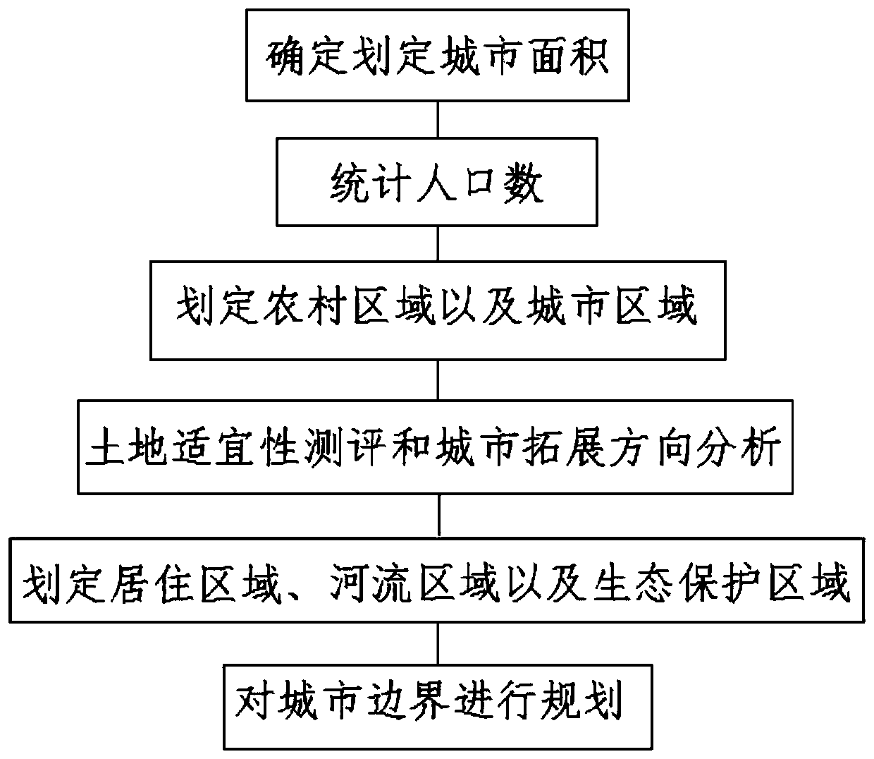
[0021] refer to figure 1 , a shrinking urban development boundary delineation method, including the following steps:
[0022] S1: Determine the shrinking city area that needs to be demarcated, and measure the land area and river area respectively;
[0023] S2: The total urban population and the total rural population are counted separately through the equipment;
[0024] S3: Rationally delineate rural areas and urban areas according to the statistical population data results;
[0025] S4: Measure the suitability of the land and analyze the expansion direction of the city;
[0026] S5: Delineate the river area, ecological protection area and residential area according to the survey results;
[0027] S6: Plan the boundary of the city according to the result of demarcation.
[0028] Among them, when delineating the residential area, the construction route of the road is delineated at the same time.
[0029] Among them, the ecological protection area is located on the periphe...
Embodiment 2
[0033] refer to figure 2 , a shrinking urban development boundary delineation method, compared with embodiment 1, this embodiment mainly divides the urban planning into allowed construction area, restricted construction area, prohibited construction area and reserved area.
[0034] Working principle: Determine the shrinking city area that needs to be demarcated, measure the land area and river area respectively, use the equipment to count the total urban population and the total rural population, and calculate the rural area and rural area according to the statistical population data Reasonably delineate the urban area, measure the suitability of the land and analyze the expansion direction of the city, delineate the river area, ecological protection area and residential area according to the survey results, and delineate the urban The boundary is planned. When delineating the residential area, the road construction route is delineated at the same time. The ecological protect...
PUM
 Abstract
Description
Claims
Application Information
 - R&D Engineer
- R&D Manager
- IP Professional
- Industry Leading Data Capabilities
- Powerful AI technology
- Patent DNA Extraction
Browse by: Latest US Patents, China's latest patents, Technical Efficacy Thesaurus, Application Domain, Technology Topic, Popular Technical Reports.
© 2024 PatSnap. All rights reserved.Legal|Privacy policy|Modern Slavery Act Transparency Statement|Sitemap|About US| Contact US: help@patsnap.com


