
Track processing and spatialization management method based on multi-beam discrete data

A discrete data and management method technology, applied in special data processing applications, visual data mining, structured data retrieval, etc., can solve the problems of discrete data that cannot be processed, inconvenient survey line search, harsh conditions, etc., to improve visualization Effect, easy storage and portability, effect of reducing storage space

Active Publication Date: 2020-03-31
NAT MARINE DATA & INFORMATION SERVICE
View PDF5 Cites 2 Cited by
  • Summary
  • Abstract
  • Description
  • Claims
  • Application Information

AI Technical Summary

Problems solved by technology

[0003] The traditional topographic survey track uses multi-beam acquisition and processing software to analyze, process and export the original data. The conditions required for this process are relatively harsh, and it is mainly aimed at the original data, and the discrete data cannot be processed.
Or use the GPS information of the survey voyage as the track, but this is inconvenient to search for a single survey line, it can only be applied to the entire voyage, and it will lead to wrong judgments for places that have not been surveyed or shut down without collecting terrain data.

Method used


Image

  • Track processing and spatialization management method based on multi-beam discrete data
  • Track processing and spatialization management method based on multi-beam discrete data
  • Track processing and spatialization management method based on multi-beam discrete data

Examples


Embodiment Construction

[0044] Below in conjunction with the examples, the present invention is further described, the following examples are illustrative, not limiting, and the protection scope of the present invention cannot be limited by the following examples.

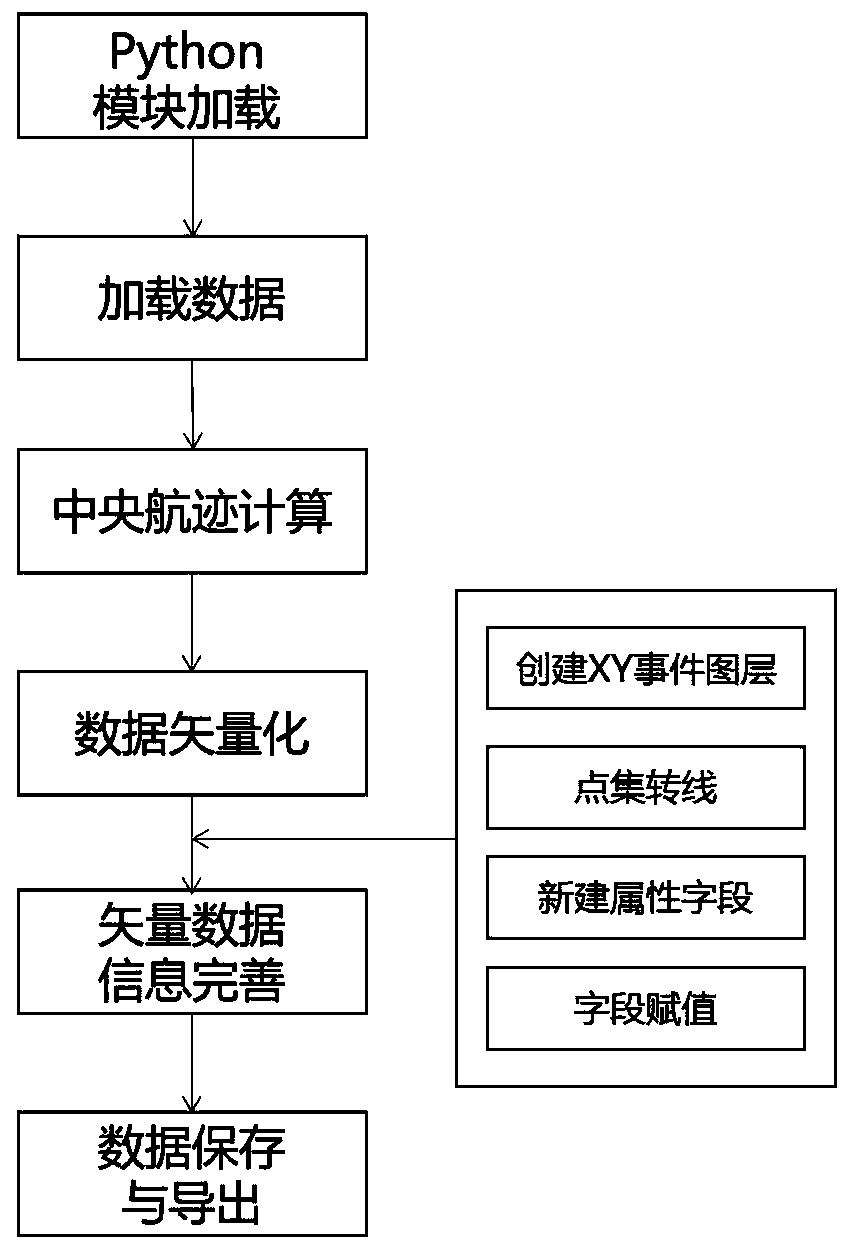
[0045] A track processing and spatial management method based on multi-beam discrete data, characterized in that the steps are as follows:

[0046] ⑴Python module loading: according to the characteristics of discrete data, load python’s os, numpy, arcpy modules to provide support for data aggregation and vectorization; os module is used for interactive operation with the operating system; Numpy is used for discrete data reading, calculation and Write; the arcpy module is used for vectorization of data.

[0047] (2) Loading data: the type of data loaded is the xyz discrete terrain data output by the original multi-beam data, and the data format is longitude, latitude and water depth; the discrete terrain data is exported according to the o...


PUM


Abstract

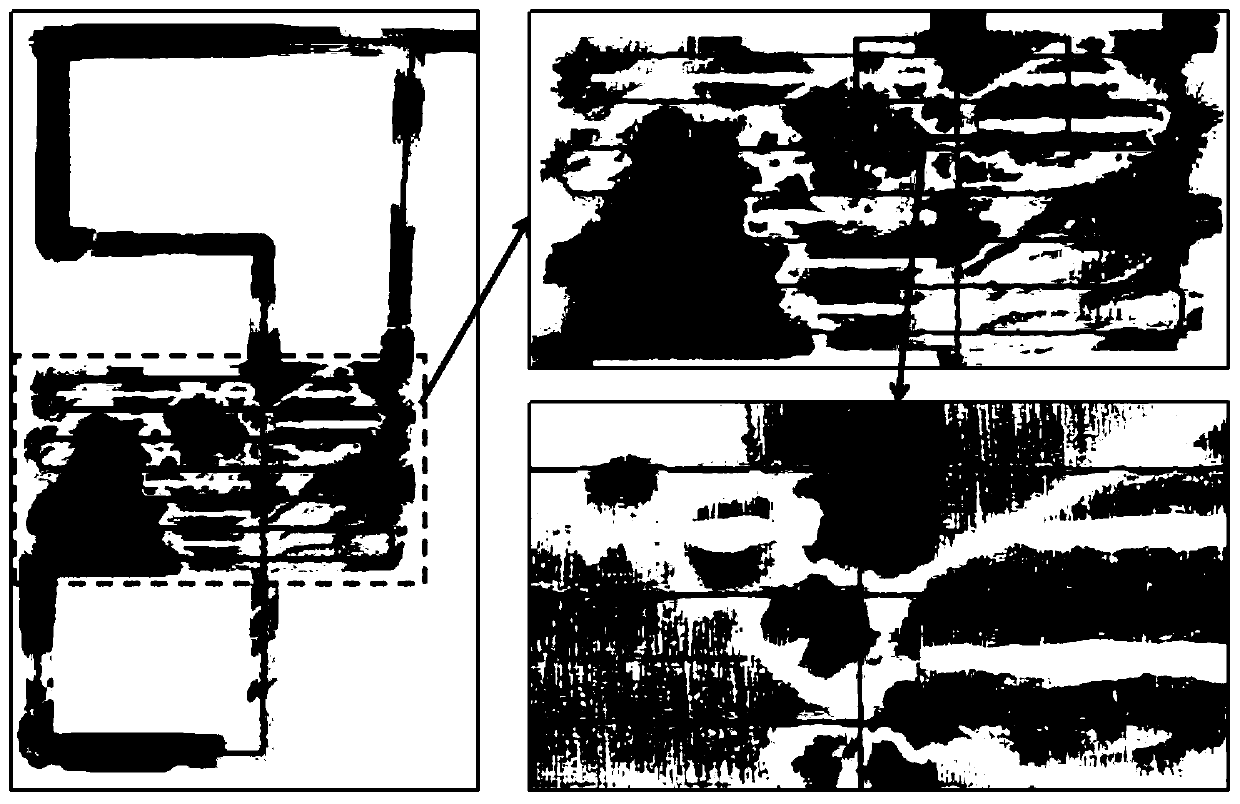
The invention belongs to the technical field of marine geographic information. The invention relates to a track processing and spatialization management method based on multi-beam discrete data, whichis mainly used for extracting a central flight path based on multi-beam discrete terrain data, carrying out discrete data spatialization viewing and query and facilitating discrete data retrieval andmanagement, and comprises the following steps of: (1) loading a Python module; (2) loading data; (3) calculating a central track; (4) vectorizing the data; (5) perfecting vector data information; and(6) storing and exporting data; by adopting the steps, the blank of the prior art can be filled up, Python data processing and spatial management are taken as the purpose, the characteristics of submarine topographic data are combined, and the automatic discrete data track extraction and spatial vectorization work is realized on the GIS platform for the first time. Manpower and material resourcesare saved, and the problem that a large amount of discrete data is inconvenient to check and manage is solved.

Description

technical field [0001] The invention belongs to the technical field of marine geographic information, and mainly extracts the central track based on multi-beam discrete topographic data, performs spatial viewing and query of discrete data, and facilitates the retrieval and management of discrete data, especially a track based on multi-beam discrete data processing and spatial management methods. Background technique [0002] The spatial management of submarine terrain discrete data can directly reflect the distribution of data. Different from the coverage of raster terrain data, discrete terrain data can directly reflect the survey route and distribution of data, and the location and search of discrete terrain data can be realized by viewing metadata. [0003] The traditional terrain survey track uses multi-beam acquisition and processing software to analyze, process, and export track data from the original data. This process requires more stringent conditions, and is mainl...

Claims


Application Information

Patent Timeline
Patent Type & Authority Applications(China)
IPC IPC(8): G06F16/29G06F16/26
CPCG06F16/29G06F16/26
Inventor 马永樊妙郭灿文马丹孙毅章任群邢喆张峰赵现仁王朝阳
Owner NAT MARINE DATA & INFORMATION SERVICE
Learn More