Method of Reconstructing Vertical Rain Field Based on Satellite-Earth Link Scanning
A satellite-ground link and rainfall field technology, applied in the field of meteorological detection, can solve problems such as low time resolution, inability to achieve real-time rainfall monitoring, difficulties in layout and maintenance, and increased operating costs.
- Summary
- Abstract
- Description
- Claims
- Application Information
AI Technical Summary
Problems solved by technology
Method used
Image
Examples
Embodiment Construction
[0035] The present invention will be further described below in conjunction with the accompanying drawings and specific embodiments.
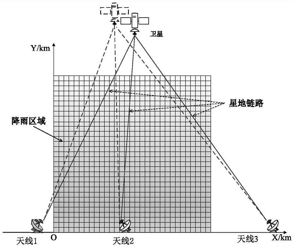
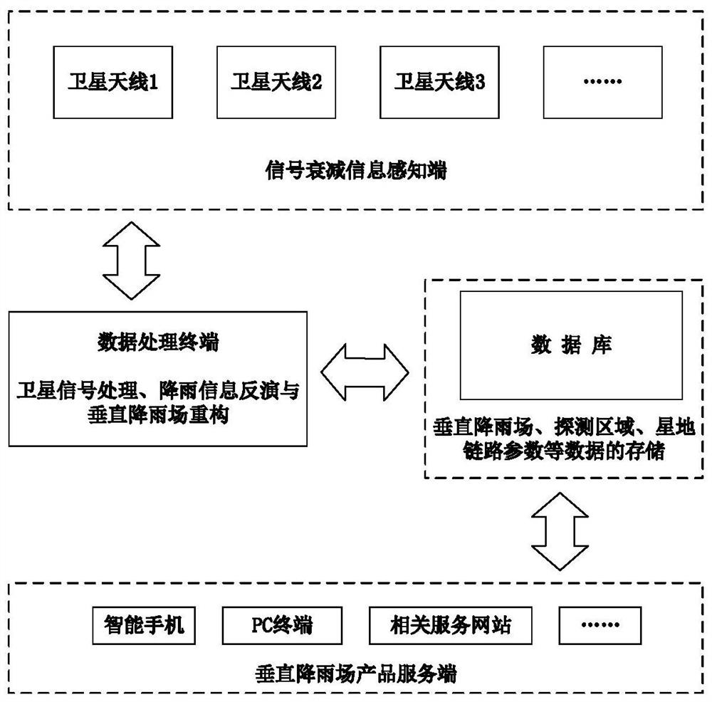
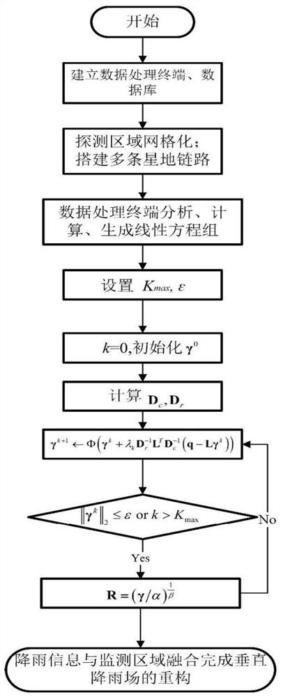
[0036] At first provide a kind of system that can be used for realizing the method described in the present invention, this system is as figure 2 As shown, it includes: signal attenuation information perception terminal, data processing terminal, database and vertical rainfall product server. Wherein, the signal attenuation information sensing end specifically refers to a satellite signal receiving end, such as a satellite antenna, which is used to receive satellite signals, and to receive satellite signals and antenna position information (x i ,y i ) and satellite position information Incoming data processing terminal and database; data processing terminal specifically completes satellite signal processing (extracting frequency information f from satellite signal i and intensity information p i ), rainfall information inversion and verti...
PUM
 Abstract
Description
Claims
Application Information
 - Generate Ideas
- Intellectual Property
- Life Sciences
- Materials
- Tech Scout
- Unparalleled Data Quality
- Higher Quality Content
- 60% Fewer Hallucinations
Browse by: Latest US Patents, China's latest patents, Technical Efficacy Thesaurus, Application Domain, Technology Topic, Popular Technical Reports.
© 2025 PatSnap. All rights reserved.Legal|Privacy policy|Modern Slavery Act Transparency Statement|Sitemap|About US| Contact US: help@patsnap.com


