
Grid drawing method based on map area boundary GPS coordinates

A technology of coordinates and boundaries, applied in the field of map information, can solve the problems of inability to reflect regionality, inability to draw grids, and inability to highlight the characteristics of regions.

Pending Publication Date: 2019-09-17
苏州猫耳网络科技有限公司
View PDF5 Cites 0 Cited by
  • Summary
  • Abstract
  • Description
  • Claims
  • Application Information

AI Technical Summary

Problems solved by technology

However, this kind of map application grid drawing usually has two common problems: first, the overall drawing grid of the grid is relatively regular (square), which cannot reflect a certain region; second, the map is generally gridded, and the specifications Relatively uniform, unable to draw a specific grid according to the region, third, unable to highlight the characteristics of the region on the basis of the whole

Method used


Image

  • Grid drawing method based on map area boundary GPS coordinates
  • Grid drawing method based on map area boundary GPS coordinates
  • Grid drawing method based on map area boundary GPS coordinates

Examples


specific Embodiment example 1

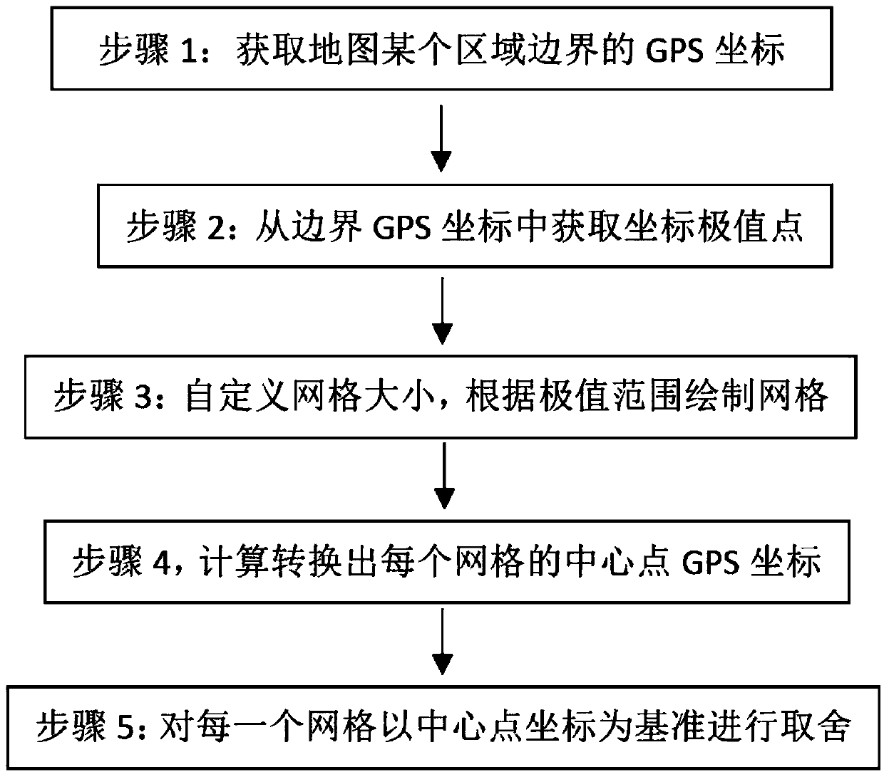
[0029] Step 1. Obtain the GPS coordinates (p1, p2, p3...pn) of the boundary of a certain area on the map

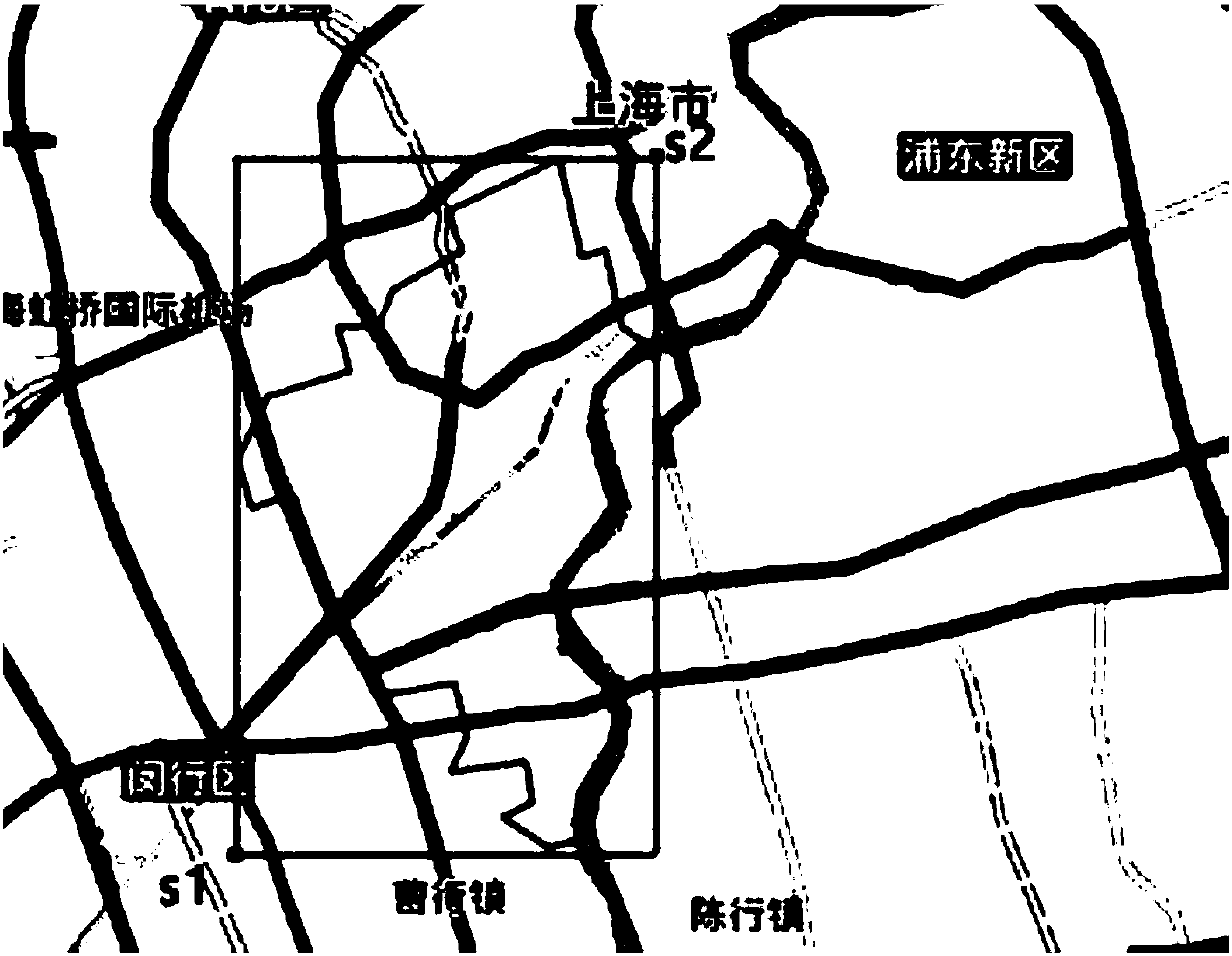
[0030] Step 2, obtain coordinate extreme points from the boundary GPS coordinates, the first point S1 has the smallest longitude and the smallest latitude, and the second point S2 has the largest longitude and the largest latitude.

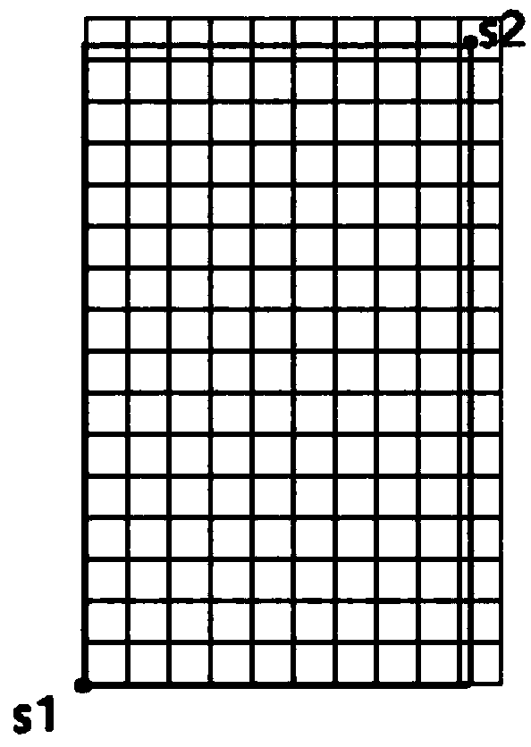
[0031] Step 3, customize a grid with a distance of X meters as required, starting from S1, draw a grid every X meters in latitude and longitude until S2 is covered.

[0032] Step 4, calculate and convert the GPS coordinates (c1, ... cn) of the center point of each grid.

[0033] Step 5, judge whether the GPS coordinates (c1,....cn) of each grid center point are in the area, and keep the grid if it is in the area, and discard the grid if not.

[0034] In the step 5, the specific method for calculating whether a certain center point (eg c1) is within the area (p1, p2, p3...pn) is as follows:

[0035] 1. First, determine whether the center poi...


PUM


Abstract

The invention relates to a grid drawing method based on map area boundary GPS coordinates, and the method comprises the steps: a boundary line segment is taken as a reference in an area, a grid distance drawing grid in the area is set according to requirements, and the further selection and selection of the grid are carried out; the overall difference of the map can be embodied; each area can be further described according to specific purposes and requirements; according to the technical scheme, the characteristics in each area are displayed more specifically, the refinement and differentiation of the areas can meet the requirements of people more conveniently, the broadening of some areas also omits the complexity of drawing a wide and thin map by a map maker, and the characteristics of different areas in the whole map are highlighted clearly.

Description

technical field [0001] The invention relates to the technical field of map information, in particular to a grid drawing method based on GPS coordinates of the border of a map area. Background technique [0002] In the existing map grid drawing to display various data, various data display applications based on grid maps are very common, such as heat maps, traffic distribution maps, etc. However, this kind of map application grid drawing usually has two common problems: first, the overall drawing grid of the grid is relatively regular (square), which cannot reflect a certain region; second, the map is generally gridded, and the specifications It is relatively uniform and cannot draw a specific grid according to the region. Third, it cannot highlight the characteristics of the region on the basis of the whole. In order to achieve a specific purpose and reflect regional differences in the overall map, an improved method that is consistent with the current map specification is ...

Claims


Application Information

Patent Timeline
IPC IPC(8): G06T11/20G09B29/00
CPCG06T11/206G09B29/003
Inventor 张祖良孔纯罗灿锋
Owner 苏州猫耳网络科技有限公司
Learn More