
Multi-sensor fusion-based robot indoor path planning method

A multi-sensor fusion and path planning technology, which is applied in two-dimensional position/channel control and other directions, can solve problems such as lost tracking, difficult extraction of image features, and sparse texture of acquired images, so as to ensure high efficiency and reduce pose deviation Effect

Inactive Publication Date: 2019-05-31
ZHEJIANG UNIV OF TECH
View PDF4 Cites 26 Cited by
  • Summary
  • Abstract
  • Description
  • Claims
  • Application Information

AI Technical Summary

Problems solved by technology

However, when only relying on a single sensor to operate, the system is easily limited by sensor performance and environmental factors. As far as the visual sensor is concerned, the frame loss and image blurring during operation will affect the system processing effect, and in low-complexity Running in the environment will cause the texture of the acquired image to be relatively sparse, resulting in difficult extraction of image features and loss of tracking

Method used


Image

  • Multi-sensor fusion-based robot indoor path planning method
  • Multi-sensor fusion-based robot indoor path planning method
  • Multi-sensor fusion-based robot indoor path planning method

Examples


Embodiment Construction

[0026] The present invention will be further described below in conjunction with the accompanying drawings.

[0027] A method for indoor path planning of a robot based on multi-sensor fusion, said method comprising the following steps:

[0028] 1) Use visual sensors for mapping work, use visual SLAM as the basis for indoor mapping applications, and use ORBSLAM as the basic method of mapping. ORBSLAM extracts feature points based on FAST features, and uses the BRIEF descriptor to describe feature directionality, so When building a map, it can quickly extract camera image features and perform multiple operations based on the features to ensure the efficiency of map building;

[0029] 2) The point cloud data obtained by the depth camera is used as a reliable basis for obtaining the drivable area in the environment. The point cloud corresponds to the 3D model of specific objects in the environment, and can restore various details of objects and scenes in space, enabling the system...


PUM


Abstract

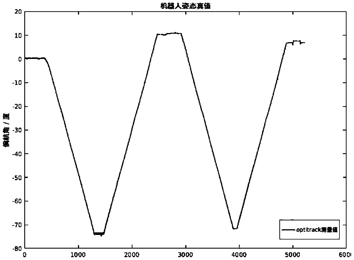
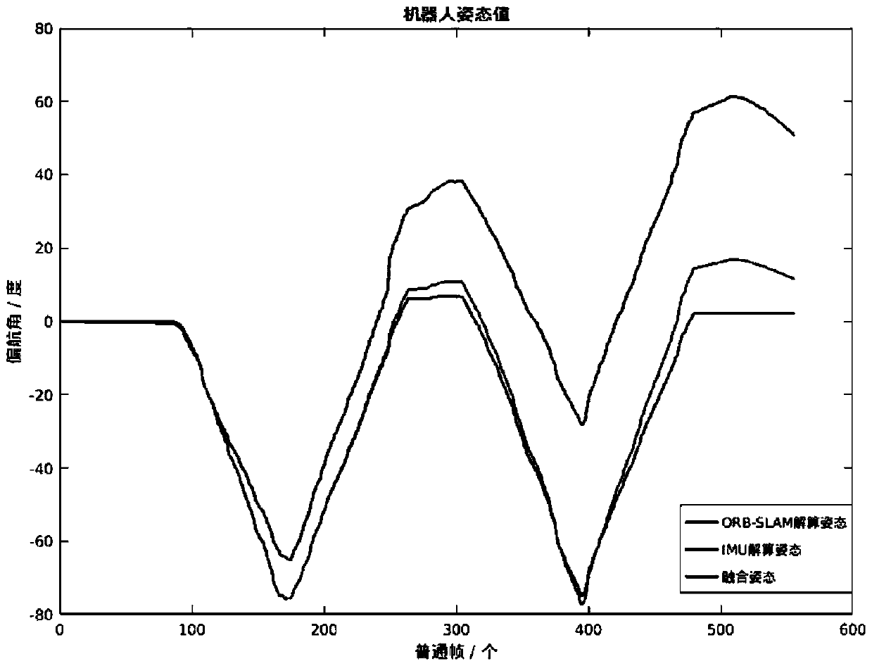
The invention relates to a multi-sensor fusion-based robot indoor path planning method. According to the method, after a robot system reconstructs an environmental map by using visual positioning andmapping (SLAM) technology, a multi-sensor coordinated working mode is adopted, so that the robot performs path planning according to a target location determined in the map and realizes obstacle avoidance as well as posture correction and operation direction correction during the driving of the robot according to environmental data obtained by sensors mounted on the system. In order to effectivelyverify the effectiveness of the method, a depth camera, an ultrasonic sensor, an inertial sensor and the like which are mounted on the robot mobile platform are tested. A plurality of tests in an indoor environment prove that the multi-sensor collaborative work can improve mapping accuracy during a process in which the robot performs indoor working environment-based movement path planning, and can effectively realize the autonomous path planning of the machine.

Description

technical field [0001] The present invention relates to the fields of mechanical control, image processing, etc., and more precisely, it is an autonomous path planning method based on multi-sensor cooperation. For problems such as pose errors and path offsets that exist when a robot performs path planning in an indoor environment, the present invention The invention proposes a method based on multi-sensor cooperative work to try to improve the robustness and accuracy of robot path planning in an indoor environment. Background technique [0002] As a comprehensive system integrating multiple functions such as environmental perception, path planning, dynamic decision-making and work order execution, mobile robots can assist in complex and lengthy tasks and improve work efficiency and safety. [0003] At present, image processing and path planning of robots based on visual sensors is a commonly used method for mobile robots to process environmental information for path planning...

Claims


Application Information

Patent Timeline
Patent Type & Authority Applications(China)
IPC IPC(8): G05D1/02
Inventor 张剑华黄家豪
Owner ZHEJIANG UNIV OF TECH
Learn More