Eureka AIR delivers breakthrough ideas for toughest innovation challenges, trusted by R&D personnel around the world.

Satellite orbit determination method, device and electronic equipment

A technology of orbit determination and satellite, which is applied in the field of satellite navigation, can solve problems such as difficult real-time performance, long convergence time, and slow convergence time, and achieve the effects of accelerating convergence speed, reducing convergence time, and rapid geometric changes

Active Publication Date: 2021-04-20
SHANGHAI HAIJI INFORMATION TECH
View PDF4 Cites 0 Cited by
  • Summary
  • Abstract
  • Description
  • Claims
  • Application Information

AI Technical Summary

Problems solved by technology

[0008] On-board autonomous orbit determination relies on on-board GNSS receivers or inertial measurement units for orbit determination. Among them, the on-board autonomous orbit determination method based on GNSS observations can provide real-time autonomous and continuous satellite orbits. However, due to the influence of GNSS navigation satellites Influenced by the orbit error and clock error of the broadcast ephemeris, on-board autonomous orbit determination based on GNSS observations can usually only obtain orbit determination accuracy on the order of a few meters
In order to obtain high-precision orbit determination, satellite-based augmentation satellites are mainly distributed in GEO orbits, which are divided into wide-area differential integrity enhancement for civil aviation and other users and wide-area precision positioning enhancement for high-precision users such as surveying and mapping. However, the current wide-area precision positioning technology takes a long time to converge, and it is difficult to form a PNT application with high real-time requirements, so the problem of slow convergence time needs to be solved

Method used


Image

  • Satellite orbit determination method, device and electronic equipment
  • Satellite orbit determination method, device and electronic equipment
  • Satellite orbit determination method, device and electronic equipment

Examples


Embodiment Construction

[0094] In order to make the purpose, technical solutions and advantages of the embodiments of the present invention more clear, the technical solutions in the embodiments of the present invention will be clearly and completely described below in conjunction with the drawings in the embodiments of the present invention.

[0095] The following describes the technical background of the embodiments of the present invention.

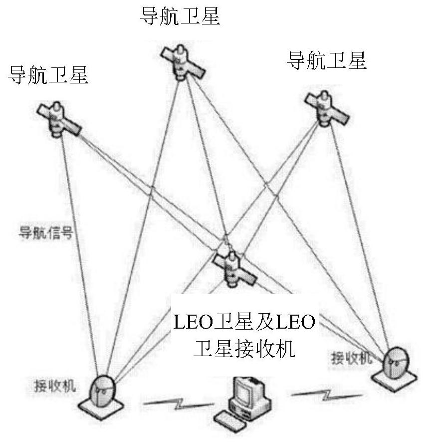
[0096] In 2015, the Boeing Company of the United States won a contract of about 160 million U.S. dollars from the U.S. military to further carry out research and application experiments on Iridium-based GPS navigation enhancement technology. To this end, a new research team was formed, and the main participant was changed to Satelles. The new low-orbit enhancement technology is based on the STL (Satelles Time and Location) service for GPS navigation enhancement newly set by the Iridium system. On the basis of iGPS, the enhancement function is further enhanced...


PUM


Abstract

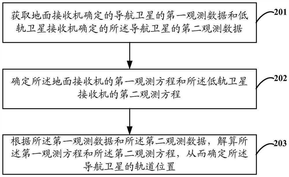
The present application provides a satellite orbit determination method, device and electronic equipment, the method comprising: obtaining the first observation data of the navigation satellite determined by the ground receiver and the second observation data of the navigation satellite determined by the low-orbit satellite receiver ; determine the first observation equation of the ground receiver and the second observation equation of the low-orbit satellite receiver; according to the first observation data and the second observation data, solve the first observation equation and The second observation equation, thereby determining the orbital position of the navigation satellite.

Description

[0001] This application claims the priority of the Chinese patent application submitted to the Intellectual Property Office of the People's Republic of China on December 28, 2018, the application number is 201811627358.1, and the invention title is "A Method and Device for Precise Satellite Orbit Determination", the entire content of which is incorporated by reference incorporated in this application. technical field [0002] The present application relates to the technical field of satellite navigation, in particular to a satellite orbit determination method, device and electronic equipment. Background technique [0003] Satellite Navigation and Positioning System (GNSS) can provide real-time positioning services around the world, and has been widely used in many industries around the world. The current standard GNSS positioning technology accuracy is about 5-10 meters. For applications requiring higher precision, precision positioning methods are usually required. By rec...

Claims


Application Information

Patent Timeline
Patent Type & Authority Patents(China)
IPC IPC(8): G01C21/24G01S19/44G01S19/42
CPCG01C21/24G01S19/425G01S19/428G01S19/44
Inventor åˆ˜ę¬¢é™†čµ›čµ›å§šę–‡å¹³ę®·å¹“å‰å‰é’
Owner SHANGHAI HAIJI INFORMATION TECH
Why Eureka
Eureka Blog
Learn More