A geographic data availability evaluation method

A geographic data and usability technology, applied in geographic information databases, structured data retrieval, database design/maintenance, etc., can solve problems such as deciphering geographic data with geometric precision

Inactive Publication Date: 2019-04-09
HUANGSHAN POWER SUPPLY COMPANY OF STATE GRID ANHUI ELECTRIC POWER +1
View PDF2 Cites 1 Cited by
  • Summary
  • Abstract
  • Description
  • Claims
  • Application Information

AI Technical Summary

Problems solved by technology

[0005] The purpose of the present invention is a method for assessing the usability of geographic data, which solves the problem of determining whether the geographic data that has been declassified with geometric precision can still meet the needs of business applications

Method used


Image

  • A geographic data availability evaluation method
  • A geographic data availability evaluation method
  • A geographic data availability evaluation method

Examples


Embodiment Construction

[0097] Examples such as figure 1 A method for assessing the usability of geographical data shown is characterized in that:

[0098] By evaluating the geographic data in terms of visualization effect, reliability and validity, the visual effect SIM≥90 is judged as excellent, 85≤SIM<90 is judged as qualified, and SIM<85 is judged as unqualified; the reliability W≥99.99 is judged as excellent, 95≤W<99.99 is judged as qualified, W<95 is judged as unqualified; effectiveness Eff≥99.99 is judged as excellent, 95≤Eff<99.99 is judged as qualified, and Eff<95 is judged as unqualified ; In addition to the evaluation of the three aspects of visualization, reliability, and validity, the availability of all geographic data with elements that do not meet the relevant national regulations is judged as unqualified.

[0099] Among them, the measurement method of geographic data visualization effect is as follows:

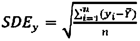
[0100] In geographic data, various geographic entities are usually represented...


PUM


Abstract

The invention discloses a geographic data availability evaluation method, which comprises the following steps of: evaluating geographic data in three aspects of visualization effect, reliability and effectiveness, judging that the visualization effect SIM >=90 is excellent, judging that the 85<=SIM<90 is qualified and judging that the SIM <= 85 and is unqualified; judging the reliability W>=99.99is excellent, judging that the reliability 95<=W<99.9 is qualified, and judging the reliability W<95 is unqualified; Judging that the validity Eff >= 99.99 is excellent, judging that the validity 95<=Eff<99 is qualified, and judging that the validity Eff<95 is unqualified; In addition to the evaluation of the visualization effect, reliability and validity, the availability of all geographic data having elements that do not conform to relevant national regulations is determined to be unqualified. The method can effectively solve the problem that geographic data subjected to geometric precisiondecryption needs to be judged whether to still meet the service application or not.

Description

technical field [0001] The invention relates to a method for assessing the usability of geographic data Background technique [0002] Geographical data is widely used in various businesses in the power industry, including navigation maps, remote sensing images, location information of power grid equipment, sensors, users, etc. The current main application mode is to publish maps of the CGCS2000 coordinate system on the power intranet, supplemented by various Spatial Information Services. Geographic data implies high-precision spatial information, so there are great security risks in the sharing process of geographic data. According to the relevant policies and regulations of the State Bureau of Surveying and Mapping and the Security Bureau, the power intranet is not a confidential network and needs to be dithered to ensure that the geometric accuracy of geographic data cannot be higher than 50 meters. , in order to take into account business needs and confidential data sec...

Claims


Application Information

Patent Timeline
Patent Type & Authority Applications(China)
IPC IPC(8): G06F16/29G06F16/21
Inventor 朱兵王旭东邵名声陈清萍王萍胡聪蔡翔王阳唐波叶水勇朱笔挥陈明刘琦
Owner HUANGSHAN POWER SUPPLY COMPANY OF STATE GRID ANHUI ELECTRIC POWER
Why Eureka
Try Eureka