Method, system and device for converting ground coordinates to picture coordinates of ptz camera

A technology of coordinate conversion and ground coordinates, applied in CCTV systems, image enhancement, image analysis and other directions, can solve the problems of inability to realize automatic labeling and low efficiency, and achieve the effect of accurate, reliable and high efficiency.

Active Publication Date: 2019-02-22
AQUILLANETWORKTECH
View PDF3 Cites 4 Cited by
  • Summary
  • Abstract
  • Description
  • Claims
  • Application Information

AI Technical Summary

Problems solved by technology

[0004] Although the above manual labeling method is accurate and reliable, it has the problem of low efficiency and the inability to realize automatic labeling

Method used


Image

  • Method, system and device for converting ground coordinates to picture coordinates of ptz camera
  • Method, system and device for converting ground coordinates to picture coordinates of ptz camera
  • Method, system and device for converting ground coordinates to picture coordinates of ptz camera

Examples


Embodiment Construction

[0040] In order to make the object, technical solution and advantages of the present invention clearer, the embodiments of the present invention will be further described in detail below in conjunction with the accompanying drawings.

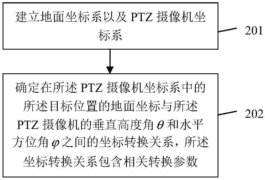
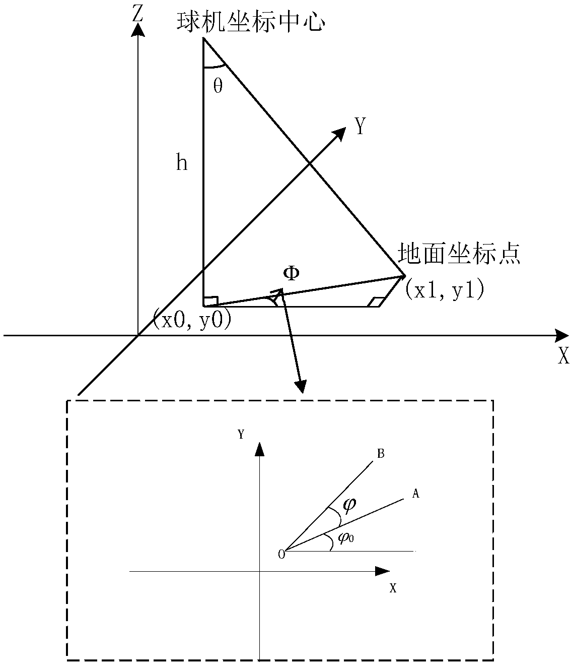
[0041] It should be noted that the method for converting ground coordinates and PTZ camera screen coordinates proposed by the present invention is applicable to a wide range of scenarios. In today's security field, in a possible practical operation, for some key targets in cities or key communities, we often need to track the location of these targets in real time and accurately mark them on the camera screen, so as to It makes it possible to observe the target position through the monitoring camera, so as to effectively ensure the safety of these security areas.

[0042] Such as figure 1 Shown is a kind of ground coordinates of the present invention and the picture coordinate conversion method flowchart of PTZ camera, has shown the specific im...


PUM


Abstract

The invention discloses a method, a system and a device for converting ground coordinates to picture coordinates of a PTZ camera, which relates to the field of security. The method comprises: converting the ground coordinates of the target position into a vertical height angleTheta. And a horizontal azimuth angle when the PTZ camera is aligned with the target position at the center of its pictureaccording to a first coordinate conversion mechanism according to the second conversion mechanism and the current vertical height angle Theta and horizontal azimuth angle of the PTZ camera the vertical height angle theta and the horizontal azimuth angle are converted into coordinates of the target position in the PTZ camera picture. The technical proposal of the invention can realize automatic marking of the target position in the PTZ camera picture, and has the advantages of high efficiency, accuracy and reliability.

Description

technical field [0001] The invention relates to the security field, in particular to a method, system and device for converting ground coordinates and screen coordinates of a PTZ camera. Background technique [0002] In the field of security, it often involves the interchange between GNSS coordinates and coordinates of the dome camera screen. For example, when the dome camera is rotating, we hope to display a label on the dome camera screen, marking the name of the building, etc., and then With the rotation of the speed dome, the label also moves and is always displayed in the correct position. [0003] To achieve this kind of marking, the current general method is to manually mark on the screen of the dome camera. When labeling, record the dome coordinates of the marked points such as buildings. When the dome rotates, the dome coordinates are converted into screen coordinates, so that the dome tag keeps following the building during the rotation. [0004] Although the abo...

Claims


Application Information

Patent Timeline
Patent Type & Authority Applications(China)
IPC IPC(8): G06T7/80H04N7/18
CPCG06T2207/30244G06T7/85H04N7/18
Inventor 刘玉平杨帅
Owner AQUILLANETWORKTECH
Why Eureka
Try Eureka