Multi-exploration geophysical field parallel acquisition system and method
A technology of geophysics and acquisition system, applied in the fields of comprehensive geophysical exploration and geophysical exploration, can solve the problems of low construction efficiency, complicated device types, etc., and achieve the effect of improving exploration construction efficiency and diversifying detection methods.
- Summary
- Abstract
- Description
- Claims
- Application Information
AI Technical Summary
Problems solved by technology
Method used
Image
Examples
Embodiment 1
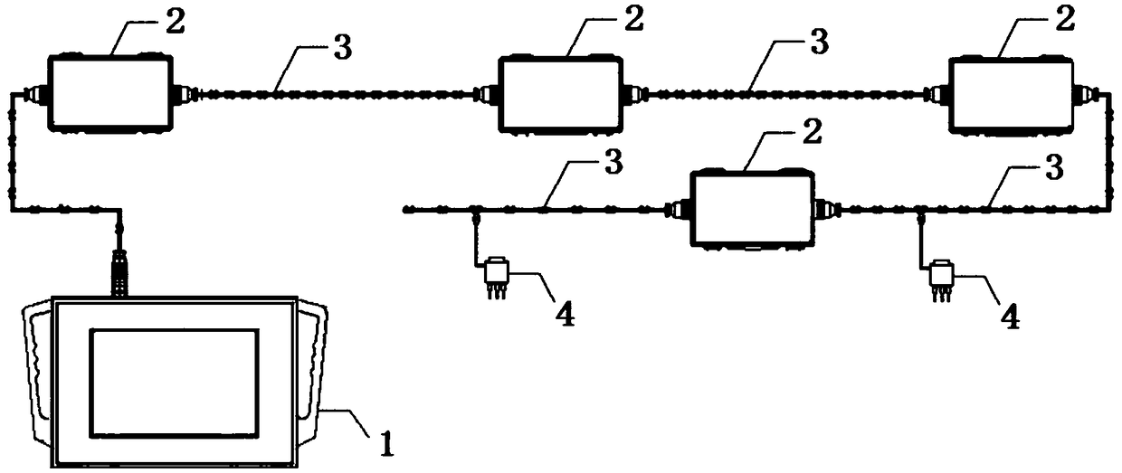
[0058] Such as figure 1 As shown, the intelligent collection devices 2 are connected in series to form a distributed intelligent collection system, and the collection mode of the intelligent collection devices is passive source collection.
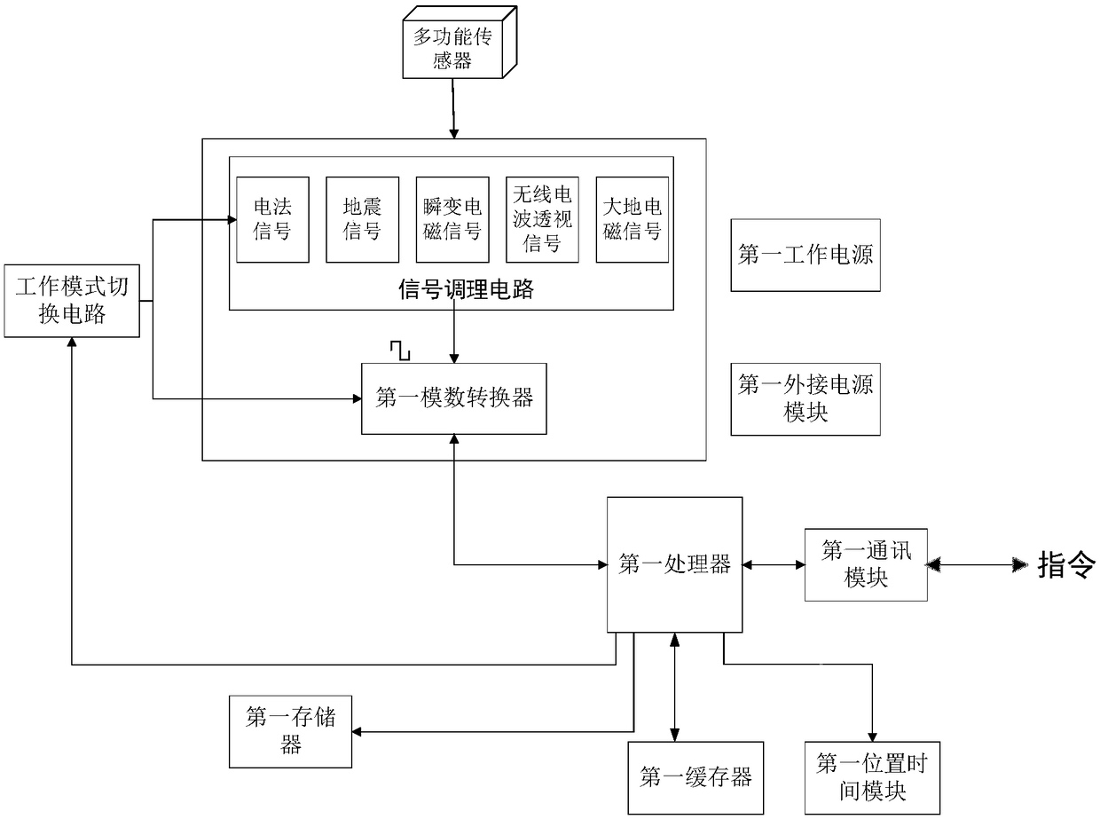
[0059] The multi-exploration geophysical field parallel acquisition system includes a control host 1, several intelligent acquisition devices 2, a large line 3, and several sensor receiving devices 4. The control host 1 is connected to the intelligent acquisition device 2 through a cable, and the intelligent acquisition device 2 is The line 3 is connected to several sensor receiving devices 4, and the aviation plug connected to the large line 3 is connected to the intelligent collection device 2, and the control host 1 sends the specified working mode and collection parameters for collection to the intelligent collection device 2, and the intelligent collection device 2 is in the To switch between multiple working modes, the intelligent ac...
Embodiment 2
[0071] Embodiment 2: The difference from Embodiment 1 is that an intelligent electromagnetic emission device 5 is added. The intelligent electromagnetic emission device 5 receives the physical field emission mode and emission parameters issued by the control host 1. The intelligent electromagnetic emission device 5 transmits the physical field according to the physical field emission mode and Emission parameters excite different field source signals. Among them, it is also possible to use a seismic source or an ordinary electromagnetic transmitting device to transmit a signal of a certain electric method, earthquake, transient electromagnetic method, radio wave perspective, and magnetotelluric.
[0072] Such as Figure 4 shown in figure 1 Increase the intelligent electromagnetic launcher 5 on the basis of the above, and communicate between the intelligent electromagnetic launcher 5 and the control host 1, and the intelligent electromagnetic launcher 5 and the control host 1 c...
Embodiment 3
[0076] Embodiment three: the difference with embodiment two is that a plurality of intelligent collection devices 2 are connected wirelessly, and the intelligent collection devices 2 are arranged independently and freely, which is a free arrangement intelligent collection system.
[0077] Such as Figure 6 As shown, the intelligent acquisition device 2 adopts a free arrangement form, and if multiple intelligent acquisition devices 2 are placed side by side at the same measuring point, different geophysical field information of the measuring point can be obtained at the same time. When multi-geophysical fields are collected in parallel, it can be collected passively, that is, it can not be connected to the intelligent electromagnetic emission device 5, or it can be collected by an active source, that is, it can be connected to the intelligent electromagnetic emission device 5, and the host computer 1 and the intelligent electromagnetic emission device can be controlled. 5 can a...
PUM
 Abstract
Description
Claims
Application Information
 - R&D Engineer
- R&D Manager
- IP Professional
- Industry Leading Data Capabilities
- Powerful AI technology
- Patent DNA Extraction
Browse by: Latest US Patents, China's latest patents, Technical Efficacy Thesaurus, Application Domain, Technology Topic, Popular Technical Reports.
© 2024 PatSnap. All rights reserved.Legal|Privacy policy|Modern Slavery Act Transparency Statement|Sitemap|About US| Contact US: help@patsnap.com


