Continuous monitoring path planning method for large-scale environment with multiple unmanned aerial vehicles

A technology for unmanned aerial vehicles and path planning, applied in the field of environmental information collection, to achieve the effect of reducing calculation pressure

Active Publication Date: 2018-11-27
NANKAI UNIV
View PDF8 Cites 20 Cited by
  • Summary
  • Abstract
  • Description
  • Claims
  • Application Information

AI Technical Summary

Problems solved by technology

[0006] The purpose of the present invention is to solve the problem of continuous monitoring of large-scale environments by multiple unmanned aerial vehicles, and provide a monitoring path planning method to improve the efficiency of environmental monitoring, prevent forest fires, and protect forest resources

Method used


Image

  • Continuous monitoring path planning method for large-scale environment with multiple unmanned aerial vehicles
  • Continuous monitoring path planning method for large-scale environment with multiple unmanned aerial vehicles
  • Continuous monitoring path planning method for large-scale environment with multiple unmanned aerial vehicles

Examples


Embodiment Construction

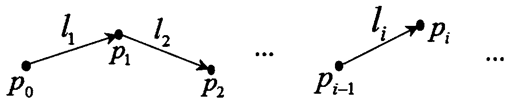
[0047] The present invention provides a continuous monitoring path planning method for large-scale environments with multiple unmanned aerial vehicles, including sensor models, sub-area path optimization, overall monitoring process planning, simulation and description of experimental results.

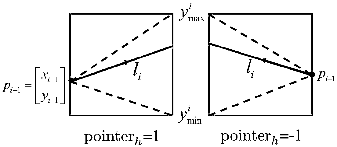
[0048] First, the sensor model

[0049] In order to better describe the coverage effect of the sensor on its surrounding environment, and quantitatively reflect the accuracy and reliability of the information collected by the sensor, the present invention first establishes a relatively universal sensor model. The information collection quality of a sensor to a point in its surrounding environment is related to the relative position of the point and the sensor. In order to better describe their relationship, the present invention establishes an innovative sensor model, which describes when the sensor moves along a The reliability of the information collection of any point q in the enviro...


PUM


Abstract

A continuous monitoring path planning method for a large-scale environment with multiple unmanned aerial vehicles is provided. According to the invention, the monitoring path of the aerial vehicles isscientifically planned, so that the maximization of the environmental coverage efficiency is realized. For the large-scale environment, the integrity of the whole environment coverage is guaranteed,and information which is accurate and reliable as possible is collected in the monitoring process, and the calculation of the optimal coverage path is very difficult. The method comprises, based on ablock optimization thought, the following steps: firstly, dividing the whole environment into a plurality of small-area sub-regions, calculating the optimal path covering the region in each sub-region, finally connecting the path in each sub-region into an integral path by setting specific constraints, namely a monitoring path of the aerial vehicles in the whole environment. In addition to the coverage effect, the method also considers factors such as energy and time consumption of flight, and an efficient monitoring path suitable for aircraft tracking is planned. The method is effective and feasible through simulation and experimental verification.

Description

technical field [0001] The invention belongs to the technical field of the application of multiple unmanned aerial vehicles to the collection of environmental information, and has significant advantages especially for large-scale dynamic environments. Background technique [0002] In recent years, there has been an increasing demand for information collection and continuous monitoring of large-scale environments. For example, in scenarios such as meteorological monitoring, disaster relief, crop growth monitoring, pesticide spraying and weeding, theories and methods of environmental coverage monitoring are required , the typical application is to monitor the vast forest environment in forest fire prevention and monitoring [1]-[2] . As we all know, the forest plays an indispensable role in the earth's ecosystem. It not only regulates the water cycle, purifies the air and other ecological functions, but also provides abundant and sustainable natural resources. However, due to ...

Claims


Application Information

Patent Timeline
Patent Type & Authority Applications(China)
IPC IPC(8): G05D1/02
CPCG05D1/0221G05D1/0276
Inventor 方勇纯肖玉婷梁潇林河何桢
Owner NANKAI UNIV
Why Eureka
Try Eureka