
Method and device for calibrating and positioning base station coordinate system

A technology for positioning base stations and coordinate systems, applied in the fields of lasers and electronics, and can solve problems such as positioning disorder

Active Publication Date: 2020-11-13
SHANGHAI LEXIANG TECHNOLOGY CO LTD
View PDF7 Cites 0 Cited by
  • Summary
  • Abstract
  • Description
  • Claims
  • Application Information

AI Technical Summary

Problems solved by technology

[0005] The embodiment of the present application provides a method and device for calibrating the coordinate system of the positioning base station, which is used to solve the problem of positioning disorder when the user uses the tracked device in an area with multiple positioning base stations

Method used


Image

  • Method and device for calibrating and positioning base station coordinate system
  • Method and device for calibrating and positioning base station coordinate system
  • Method and device for calibrating and positioning base station coordinate system

Examples


Embodiment Construction

[0026] In order to make the purpose, technical solutions and beneficial effects of the present application clearer, the present application will be further described in detail below in conjunction with the accompanying drawings and embodiments. It should be understood that the specific embodiments described here are only used to explain the present application, and are not intended to limit the present application.

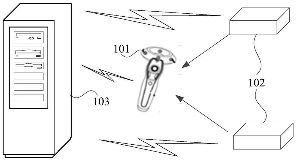
[0027] figure 1 An example of a system architecture diagram applicable to the embodiment of the present application is shown, such as figure 1 As shown, it includes a tracked device 101 , a positioning base station 102 and a server 103 . Wherein, multiple positioning base stations 102 shown in the figure may be placed in the same area. Optionally, the tracked device 101 may be a handle, or a VR helmet.

[0028] In the embodiment of the present application, multiple positioning base stations 102 can be respectively connected to the server 103 through a wireless ...


PUM


Abstract

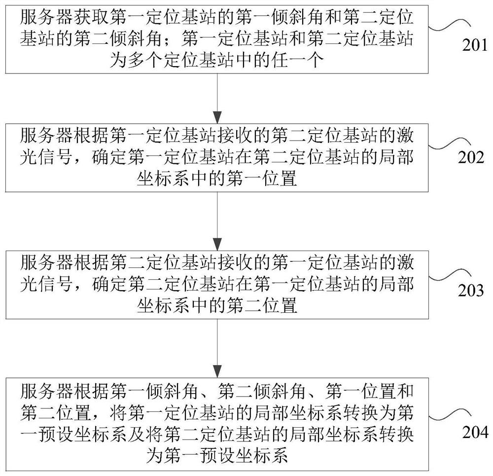
The embodiment of the present application relates to the technical field of laser and electronics, and in particular to a method and device for calibrating the coordinate system of a positioning basestation. The method comprises steps that a server obtains a first tilt angle of a first positioning base station and the second tilt angle of a second positioning base station; determines the first position of the first positioning base station in the local coordinate system of the second positioning base station according to a laser signal received by the first positioning base station from the second positioning base station, and the second position of the second positioning base station in the local coordinate system of the first positioning base station according to a laser signal receivedby the second positioning base station from the first positioning base station, and converts the local coordinate system of the first positioning base station and the local coordinate system of the second positioning base station into a first preset coordinate system according to the first tilt angle, the second tilt angle, the first position, and the second position. In this way, the server canunify a plurality of positioning base stations in the system to the same coordinate system so as to solve the disordered problem when a user uses a tracked device in an area having multiple positioning base stations.

Description

technical field [0001] The embodiments of the present application relate to the field of laser and electronic technologies, and in particular to a method and device for calibrating and positioning a coordinate system of a base station. Background technique [0002] Virtual Reality (VR) technology is a technology that uses computers to generate a simulated environment, and with the help of professional equipment, allows users to enter the virtual space, perceive and operate in real time, so as to obtain an immersive experience. [0003] The most important feature of VR technology is its sense of immersion, and a high-precision, real-time three-dimensional space positioning system is an important part of realizing this feature. The accuracy of the laser positioning solution can reach the millimeter level, which is currently the best way to realize VR positioning. One of the main technical means. Among them, the basic principle of laser positioning is to use the positioning ba...

Claims


Application Information

Patent Timeline
Patent Type & Authority Patents(China)
IPC IPC(8): G01S5/16
CPCG01S5/16
Inventor 刘超陈玉琨何风行
Owner SHANGHAI LEXIANG TECHNOLOGY CO LTD
Learn More