
Modeling method for three-dimensional geological model

A 3D geological and model modeling technology, applied in 3D modeling, image data processing, instruments, etc., can solve problems such as ore body shape deviation and distortion, reduce mining costs, save engineering work, and improve resource utilization Effect

Pending Publication Date: 2018-10-16
中冶北方(大连)工程技术有限公司
View PDF4 Cites 16 Cited by
  • Summary
  • Abstract
  • Description
  • Claims
  • Application Information

AI Technical Summary

Problems solved by technology

[0006] In view of the above problems, the purpose of the present invention is to provide a three-dimensional geological model modeling method to truly reflect the three-dimensional spatial position and s

Method used


Image

  • Modeling method for three-dimensional geological model
  • Modeling method for three-dimensional geological model
  • Modeling method for three-dimensional geological model

Examples


Embodiment

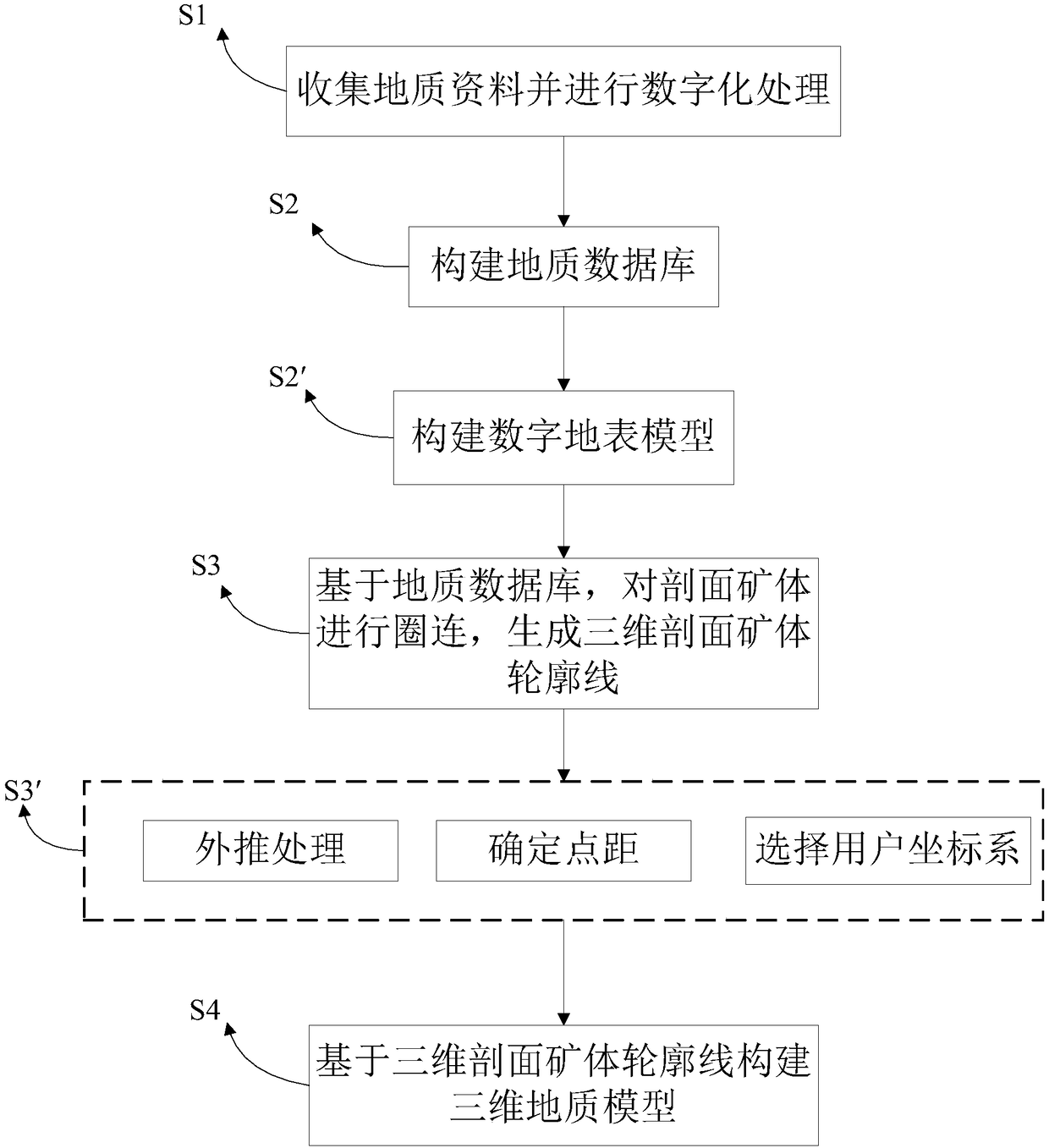
[0085] Step S1, by collecting and sorting out the original geological data of the ore deposit, the original data for three-dimensional geological modeling of the ore deposit are finally obtained as follows:

[0086] 1) Topographic and geological maps of each period, regional geological and mineral maps, and mining status maps;

[0087] 2) Sectional drawing of the exploration line;

[0088] 3) Ore body resource reserve estimation projection map;

[0089] 4) Geological exploration data, mainly including borehole catalog data, borehole histogram, trench sketch, tunnel sketch;

[0090] 5) Geological surveys, detailed surveys, exploration reports, reserves verification reports, etc. in various periods.

[0091] Step S2, using Access to build a geological database, the established geological database contains 225 sets of orifice coordinates, 1804 sets of inclinometer data, and 5970 sets of sample analysis data. After inputting one by one and checking for errors and omissions, the...


PUM


Abstract

The invention discloses a modeling method for a three-dimensional geological model. The modeling method for a three-dimensional geological model comprises the following steps of: S1, collecting and digitally processing geological data; S2, constructing a geological database based on geological data; S3, looping the section ore body based on the geological database to generate a three-dimensional section ore body contour line; S4, constructing a three-dimensional geological model based on the three-dimensional section ore body contour line. The three-dimensional geological model of the invention is constructed based on the three-dimensional section ore body contour line, truly reflects the storage state of the ore body in space, so that the risk caused by inaccurate positioning of the three-dimensional space of the ore body is reduced, and the problems of deviation and distortion of the ore body are solved.

Description

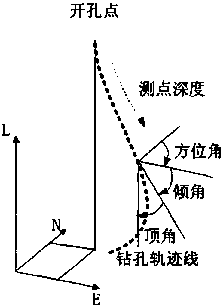
technical field [0001] The invention relates to the technical field of geological modeling, in particular to a three-dimensional geological model modeling method. Background technique [0002] In recent years, with the mining of near-surface ore bodies exhausted, deep mineral resources have become the main object of mining. In order to find out the shape of deep ore bodies, it is necessary to construct thousands of meters of boreholes to explore underground resources. figure 1 is the schematic diagram of the elements of the drilling trajectory, such as figure 1 As shown, due to the influence of geological structure, construction technology and drilling technology, ultra-deep boreholes often deviate from the predetermined spatial position during construction, and bend to different degrees, resulting in distortion of geological conditions. The interpretation of the ore body shape by the geological department is to form a two-dimensional ore body outline by projecting the dri...

Claims


Application Information

Patent Timeline
IPC IPC(8): G06T17/05G06T19/00
CPCG06T17/05G06T19/00
Inventor 秦健朱晓杰王少泉周育
Owner 中冶北方(大连)工程技术有限公司
Learn More