
A marine highway navigation system for cross-sea traffic

A road and transportation technology, applied in buildings, bridges, floating bridges, etc., can solve problems such as unsatisfactory requirements, impact on the earth's ecological environment, high cost, etc., to improve the adaptability of the deep sea environment, protect the marine ecological environment, and reduce engineering difficulty. Effect

Active Publication Date: 2019-12-10
708TH RES INST OF CSSC
View PDF5 Cites 0 Cited by
  • Summary
  • Abstract
  • Description
  • Claims
  • Application Information

AI Technical Summary

Problems solved by technology

[0002] There are generally many sea-crossing bridges in the world. With the maturity and improvement of bridge technology, the setting of navigation holes generally has the same form, especially now that the construction of artificial islands makes the sea-crossing bridges longer and longer. However, the traditional navigable hole form can only meet the navigation needs of ships with small displacement and low deckhouses. For long-span sea-crossing bridges, they often span several navigation areas and are located in certain navigation areas. Ships usually need Higher space above the water, such as the water height of the drilling ship is generally more than 100 meters, the traditional navigation hole form cannot meet the requirements, so the change of the navigation method is particularly important
[0003] The traditional navigable area is usually set in the form of navigable holes of long-span suspension bridges. This method has many disadvantages. On the one hand, the loads of vehicles, bridges and wind, wave and current within the span are all accumulated on the suspension cables, which not only poses safety hazards. The sea-crossing bridge is a permanent project, so the determination of the type of material and the amount of material are often determined directly according to the life estimate, which also increases the huge cost. Barriers are set up for the passage of ships. In terms of ecology, a large amount of extraction, consumption, and waste of raw materials required for setting up navigation areas, changes in marine ecology, extrusion of underwater space, material corrosion, and irreversible changes in seabed topography, etc. It is determined that the traditional permanent bridge form is no longer suitable for the trend of the new era
[0004] Therefore, the current navigation method has potential safety hazards, high costs, restrictions on the passage of ships, and many adverse effects such as affecting the earth's ecological environment.

Method used


Image

  • A marine highway navigation system for cross-sea traffic
  • A marine highway navigation system for cross-sea traffic
  • A marine highway navigation system for cross-sea traffic

Examples


Embodiment Construction

[0032] The following will clearly and completely describe the technical solutions in the embodiments of the present invention with reference to the accompanying drawings in the embodiments of the present invention. Obviously, the described embodiments are only some, not all, embodiments of the present invention. Based on the embodiments of the present invention, all other embodiments obtained by persons of ordinary skill in the art without creative efforts fall within the protection scope of the present invention.

[0033] It should be noted that, in the case of no conflict, the embodiments of the present invention and the features in the embodiments can be combined with each other.

[0034] The present invention will be further described below in conjunction with the accompanying drawings and specific embodiments, but not as a limitation of the present invention.

[0035] refer to Figure 1-6 As shown, a preferred embodiment of a marine road navigation system for cross-sea t...


PUM


Abstract

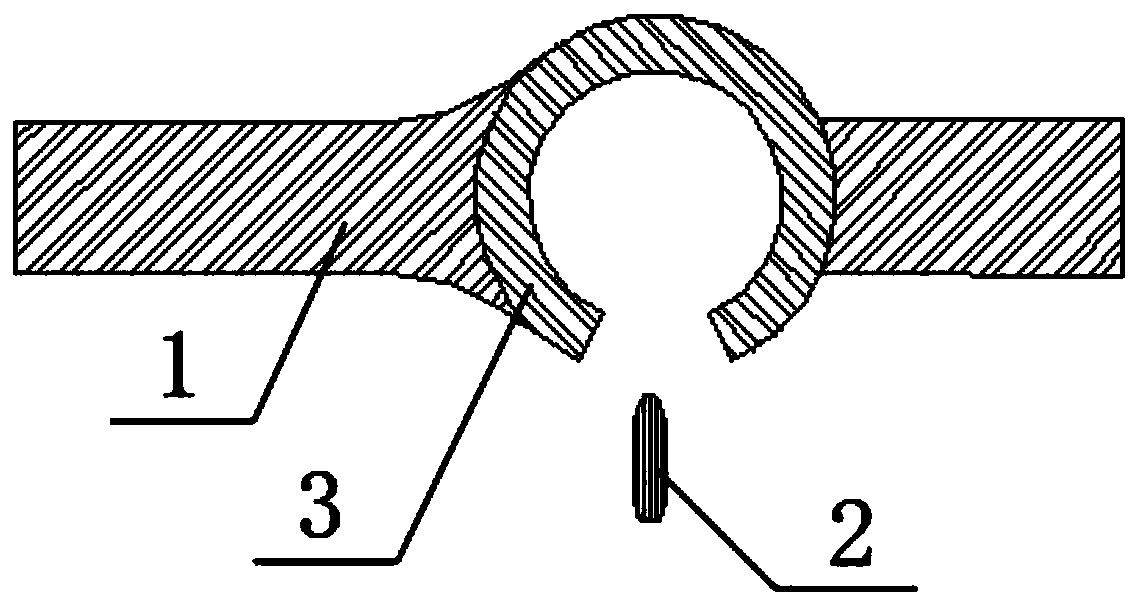
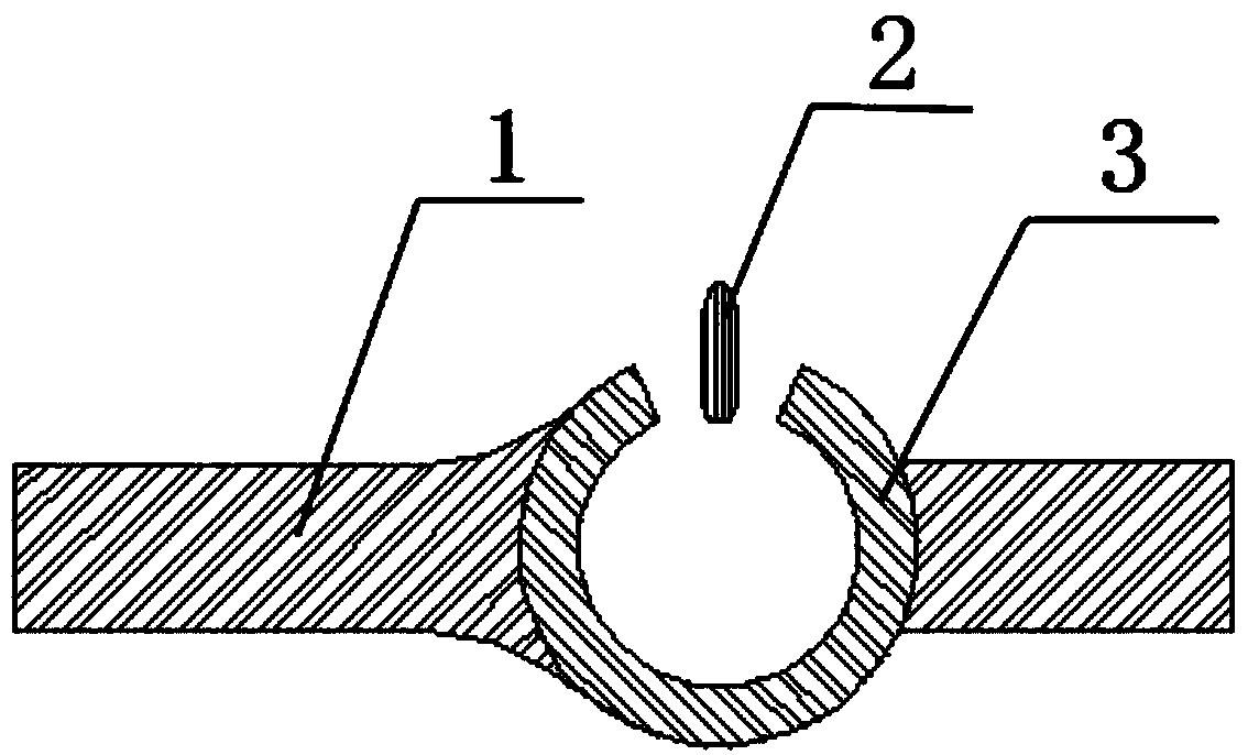
The present invention relates to a maritime highway navigation system for sea-crossing traffic. The maritime highway navigation system comprises a bridge floor deck, a rotating disc deck, a floater system, a connecting structure and a driving rotating disc; the bridge floor deck comprises a first section of bridge floor deck body and a second section of bridge floor deck body; the rotating disc deck is a section of annular deck with notches and is located between the first section of bridge floor deck body and the second section of bridge floor deck body; a plurality of floaters are arranged on the lower parts of the bridge floor deck and the rotating disc deck correspondingly, the surfaces, making contact with the rotating disc deck, of the first section of bridge floor deck body and thesecond section of bridge floor deck body are provided with racks, the outer edge surface of the rotating disc deck is provided with gears, and the gears and the racks are engaged mutually; and the driving rotating disc is located under the rotating disc deck, a plurality of floaters provided with propellers are arranged on the lower portion of the driving rotating disc, the rotating disc deck andthe driving rotating disc are connected through a connecting structure, and the driving rotating disc can drive the rotating disc deck to rotate coaxially. The maritime highway navigation system for sea-crossing traffic is suitable for passing of various hulls.

Description

technical field [0001] The invention relates to marine highway facilities, in particular to a marine highway navigation system for cross-sea traffic. Background technique [0002] There are generally many sea-crossing bridges in the world. With the maturity and improvement of bridge technology, the setting of navigation holes generally has the same form, especially now that the construction of artificial islands makes the sea-crossing bridges longer and longer. However, the traditional navigable hole form can only meet the navigation needs of ships with small displacement and low deckhouses. For long-span sea-crossing bridges, they often span several navigation areas and are located in certain navigation areas. Ships usually need In the higher space above the water, for example, the water height of the drilling ship is generally more than 100 meters, and the traditional navigation hole form cannot meet the requirements. Therefore, the change of the navigation method is parti...

Claims


Application Information

Patent Timeline
Patent Type & Authority Patents(China)
IPC IPC(8): E01D15/14
CPCE01D15/145
Inventor 李成君徐贺唐旭东李永超周书敏张勇
Owner 708TH RES INST OF CSSC
Learn More