Calculation method and system for quantitative characterization of vegetation vertical zone
A calculation method and vegetation technology, applied in the field of data processing, can solve problems such as no prediction model and immature ecological model method
- Summary
- Abstract
- Description
- Claims
- Application Information
AI Technical Summary
Problems solved by technology
Method used
Image
Examples
Embodiment Construction
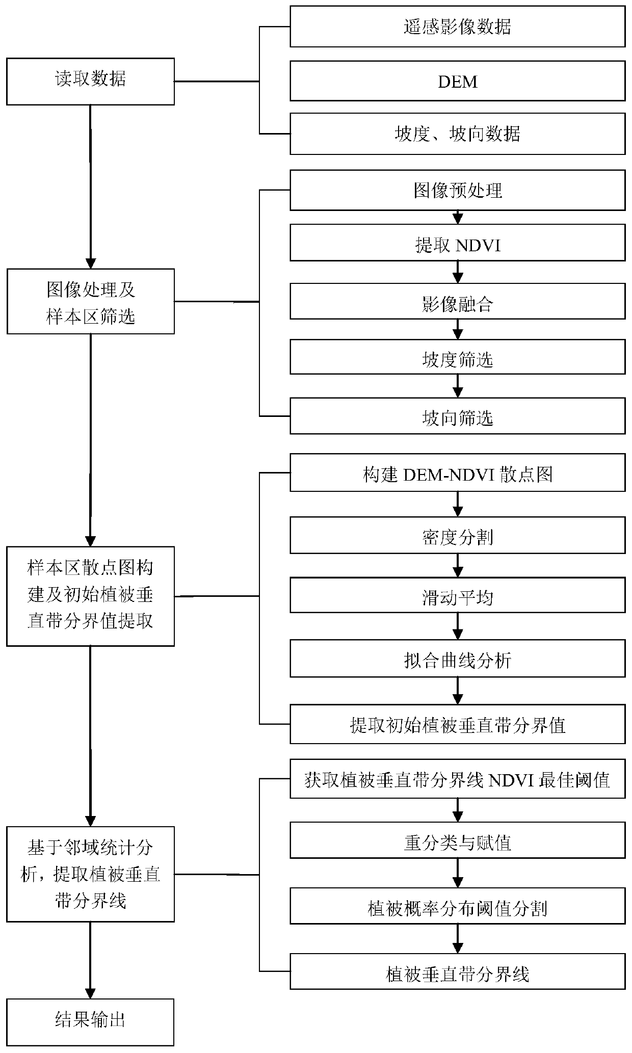
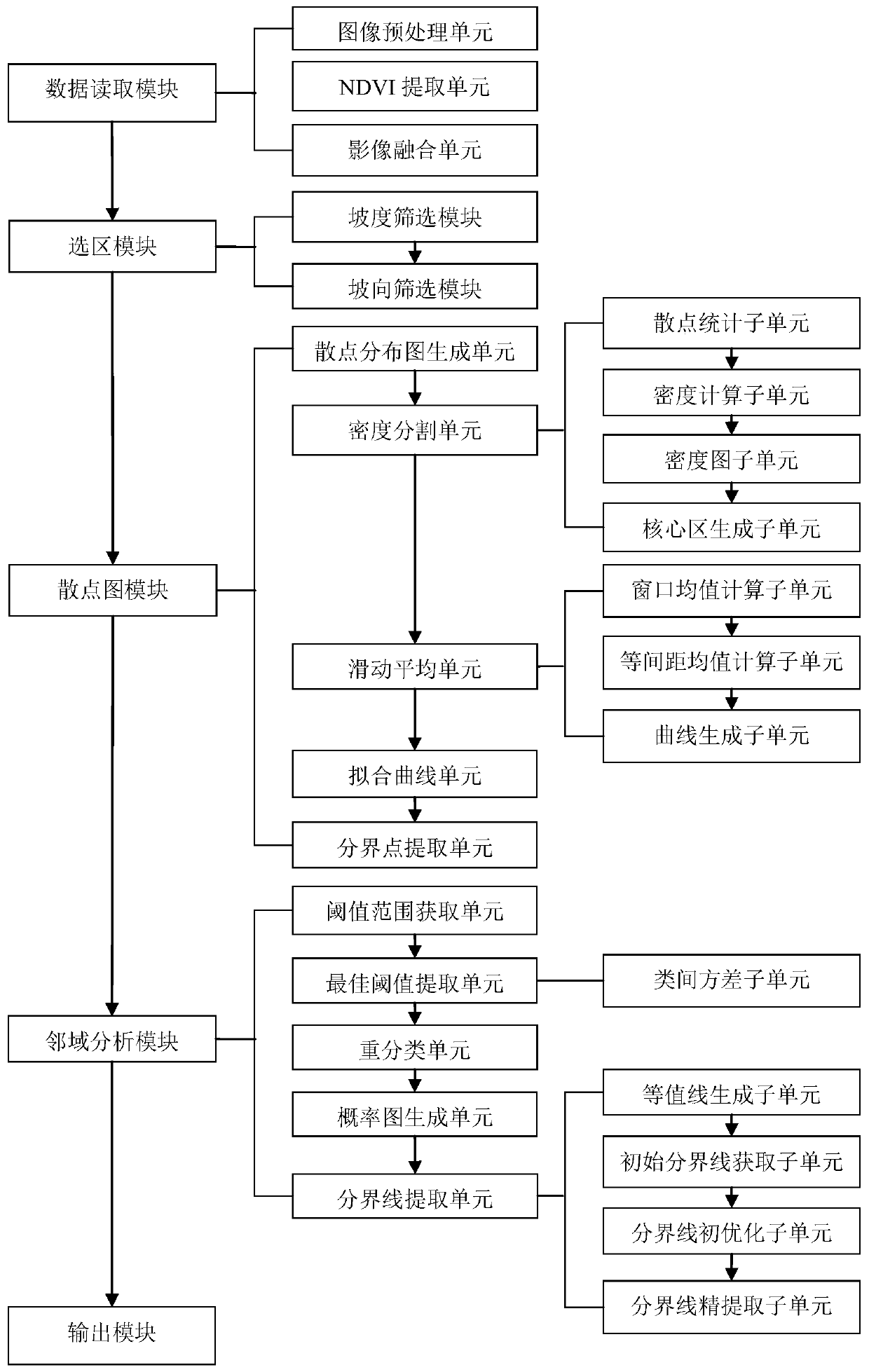
[0135] as attached figure 1 As shown, the application discloses a method for quantitatively describing the vertical vegetation zone, which is used to quantitatively describe the distribution characteristics of the vegetation vertical zone, including the following steps:
[0136] Step 1: Obtain the remote sensing image data of the vegetation vertical belt area to be extracted through the satellite, and extract the corresponding slope and aspect data through the digital elevation model DEM of the area.
[0137] In this embodiment, the remote sensing image, DEM, slope and aspect need to be within the same research area. In order to ensure that the experimental data are all within the same research area, the original remote sensing images and DEM need to be clipped with the vector data of the research area. The slope and aspect data are all clipped DEM extraction results.
[0138] Step 2: Perform image processing on the image data, and perform sample area screening.
[0139] In...
PUM
 Abstract
Description
Claims
Application Information
 - R&D
- Intellectual Property
- Life Sciences
- Materials
- Tech Scout
- Unparalleled Data Quality
- Higher Quality Content
- 60% Fewer Hallucinations
Browse by: Latest US Patents, China's latest patents, Technical Efficacy Thesaurus, Application Domain, Technology Topic, Popular Technical Reports.
© 2025 PatSnap. All rights reserved.Legal|Privacy policy|Modern Slavery Act Transparency Statement|Sitemap|About US| Contact US: help@patsnap.com


