
Remote sensing image landslide single body dividing method

A technology for remote sensing images and landslides, which is applied in image analysis, image data processing, spectrometry/spectrophotometry/monochromator, etc., and can solve problems such as difficulty, increased identification of landslide units, and complex structure.

Active Publication Date: 2017-10-17
BEIJING NORMAL UNIVERSITY
View PDF2 Cites 9 Cited by
  • Summary
  • Abstract
  • Description
  • Claims
  • Application Information

AI Technical Summary

Problems solved by technology

For example, the Wenchuan Earthquake formed a large number of connected landslide areas with complex structures and large areas, which made it difficult to identify the individual landslides.

Method used


Image

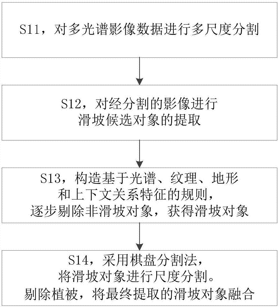
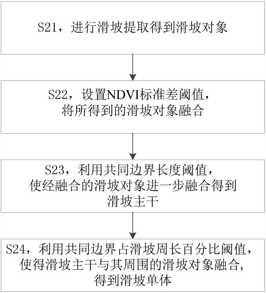
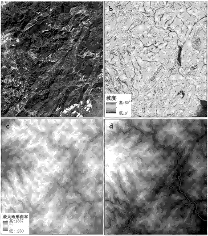
  • Remote sensing image landslide single body dividing method
  • Remote sensing image landslide single body dividing method
  • Remote sensing image landslide single body dividing method

Examples


Embodiment Construction

[0037] Embodiments according to the present invention will be described in detail below with reference to the accompanying drawings. It should be understood that the embodiments according to the present invention are illustrative and not restrictive. The examples should not be taken as limiting the scope of the claimed invention.

[0038] The following takes the object-oriented remote sensing image landslide extraction method as an example to illustrate the remote sensing image landslide extraction method. Those skilled in the art can understand that other landslide extraction methods based on remote sensing images, such as the artificial visual interpretation method based on the characteristics of the landslide shape, color tone, vegetation, etc. on the image, and the image classification method based on pixel spectral information, can be used in the present invention. The landslide monomer division method.

[0039] Object-oriented classification can not only use the spectr...


PUM


Abstract

The invention provides a remote sensing image landslide single body dividing method. The method includes based on the multi-spectral image data and DEM data of the study area, performing landslide extraction to obtain landslide objects; setting the NDVI standard deviation threshold and fusing the obtained landslide objects by means of a fusion algorithm; further fusing the fused landslide objects to a landslide trunk by means of the common boundary length threshold between landslides; and fusing the landslide trunk to the surrounding landslide objects by means of the percentage threshold of the common boundary in the landslide circumference to obtain landslide single bodies. According to the landslide single body dividing method, the extracted landslide objects can be divided into landslide single bodies one by one, so that an unreasonable huge landslide area can be prevented. Particularly, the large-scale landslide hazard caused by earthquakes or heavy rains can be rapidly evaluated, so that the landslide hazard area and quantity are obtained to be the reference for the post-disaster emergency rescue and rehabilitation work.

Description

technical field [0001] The invention relates to remote sensing image data processing. More specifically, the present invention relates to a method for classifying landslide monomers based on remote sensing images. Background technique [0002] A landslide is the downward and outward movement of rock, soil, artificial landfill, or various substances that make up a slope, including typical slips, rockfalls, and flows. Earthquakes are the main factors that induce landslides, and often cause a large number of casualties and economic losses. The 2008 Wenchuan earthquake caused a large number of landslides and other geological disasters, which not only destroyed lifeline projects such as roads, power lines, and pipelines, buried a large amount of farmland and forests, but also caused about 20,000 casualties. Therefore, it is necessary to quickly grasp the situation of landslide disasters after the earthquake, whether it is considered from the rapid assessment of the disaster sit...

Claims


Application Information

Patent Timeline
IPC IPC(8): G01J3/28G06T7/136
CPCG01J3/2823G01J2003/2826G06T7/136
Inventor 王瑛林齐根刘天雪隋琦
Owner BEIJING NORMAL UNIVERSITY
Learn More