Location coding map-based motion track comparison method
A motion track and map technology, applied in the direction of measuring devices, satellite radio beacon positioning systems, instruments, etc., can solve the problems of large data delay and poor user experience, and achieve the effect of increasing speed, reducing data volume, and facilitating search
- Summary
- Abstract
- Description
- Claims
- Application Information
AI Technical Summary
Problems solved by technology
Method used
Image
Examples
Embodiment 1
[0034] To achieve the acquisition of the most traveled trajectory of 800 targets in the map module within the same period of time, the specific process is as follows:
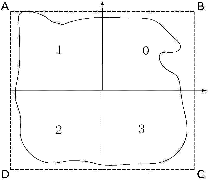
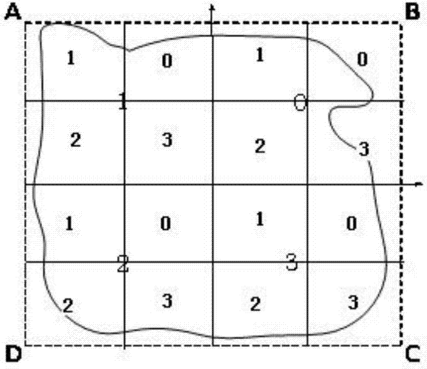
[0035] Step 1, get the target map module, such as figure 1 As shown, four first-level equal-division map modules are divided on the map module, and then all the first-level equal-division map modules are encoded according to the order of the quadrants, and the first-level coding information 0, 1 corresponding to the first-level equal division map module is obtained , 2 and 3; if figure 2 As shown, continue to divide each first-level equal-division map module in the same way, and obtain the second-level equal-division map module accordingly, and then use the same coding method to encode the second-level equal-division map in each first-level equal-division map module The module is coded to obtain the corresponding two-level code information; similarly, the map module is divided into eight-level equal division ...
Embodiment 2
[0042] To realize the coded map module of a certain location that determines the most passing targets in the map module, the specific process is as follows:
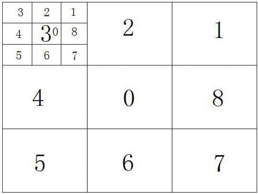
[0043] Step 1, such as image 3 As shown, divide 9 first-level equal-division map modules on the target map module, and then encode all the first-level equal-division map modules in sequence, and obtain the first-level coding information corresponding to the first-level equal-division map modules as 0 -8; then divide each first-level equal-division map module in the same way, and correspondingly obtain the second-level coding information corresponding to the divided second-level equal-division map module; similarly divide the map module into four-level equal division modules ; Each seven-level equally divided map module can be represented by 4 digits of 9-digit data, and finally a map module with the above-mentioned location coding information is obtained.
[0044] Step 2. The target obtains its own location data inform...
Embodiment 3
[0049] To achieve the acquisition of the movement trajectories of two targets in the map module within the same period of time, and to obtain the location and time point where the movement trajectories deviate, the specific process is as follows:
[0050] Step 1: Obtain a square target map module, divide 16 first-level equal-division map modules on the map module, and then encode all first-level equal-division map modules in order to obtain a corresponding first-level equal-division map module Level coding information 0-15; continue to divide each first-level equal division map module in the same way, and obtain a second-level equal division map module accordingly, and then use the same encoding method to divide each first-level equal division map module. The map module is coded to obtain the corresponding two-level coding information; similarly, the map module is divided into four-level equal-division modules; each eight-level equal-division map module can be represented by 4-...
PUM
 Abstract
Description
Claims
Application Information
 - R&D
- Intellectual Property
- Life Sciences
- Materials
- Tech Scout
- Unparalleled Data Quality
- Higher Quality Content
- 60% Fewer Hallucinations
Browse by: Latest US Patents, China's latest patents, Technical Efficacy Thesaurus, Application Domain, Technology Topic, Popular Technical Reports.
© 2025 PatSnap. All rights reserved.Legal|Privacy policy|Modern Slavery Act Transparency Statement|Sitemap|About US| Contact US: help@patsnap.com


