Land risk assessment method and device based on sea level rise
A risk assessment, sea level technology, applied in data processing applications, instruments, calculations, etc., can solve problems such as low practicability and difficulty in dealing with coastal city development planning and engineering design
- Summary
- Abstract
- Description
- Claims
- Application Information
AI Technical Summary
Problems solved by technology
Method used
Image
Examples
Embodiment 1
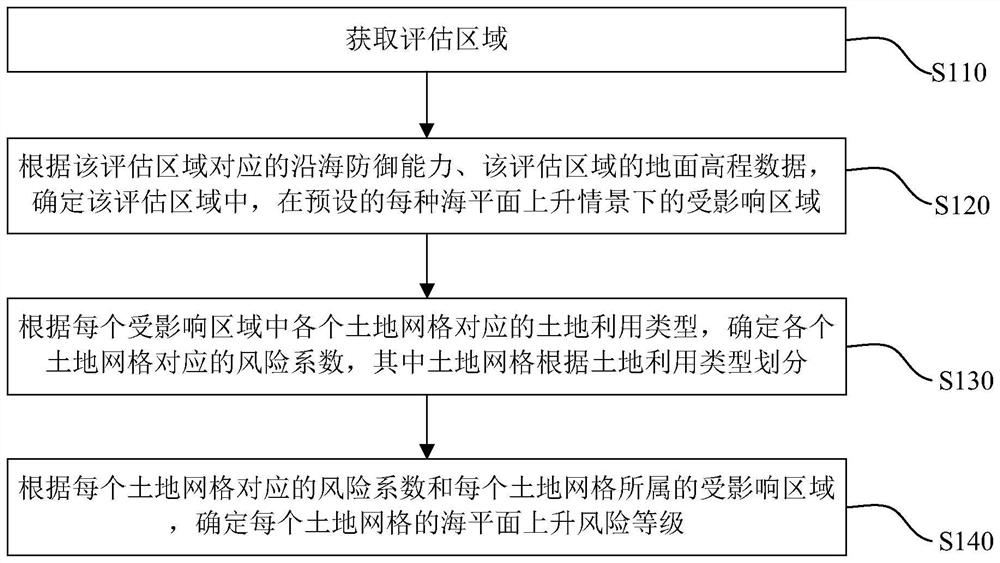
[0030] figure 1 The first schematic flow chart of the land risk assessment method based on sea level rise provided by the first embodiment of the present invention, such as figure 1 As shown, the method includes the following steps:
[0031] Step S110, obtaining an evaluation area.
[0032] Obtain the assessment area that requires risk assessment, and the assessment area is generally a coastal area that is vulnerable to sea level rise disasters.
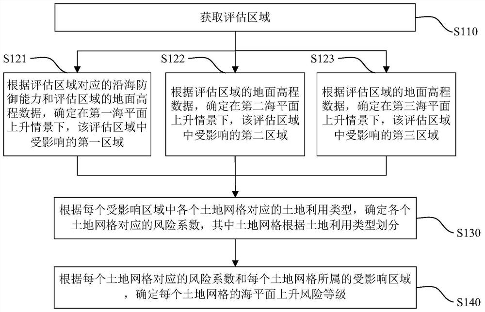
[0033] Step S120, according to the coastal defense capability corresponding to the assessment area and the ground elevation data of the assessment area, determine the affected area in each preset sea level rise scenario in the assessment area.
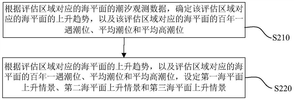
[0034] Considering that under different sea level rise scenarios, the affected areas and degrees in the assessment area are not the same, the method provided by the embodiment of the present invention also includes: setting a variety of sea level rise scenarios, for example, according to th...
Embodiment 2
[0071] Figure 4 A schematic diagram of the module composition of the land risk assessment device based on sea level rise provided by the second embodiment of the present invention, such as Figure 4 As shown, the land risk assessment device based on sea level rise provided by the embodiment of the present invention includes: an assessment area acquisition module 10, which is used to acquire the assessment area; an affected area determination module 20, which is used to determine the coastal defense capability, The ground elevation data of the evaluation area is used to determine the affected area under each preset sea level rise scenario in the evaluation area; the risk factor determination module 30 is used to determine the corresponding land grid in each affected area The land use type is used to determine the risk coefficient corresponding to each land grid, wherein the land grid is divided according to the land use type; the risk level determination module 40 is used to d...
PUM
 Abstract
Description
Claims
Application Information
 - R&D Engineer
- R&D Manager
- IP Professional
- Industry Leading Data Capabilities
- Powerful AI technology
- Patent DNA Extraction
Browse by: Latest US Patents, China's latest patents, Technical Efficacy Thesaurus, Application Domain, Technology Topic, Popular Technical Reports.
© 2024 PatSnap. All rights reserved.Legal|Privacy policy|Modern Slavery Act Transparency Statement|Sitemap|About US| Contact US: help@patsnap.com


