Scenic area motor vehicle number overload control system
A control system and motor vehicle technology, applied in the field of information management, can solve problems such as congestion, road congestion, lack of diversion measures, etc.
- Summary
- Abstract
- Description
- Claims
- Application Information
AI Technical Summary
Problems solved by technology
Method used
Image
Examples
Embodiment 1
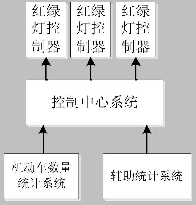
[0025] Such as figure 1 As shown in the present invention, a system for controlling the overload of the number of motor vehicles in a scenic spot includes:
[0026] The motor vehicle quantity statistics system set up at the boundary of the scenic spot counts the number M1 of motor vehicles within the scenic area at the current moment. The motor vehicle quantity statistics system can be a traffic flow monitoring device installed on the road entering the scenic spot at the border of the scenic spot, M1=I1-O1+R1, wherein, I1 is the number of vehicles entering the scenic spot, and O1 is the number of vehicles leaving the scenic spot , R1 is the number of vehicles in the scenic spot before the traffic flow statistics equipment is turned on.
[0027] The control center system receives the number of motor vehicles M1. When M1 exceeds the threshold K of the maximum number of motor vehicles that can be tolerated within the scenic area, it outputs a control signal to the traffic light ...
Embodiment 2
[0030] The difference from Embodiment 1 is that the number of motor vehicles in the scenic spot is directly counted through the monitoring or card reading equipment in the scenic spot.
[0031] For example, using the radio frequency card gear lever system, the Bluetooth gear lever system, the Bluetooth parking space, etc., the vehicles entering and leaving the scenic spot can be counted.
Embodiment 3
[0033] The difference from Embodiment 1 is that, in detail, the road leading to the scenic spot is divided into main road A and branch road B, the main road A is the main road leading to the scenic spot, and the branch road B is directly connected to the main road A. connected roads. refer to figure 2 , the Z area in the figure represents the scenic spot, and Y represents the key nodes on the road. In this embodiment, the Y1-Y2-Y3 line, the Y11-Y5-Y6 line, and the Y12-Y10-Y9 line are set as the main road A, and the main road The directly connected roads connected by road A are branch roads B, for example, Y4-Y2 line, Y7-Y5 line, Y7-Y10 line, Y8-Y6 line, Y8-Y9 line, etc.
[0034] Under the guiding ideology of the present invention, on the main road A, extend the time length of the red light leading to the direction of the scenic spot, and keep the time length of the green light leaving the direction of the scenic spot unchanged; The duration of the red light.
[0035] For e...
PUM
 Abstract
Description
Claims
Application Information
 - R&D Engineer
- R&D Manager
- IP Professional
- Industry Leading Data Capabilities
- Powerful AI technology
- Patent DNA Extraction
Browse by: Latest US Patents, China's latest patents, Technical Efficacy Thesaurus, Application Domain, Technology Topic, Popular Technical Reports.
© 2024 PatSnap. All rights reserved.Legal|Privacy policy|Modern Slavery Act Transparency Statement|Sitemap|About US| Contact US: help@patsnap.com


