
Site leveling method and system

A field and data acquisition system technology, applied in the field of surveying and mapping, can solve problems such as low efficiency and unintuitiveness, and achieve the effect of reducing workload and improving surveying and mapping efficiency.

Inactive Publication Date: 2017-05-10
SHANGHAI HUACE NAVIGATION TECH
View PDF1 Cites 5 Cited by
  • Summary
  • Abstract
  • Description
  • Claims
  • Application Information

AI Technical Summary

Problems solved by technology

General gardens involve the construction of squares. Squares are a horizontal plane or a plane with a certain slope. The traditional method requires the coordination of multiple people to complete the determination of the plane position, and is inefficient and unintuitive.

Method used


Image

  • Site leveling method and system

Examples


Embodiment Construction

[0020] In the following description, numerous specific details are given in order to provide a more thorough understanding of the present invention. It will be apparent, however, to one skilled in the art that the present invention may be practiced without one or more of these details. In other examples, some technical features known in the art are not described in order to avoid confusion with the present invention.

[0021] In order to thoroughly understand the present invention, detailed steps and detailed structures will be provided in the following description, so as to illustrate the technical solution of the present invention. Preferred embodiments of the present invention are described in detail below, however, the present invention may have other embodiments besides these detailed descriptions.

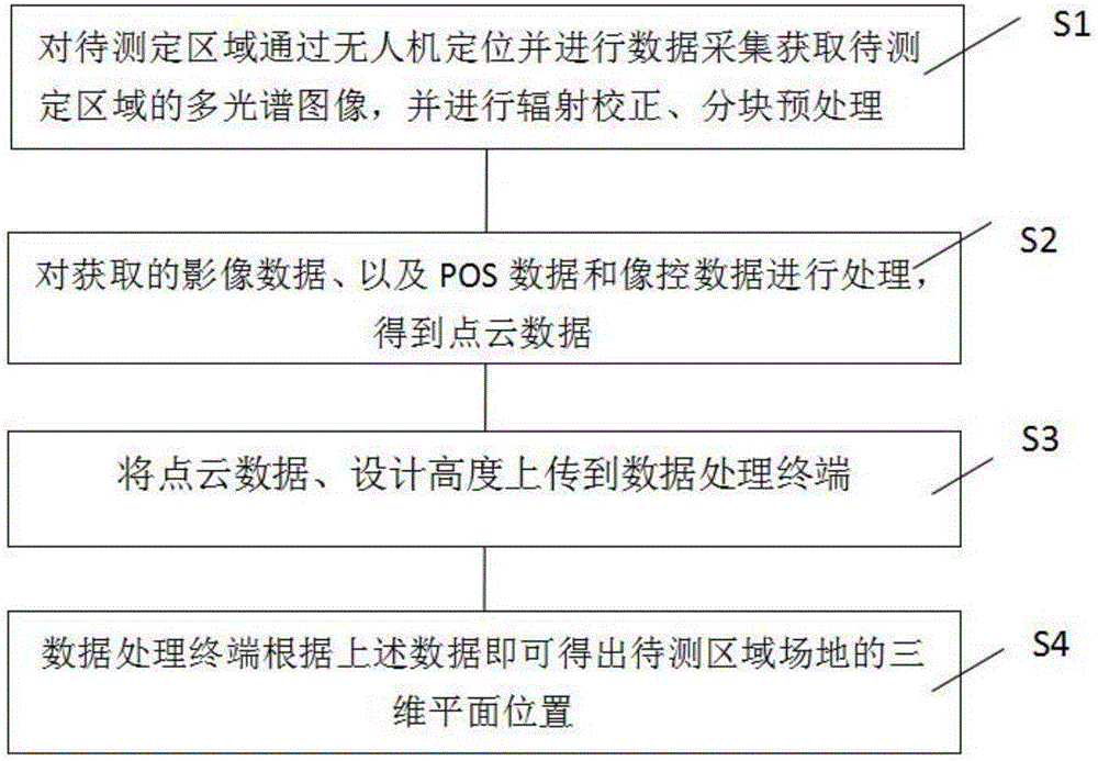
[0022] The invention provides a field leveling method, comprising the following steps:

[0023] Step S1: Position the area to be measured by UAV and collect data to obtain ...


PUM


Abstract

The invention provides a site leveling method and system. The site leveling method comprises the following steps: a multi-spectral image of a region to be measured is obtained by positioning the region to be measured and performing data acquisition through a UAV, and radiation correction and partitioning preprocessing are carried out; acquired image data, as well as POS data and image control data are processed to obtain point cloud data; the point cloud data and design height are uploaded to a data processing terminal; and the three-dimensional plane position of a site in the region to be measured can be obtained by the data processing terminal according to the data. The invention can display an altitude difference from the plane at any position in the field in real time, high efficiency and intuition are achieved, the workload is greatly reduced and the surveying and mapping efficiency is improved.

Description

technical field [0001] The invention relates to the technical field of surveying and mapping, in particular to a site leveling method and system. Background technique [0002] The construction of garden projects, from the surveying and mapping of the status quo map (topographic map) in the early stage of planning and design, to the construction survey throughout the project, and even the completion survey after completion, are directly related to the completion quality of the entire project, and are generally used in garden design. The design has round or arc-shaped steps, squares, green belts, etc. General gardens involve the construction of squares, which are a horizontal plane or a plane with a certain slope. The traditional method requires the coordination of multiple people to complete the determination of the plane position, and is inefficient and unintuitive. Contents of the invention [0003] In order to solve the above shortcomings, the present invention provides...

Claims


Application Information

Patent Timeline
Patent Type & Authority Applications(China)
IPC IPC(8): G06T7/00G06T5/00
CPCG06T7/0004G06T2207/20021G06T2207/10028G06T2207/30132G06T5/80
Inventor 何伟赵延平杨洋魏立龙车相慧
Owner SHANGHAI HUACE NAVIGATION TECH
Learn More