Integrity assessment technology for three-dimensional physical habitat of urban river
A complete, three-dimensional technique applied in the field of physical habitat integrity assessment of urban rivers
- Summary
- Abstract
- Description
- Claims
- Application Information
AI Technical Summary
Problems solved by technology
Method used
Image
Examples
Embodiment
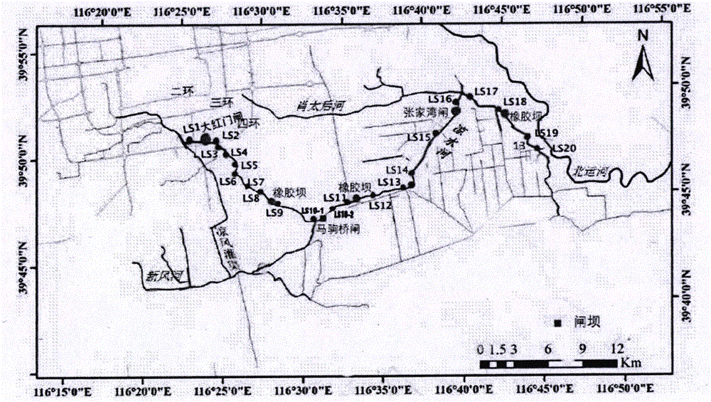
[0064] Taking the Liangshui River in Beijing as the research object, 21 sampling points were arranged along the direction of the river (attached figure 1 ), carried out field surveys in April and August 2015 according to the calculation methods of each indicator, and obtained the scores of each indicator.
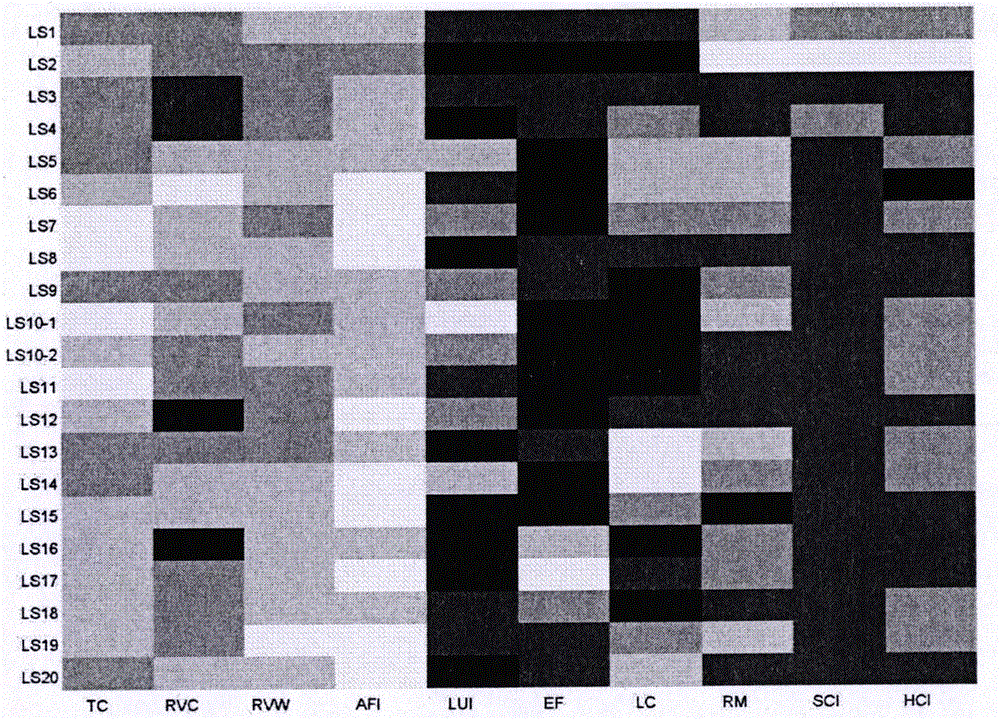
[0065] On the basis of the field survey in April 2016, combined with the historical data accumulated by the research team, the survey results of the physical habitat integrity of the Liangshui River were obtained (see Table 2).
[0066] Table 2. The survey results of physical habitat integrity of Liangshui River
[0067] Monitoring points TC RVC RVW AFI LUI EF LC RM SCI HCI LS1 0.60 0.30 0.55 0.65 0.13 0.30 0.17 0.24 0.35 0.20 LS2 0.65 0.35 0.45 0.55 0.04 0.20 0.12 0.28 0.60 0.35 LS3 0.50 0.18 0.40 0.75 0.13 0.25 0.21 0.12 0.30 0.15 LS4 0.45 0.25 0.45 0.75 0.06 0.25 0.29 0.14 0.35 0.1...
PUM
 Abstract
Description
Claims
Application Information
 - R&D
- Intellectual Property
- Life Sciences
- Materials
- Tech Scout
- Unparalleled Data Quality
- Higher Quality Content
- 60% Fewer Hallucinations
Browse by: Latest US Patents, China's latest patents, Technical Efficacy Thesaurus, Application Domain, Technology Topic, Popular Technical Reports.
© 2025 PatSnap. All rights reserved.Legal|Privacy policy|Modern Slavery Act Transparency Statement|Sitemap|About US| Contact US: help@patsnap.com


