
Cross-land ship track line correction method based on obstacle-avoiding path planning

A ship trajectory and path planning technology, applied in the field of trajectory analysis, can solve problems such as low efficiency and inapplicability of trajectory correction, and achieve the effects of increasing rationality, ensuring maritime traffic safety, and improving efficiency

Inactive Publication Date: 2017-01-04
YUNNAN NORMAL UNIV
View PDF5 Cites 11 Cited by
  • Summary
  • Abstract
  • Description
  • Claims
  • Application Information

AI Technical Summary

Problems solved by technology

[0003] The obstacle avoidance path planning methods mainly include the maze method and the line search method. These two methods are very inefficient when facing a large area of ​​land, and are not suitable for mass trajectory correction.

Method used


Image

  • Cross-land ship track line correction method based on obstacle-avoiding path planning
  • Cross-land ship track line correction method based on obstacle-avoiding path planning
  • Cross-land ship track line correction method based on obstacle-avoiding path planning

Examples


Embodiment Construction

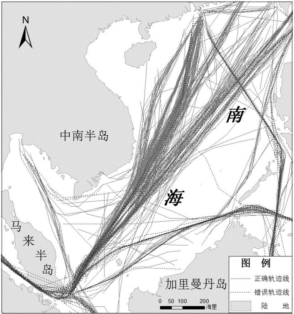
[0044] Taking the South China Sea as an example, this embodiment will be described in detail according to the accompanying drawings, so as to make the route and operation steps of this embodiment clearer.

[0045] The experimental area selected in this embodiment is the South China Sea, with latitude and longitude range: 0°-23°N, 99°E-124°E. The experimental data is the 2014 VOSCLIM data provided by the NOAA National Climate Center website, and the ship trajectory with cross-land errors is obtained by connecting the positions in chronological order.

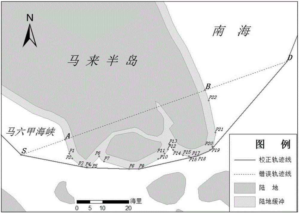
[0046] The track line correction method of this embodiment obtains the land buffer zone by analyzing the buffer range across the land; the wrong line segment of the wrong ship track line divides the land buffer zone into two parts, and the polygon formed by the smaller part is used as the obstacle avoidance polygon ; According to the starting point and end point of the wrong line segment, combined with the obstacle avoidance poly...


PUM


Abstract

The invention discloses a cross-land ship track line correction method based on obstacle-avoiding path planning, belongs to the technical field of track analysis, and aims to solve the problems that a conventional method is low in correction efficiency on a large-area land and a great number of track lines. The cross-land ship track line correction method comprises the following steps: I, acquiring a wrong ship track line; II, analyzing a buffer range of a cross land so as to obtain a land buffer area; III, dividing the land buffer area into two parts by a wrong line section of the wrong ship track line, and forming a polygon as an obstacle-avoiding polygon by a relatively small part; IV, according to the start point and the final point of the wrong line section, acquiring a shortest obstacle-avoiding path as a modified path by using the obstacle-avoiding polygon, and replacing the wrong line section of the wrong ship track line by the modified path.

Description

technical field [0001] The invention relates to a method for correcting a trajectory of a cross-land ship, in particular to a method for correcting a trajectory of a cross-land ship based on obstacle-avoiding path planning, and belongs to the technical field of trajectory analysis. Background technique [0002] The ship trajectory is a polyline formed by recording its own spatial position at a certain time interval during the ship's voyage, and then connecting them in chronological order. The spatial distribution of ship trajectories is of great significance for mastering regional maritime traffic conditions, monitoring ship behavior, and ensuring maritime traffic safety. The correctness of the trajectory is of great importance. However, due to the limitation of the time resolution of the ship's recorded position, two adjacent track points cross the land, and it is necessary to use a certain method to correct these wrong routes. If two adjacent trajectory points across the ...

Claims


Application Information

Patent Timeline
Patent Type & Authority Applications(China)
IPC IPC(8): G01C21/20
CPCG01C21/203
Inventor 王加胜杨昆王嘉学徐艳芳朱彦辉罗毅杨扬
Owner YUNNAN NORMAL UNIV
Learn More