
Real estate data integrating method based on GIS

A technology of data integration and real estate, applied in the field of GIS, it can solve the problems of data islands, repeated certification and mortgage of the same parcel of land or real estate unit, and various types of data, etc., to achieve a wide range of applications, solve data sharing problems, ensure consistency and Integrity effect

Inactive Publication Date: 2016-11-09
西安数驰信息科技有限公司
View PDF4 Cites 17 Cited by
  • Summary
  • Abstract
  • Description
  • Claims
  • Application Information

AI Technical Summary

Problems solved by technology

[0004] 1. The data of multiple business systems are intersected, and there are many types of data, lack of unified planning and centralized management, low standardization, and a large number of invalid redundancy.
[0005] 2. Data only provides services for a single system and cannot be shared globally. The phenomenon of data islands is obvious
[0006] 3. In the application process of regional informatization, due to the multi-source and heterogeneous characteristics of geospatial data, it is difficult to directly meet the requirements of geospatial data sharing and services
[0007] 4. Graphical data and attribute data are not associated, so mutual checking of map attributes cannot be realized. The existing location-based positioning of real estate is difficult to uniquely identify parcels and real estate, and it is easy to cause problems such as repeated certificates and mortgages for the same parcel or real estate unit.
[0008] 5. There are many types of application systems, most of which are basically aimed at a single management business, and the accumulated data is limited to the internal use of departments or units or even individuals, and the data of each system cannot be effectively linked and updated. Realize information interaction
[0009] 6. Unable to effectively statistically analyze existing data and provide decision support information for relevant departments
However, data integration using structural metadata alone has certain limitations, especially the lack of semantic description and mapping of multiple distributed, autonomous, and heterogeneous data sources, and this integration method cannot associate spatial data with attribute data.

Method used


Image

  • Real estate data integrating method based on GIS
  • Real estate data integrating method based on GIS
  • Real estate data integrating method based on GIS

Examples


Embodiment Construction

[0040] Below in conjunction with accompanying drawing, the present invention will be further described.

[0041] In order to make the object, technical solution and advantages of the present invention clearer, the present invention will be further described in detail below in conjunction with the accompanying drawings and specific embodiments. It should be understood that the specific embodiments described here are only used to explain the present invention, and are not intended to limit the present invention.

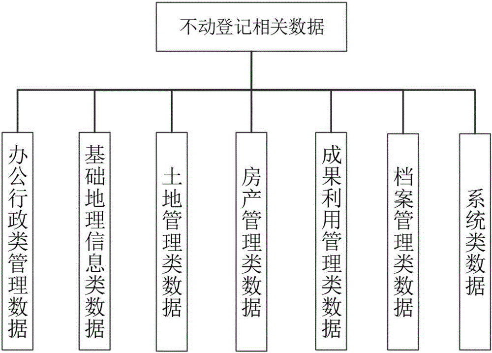
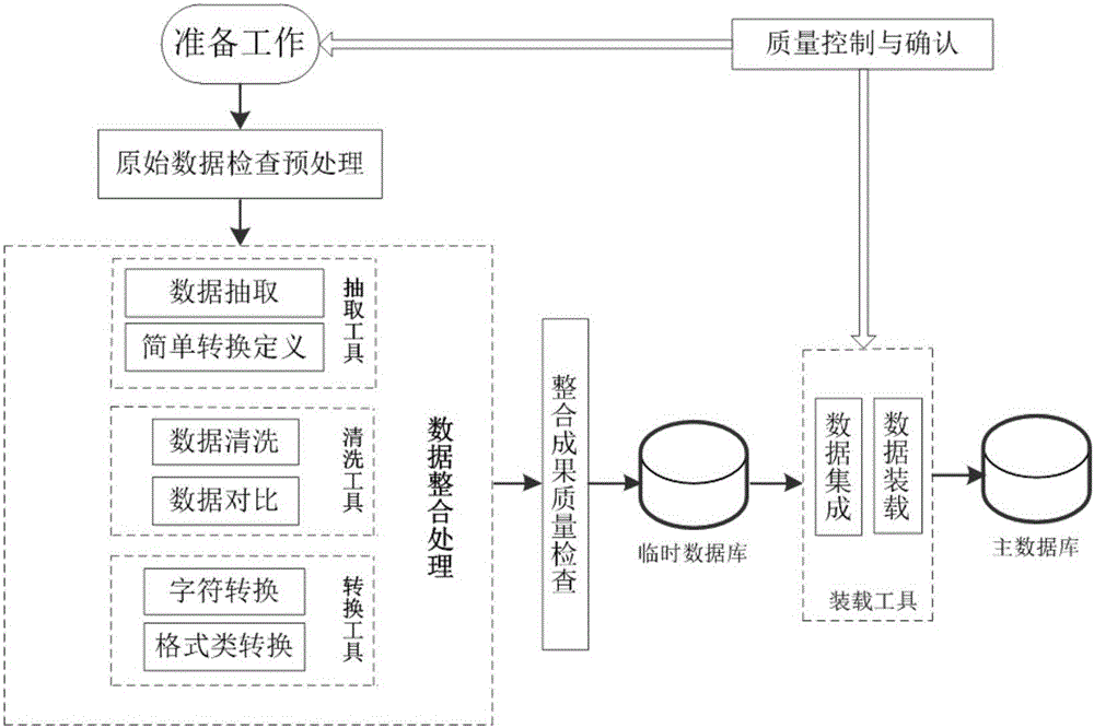
[0042] Such as Figure 1-6 As shown, this specific implementation mode adopts the following technical scheme: its method is: take the data as the core, proceed from the own characteristics of the data, according to the three construction rules commonly used in the process of human cognition and understanding of the real world (distinguish between objects and their attributes, distinguishing the whole object and its components, forming and distinguishing different object...


PUM


Abstract

The invention discloses a real estate data integrating method based on a GIS, and relates to the technical field of GIS. The method includes the step that with data as the core, starting from the characteristics of data, a data integrating rule is established according to three establishing rules generally used when human beings cognize and understand the real world, that is, the data integrating rule is established by classifying data related to a real estate and finding out the internal relation of the data. The method is wide in application range; the data integrating procedure is guided by means of the data integrating rule, the consistency and integrity of the final data result are ensured, and the data sharing problem can be effectively solved; data can be seamlessly integrated to a national or provincial cloud side real estate information foundation platform.

Description

technical field [0001] The invention relates to the technical field of GIS, in particular to a GIS-based real estate data integration method. Background technique [0002] With the development of information technology and the deepening of its application, everyone has realized that data is the most precious wealth, the cornerstone of ensuring business continuity, and the core of applications. A system without data is just a stack of hardware and software, which is meaningless. A system with meaning must have data that circulates and works on it. But for a system, data alone is not enough, the accuracy, consistency, integrity, availability and stability of the data must also be ensured. [0003] At present, my country's real estate registration data on land, houses, forest land, grasslands, and sea areas are scattered at all levels, mainly in the departments of land and resources, housing and construction, agriculture, forestry, and ocean at the city and county levels. Aft...

Claims


Application Information

Patent Timeline
IPC IPC(8): G06F17/30
CPCG06F16/29
Inventor 孔宪光殷磊汪星
Owner 西安数驰信息科技有限公司
Learn More