Vehicle location positioning information fusion method based on vehicular ad hoc network

A self-organizing network and positioning information technology, which is applied in the direction of location information-based services, network topology, wireless communication, etc., can solve problems such as failure to achieve

Active Publication Date: 2016-06-15
XIDIAN UNIV
View PDF6 Cites 19 Cited by
  • Summary
  • Abstract
  • Description
  • Claims
  • Application Information

AI Technical Summary

Problems solved by technology

[0009] None of the above-mentioned solutions in the prior art can realize the method of effectively improving the accurate positioning of the vehicle in front under the premise of real-time inspection and information sharing of the surrounding conditions of the vehicle.

Method used


Image

  • Vehicle location positioning information fusion method based on vehicular ad hoc network
  • Vehicle location positioning information fusion method based on vehicular ad hoc network
  • Vehicle location positioning information fusion method based on vehicular ad hoc network

Examples


Embodiment 1

[0165] Example 1, bicycle fusion scheme:

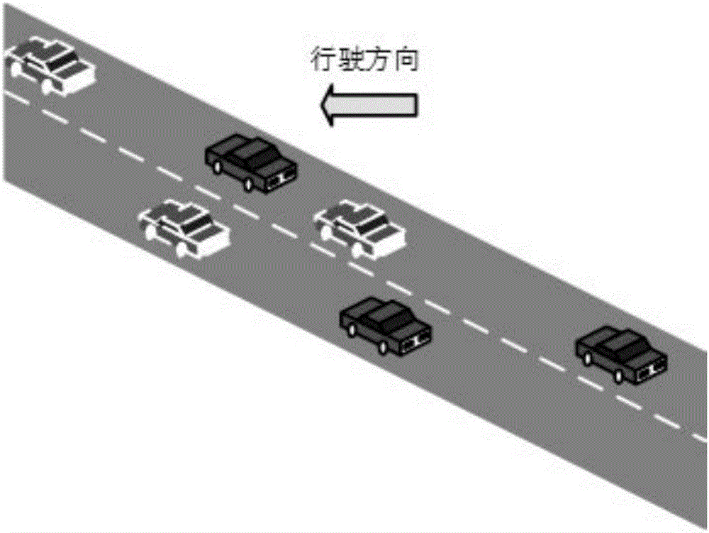
[0166] Bicycle fusion refers to the data fusion realized after the vehicle receives the sensor data shared by a vehicle in the system. In fact, the added data comes from one other vehicle in the system, so it is called single-vehicle fusion. Such as Figure 4 Shown:

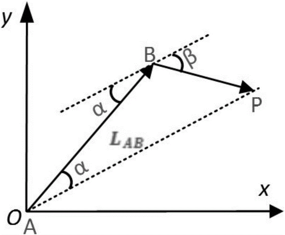
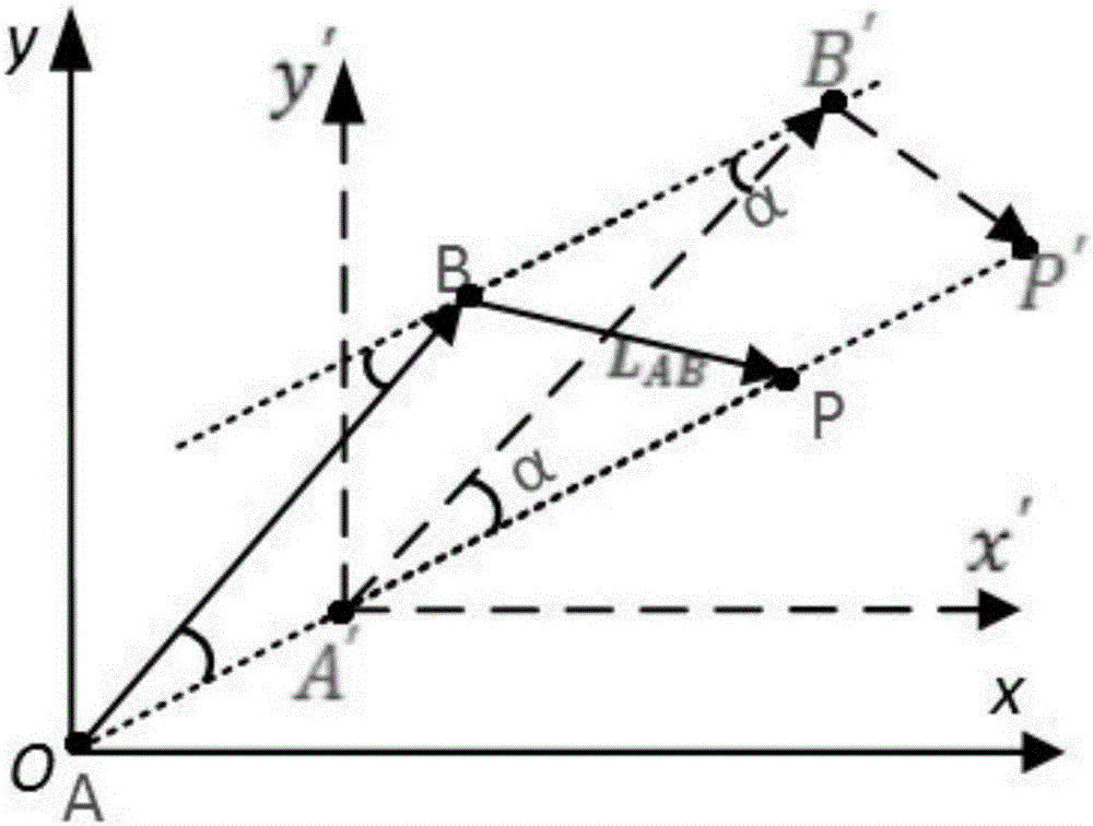
[0167] A and B are vehicles in the system. Taking A as the first perspective, car A can obtain the sensor data shared by car B in the system. At the same time, car A can also obtain its own GPS data in real time, the measurement data of car B by image ranging, and the data measured by car B by radar ranging. L AP More accurate results can be obtained through the data fusion scheme proposed by the present invention. Its program flow chart is as follows: Figure 5 as shown,

[0168] Step 1: Acquire the data of car B according to the above method, and perform pre-correction and fusion to obtain L AB = S AB(GPS) +ω AB(GPS) and the modified L B′P′ .

[0169] Step...

Embodiment 2

[0179] Embodiment 2, multi-vehicle data fusion scheme

[0180] Such as Figure 7 As shown, multi-vehicle fusion refers to the data fusion realized after the own vehicle receives the sensor data shared by multiple vehicles in the system. In fact, the added data comes from multiple other vehicles in the system, so it is called multi-vehicle fusion. Multi-vehicle fusion is suitable for the application scenarios shown in the figure above. Using the bicycle fusion method in Example 1, L can be obtained ABP , L ACP , L ADP , L AEP . Then apply the fuzzy closeness fusion method mentioned above to eliminate the missing data, and finally get is the final optimal result,

[0181] The flow chart of the multi-vehicle data fusion scheme is as follows: Figure 8 shown.

[0182] The steps of the multi-vehicle fusion method are as follows:

[0183] Step 1: Using the single-vehicle fusion fusion scheme in Example 1 multiple times, multiple optimization results can be obtained. If...


PUM


Abstract

The invention discloses a vehicle location positioning information fusion method based on a vehicular ad hoc network. The method comprises the following steps of S1, determining the number of vehicles around a target vehicle in the ad hoc network, if the number of the vehicles is n, running a single vehicle data fusion method for n times, and if four vehicles are located around the target vehicle, running the single vehicle data fusion method for four times; and S2, using a fuzzy nearness fusion method to remove negligent data therein, and working out a weight according to a close degree to obtain the vehicle location positioning information. According to the method, the error influence on ranging caused by network delay is reduced and eliminated through the difference between relative driving distances within the delay, and it assumes that the own vehicle image ranging and radar ranging are real-time. When the data such as distance and the like is used for fusing, the received positioning information of the other vehicles in the system is pre-corrected, the data fusion is performed, and at last fusion is performed again aiming at each auxiliary vehicle fusion result, thus the target positioning accuracy is improved.

Description

technical field [0001] The invention belongs to the technical field of vehicle position positioning information, and in particular relates to a vehicle position positioning information fusion method based on a vehicle ad hoc network. Background technique [0002] The Internet of Vehicles (Internet of Vehicles) is a huge interactive network composed of information such as vehicle location, speed and route. Through sensor devices such as GPS, Beidou, RFID, radar, and cameras, vehicles can complete the collection of their own environment and status information; through Internet technology, all vehicles can transmit and gather their own various information to the central processing unit; through computer technology, The information of these large numbers of vehicles can be analyzed and processed to calculate the best routes for different vehicles, report road conditions in time, and arrange signal light cycles. [0003] Vehicle Ad-hoc Network (VANET) is the application of tradi...

Claims


Application Information

Patent Timeline
IPC IPC(8): H04W64/00H04W4/02H04W4/04H04W84/18
CPCH04W4/027H04W4/046H04W64/00H04W64/006H04W84/18
Inventor 何先灯蒋奋强陈南易运晖权东晓朱畅华裴昌幸赵楠
Owner XIDIAN UNIV
Why Eureka
Try Eureka