
Navigation method and apparatus

A navigation method and road technology, applied in the field of navigation, can solve problems such as the inability to accurately locate the road type of driving vehicles

Inactive Publication Date: 2016-06-15
AUTONAVI
View PDF8 Cites 31 Cited by
  • Summary
  • Abstract
  • Description
  • Claims
  • Application Information

AI Technical Summary

Problems solved by technology

[0005] Embodiments of the present invention provide a navigation method and device to solve the problem that the existing technology cannot accurately locate the road type of the road where the vehicle is currently located or the lane where the vehicle is located

Method used


Image

  • Navigation method and apparatus
  • Navigation method and apparatus
  • Navigation method and apparatus

Examples


Embodiment Construction

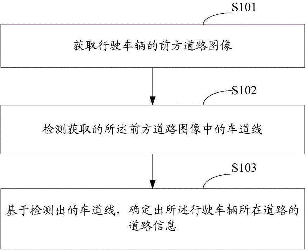
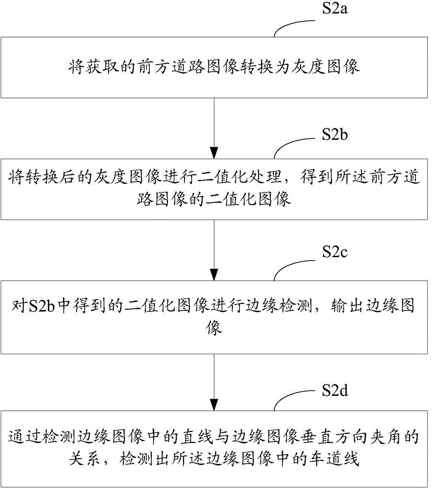
[0042] In the embodiment of the present invention, the road information of the road where the driving vehicle is located is determined by acquiring the front road image of the driving vehicle; detecting the lane lines in the acquired front road image; and based on the detected lane lines. It can be seen that the embodiment of the present invention can accurately locate the road information of the road where the driving vehicle is located, and use the located road information of the road where the driving vehicle is located, such as the lane or road type of the road, to more accurately navigate the driving vehicle.

[0043] The embodiments of the present invention will be further described in detail below in conjunction with the accompanying drawings.

[0044] Such as figure 1 As shown, the flow chart of the navigation method provided by the embodiment of the present invention includes the following steps:

[0045] S101: Acquiring an image of a road ahead of a driving vehicle....


PUM


Abstract

The present invention relates to the technical field of navigation, in particular relates to a navigation method and apparatus, and aims at solving the problems that in the prior art a type of a current road in which a driving car is or a current driveway in which the driving car is cannot be accurately positioned. The navigation method is as follows: obtaining an image of a road ahead of a driving car; detecting a driveway line of the obtained image of the road ahead of the driving car; and determining road information of the road in which the driving car is on the basis of the detected driveway line. According to the navigation method, road information of the road in which the driving car is can be accurately positioned, and by use of the road information of the road in which the positioned driving car is, such as a type of the road or the driveway, the driving car can be more accurately navigated.

Description

technical field [0001] The invention relates to the technical field of navigation, in particular to a navigation method and device. Background technique [0002] Vehicle navigation mainly uses the vehicle Global Positioning System (Global Positioning System, GPS) for navigation, which can conveniently and accurately tell the driver the shortest or fastest route to the destination. [0003] In the actual navigation process, there is a certain positioning error in GPS positioning, and the positioning error is generally about 10 meters, which may cause two problems. On the one hand, urban expressways are generally composed of main roads and auxiliary roads. Since the distance between the two types of roads is relatively close, GPS may mislocate the road type of the current road where the vehicle is driving, resulting in the navigation software being unable to accurately locate the road. Navigation for moving vehicles. For example, when a driving vehicle travels from the main ...

Claims


Application Information

Patent Timeline
Patent Type & Authority Applications(China)
IPC IPC(8): G01C21/26G01C21/36
Inventor 王晋高
Owner AUTONAVI
Learn More