Remote sensing data deep learning based offshore pollutant identifying and tracking method
A deep learning and remote sensing data technology, applied in the field of offshore pollutant identification and tracking, can solve the problems of incomplete discovery, lack of remote sensing data content mining, etc., and achieve the effect of large amount of calculation.
- Summary
- Abstract
- Description
- Claims
- Application Information
AI Technical Summary
Problems solved by technology
Method used
Image
Examples
Embodiment Construction
[0027] The present invention will be further described below in conjunction with the accompanying drawings and specific embodiments.
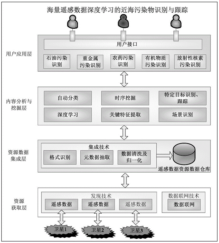
[0028] The offshore pollutant identification and tracking system based on remote sensing data deep learning of the present invention, as attached figure 1 As shown, it is divided into application layer, content analysis and mining layer, resource data integration layer, resource acquisition layer, including pollutant target identification, decision support subsystem, alarm subsystem, pollutant drift forecast subsystem, various pollution chemical composition and hazard database, pollution cleaning and salvage materials / equipment performance and inventory database, geographic information system, pollution emergency response capability assessment subsystem, pollution damage assessment subsystem, etc., can combine wireless communication system technology to realize ground emergency response center and marine The visualized information communication...
PUM
 Abstract
Description
Claims
Application Information
 - R&D
- Intellectual Property
- Life Sciences
- Materials
- Tech Scout
- Unparalleled Data Quality
- Higher Quality Content
- 60% Fewer Hallucinations
Browse by: Latest US Patents, China's latest patents, Technical Efficacy Thesaurus, Application Domain, Technology Topic, Popular Technical Reports.
© 2025 PatSnap. All rights reserved.Legal|Privacy policy|Modern Slavery Act Transparency Statement|Sitemap|About US| Contact US: help@patsnap.com


