A GPS redundant design navigation system, working method and vehicle
A navigation system and vehicle technology, applied in the field of navigation, to achieve the effects of avoiding tail drift, improving reliability, and correcting the turning radius
- Summary
- Abstract
- Description
- Claims
- Application Information
AI Technical Summary
Problems solved by technology
Method used
Image

Examples
Embodiment 1
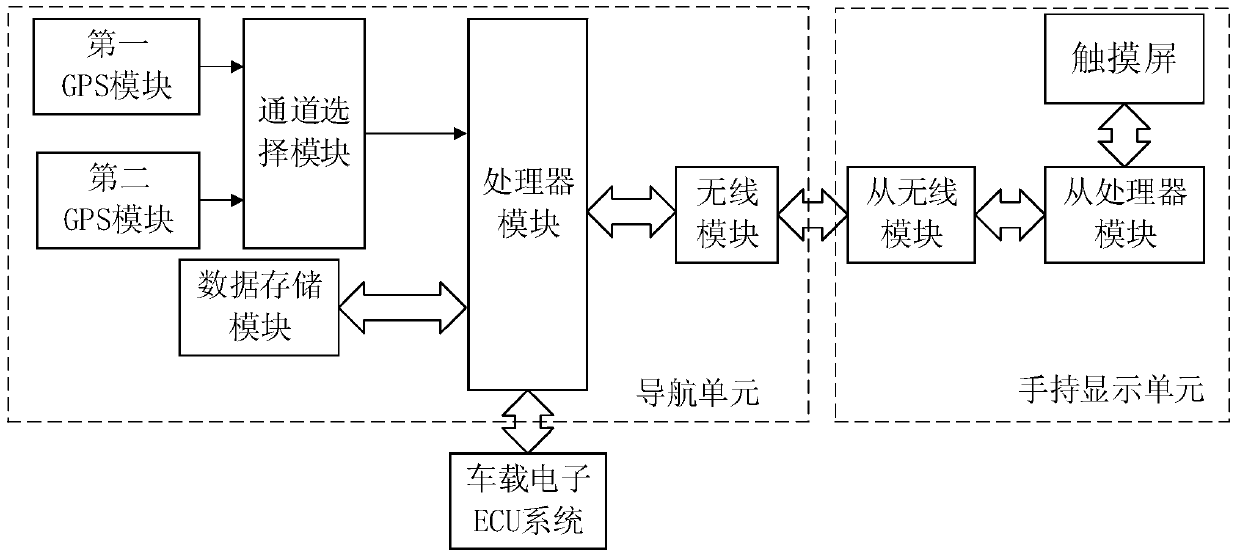
[0028] Such as figure 1 As shown, Embodiment 1 provides a navigation system, including: a handheld display unit, which is suitable for detachable installation in the control position of the car; the navigation unit of the navigation system is located in the car center console, and the navigation unit The built-in wireless module is connected with the handheld display unit; the navigation unit includes: a processor module, a first and a second GPS module, and the first and second GPS modules are connected with the processor module through a channel selection module.
[0029] The channel selection module is controlled by the processor module and used for switching between the first and second GPS modules.
[0030] Specifically, the handheld display unit includes: a touch screen, a slave processor module connected to the touch screen, and a slave wireless module connected to the slave processor module. That is, the handheld display unit can display navigation unit operations, na...
Embodiment 2
[0050] On the basis of Embodiment 1, Embodiment 2 provides a working method of the navigation system.
[0051] The navigation system includes a navigation unit, which includes: a processor module, a data storage module, first and second GPS modules, and the first and second GPS modules are connected to the processor module through a channel selection module; the data The storage module stores map data and vehicle type turning radius data; the working method includes: the processor module is adapted to plan a navigation route according to the current location of the vehicle and the input target location, and combined with the turning radius data of the current vehicle.
[0052] The processor module is adapted to pre-calculate several preliminary planning navigation paths between the vehicle's current location and the input target location; and search for corresponding curved road sections in each preliminary planning navigation path, and turn The radius data filters each curved...
Embodiment 3
[0058] Such as Figure 3a , Figure 3b and Figure 3c As shown, on Embodiment 1, Embodiment 3 provides a vehicle.
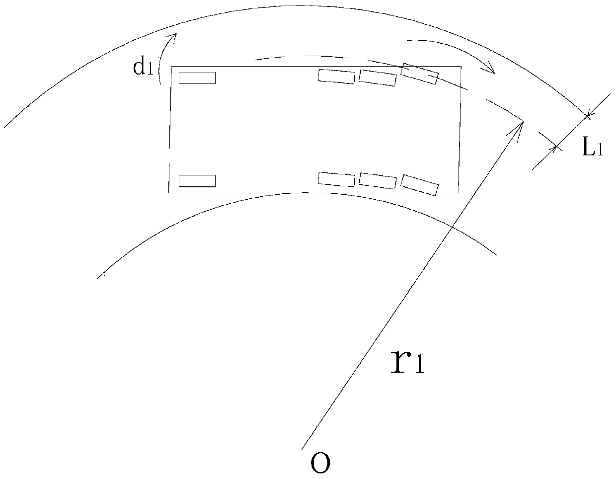
[0059] The front of the vehicle is provided with multiple rows of front wheels, and each row of front wheels corresponds to an independent steering device and a driving device, and each steering device and driving device are connected to a vehicle-mounted electronic ECU system, and the vehicle-mounted electronic ECU system is connected to the vehicle-mounted electronic ECU system. connected to the navigation system.
[0060] The vehicle-mounted electronic ECU system is connected with the vehicle-mounted panoramic camera device, and photographs the turning posture of the vehicle, specifically detects whether the vehicle is in the current lane, and feeds back the detection result to the vehicle-mounted electronic ECU system.
[0061] When the vehicle enters a curve, it first uses the first row of front wheels as the main steering wheel to make a turning action, ...
PUM
 Abstract
Description
Claims
Application Information
 - R&D
- Intellectual Property
- Life Sciences
- Materials
- Tech Scout
- Unparalleled Data Quality
- Higher Quality Content
- 60% Fewer Hallucinations
Browse by: Latest US Patents, China's latest patents, Technical Efficacy Thesaurus, Application Domain, Technology Topic, Popular Technical Reports.
© 2025 PatSnap. All rights reserved.Legal|Privacy policy|Modern Slavery Act Transparency Statement|Sitemap|About US| Contact US: help@patsnap.com