Intertidal Habitat Survey Method Based on UAV Aerial Photography
An intertidal zone and unmanned aerial vehicle technology is applied in the field of intertidal zone habitat survey based on drone aerial photography, which can solve the problems of heavy workload, difficulty in accurately determining the range of intertidal zone habitats, time-consuming and labor-intensive, etc.
- Summary
- Abstract
- Description
- Claims
- Application Information
AI Technical Summary
Problems solved by technology
Method used
Image
Examples
Embodiment 1
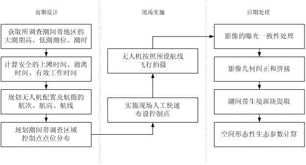
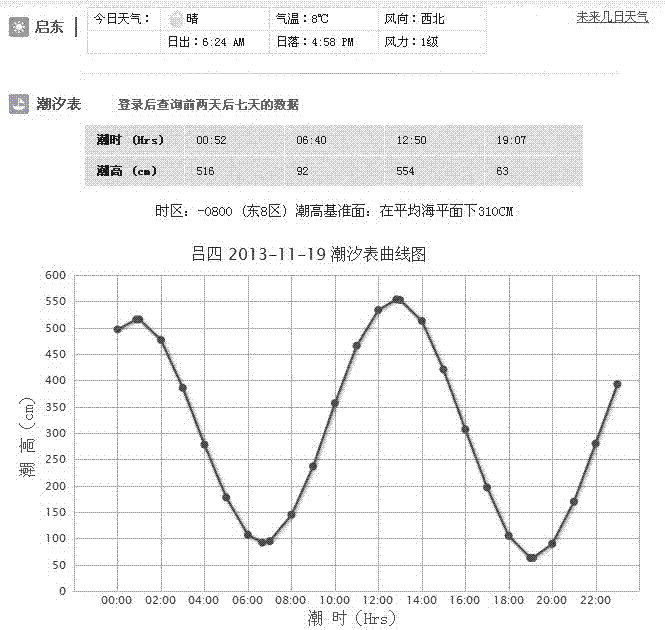
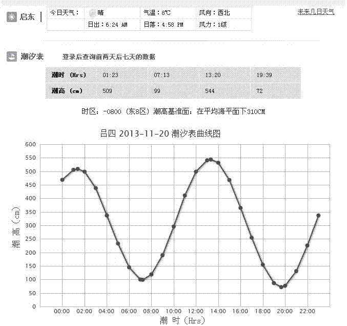
[0075] Embodiment 1: as figure 1 As shown, the following steps are included: In the research area, the UAV low-altitude aircraft is used as the remote sensing platform, and the UAV low-altitude aircraft can use a fixed-wing aircraft or a multi-rotor aircraft. The UAV low-altitude aircraft needs to be equipped with a digital camera and integrate a differential GPS and gyroscope attitude control module; query the tide table of the intertidal zone area to be investigated, and determine the specific time for the UAV aerial photography according to the spring tide period; according to the spring tide The exact time of the highest tide level and the lowest tide level of the period, determine the executable time period of the UAV aerial photography; according to the flight capability of the UAV, the shooting ability of the camera carried and the range of the intertidal zone to be investigated, plan the time period of the aerial photography Voyages and routes; according to the executa...
PUM
 Abstract
Description
Claims
Application Information
 - R&D Engineer
- R&D Manager
- IP Professional
- Industry Leading Data Capabilities
- Powerful AI technology
- Patent DNA Extraction
Browse by: Latest US Patents, China's latest patents, Technical Efficacy Thesaurus, Application Domain, Technology Topic, Popular Technical Reports.
© 2024 PatSnap. All rights reserved.Legal|Privacy policy|Modern Slavery Act Transparency Statement|Sitemap|About US| Contact US: help@patsnap.com


