Parameter estimation method of ps-dinsar surface deformation measurement based on optimal solution space search method
A space search and surface deformation technology, applied in the field of radar, can solve the problems of no parameter estimation method, estimation error, large estimation error, etc.
- Summary
- Abstract
- Description
- Claims
- Application Information
AI Technical Summary
Problems solved by technology
Method used
Image
Examples
Embodiment
[0080] The present invention is a PS-DInSAR surface deformation measurement parameter estimation method based on an optimized solution space search method, and the specific embodiments are as follows:
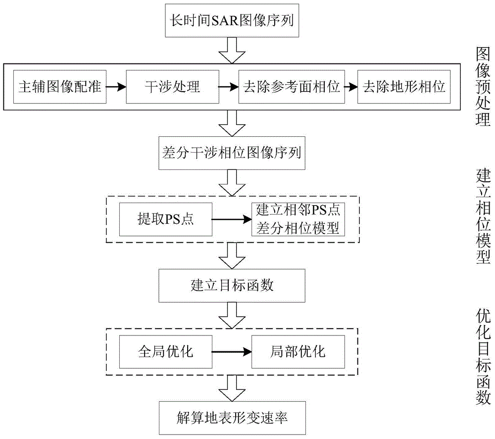
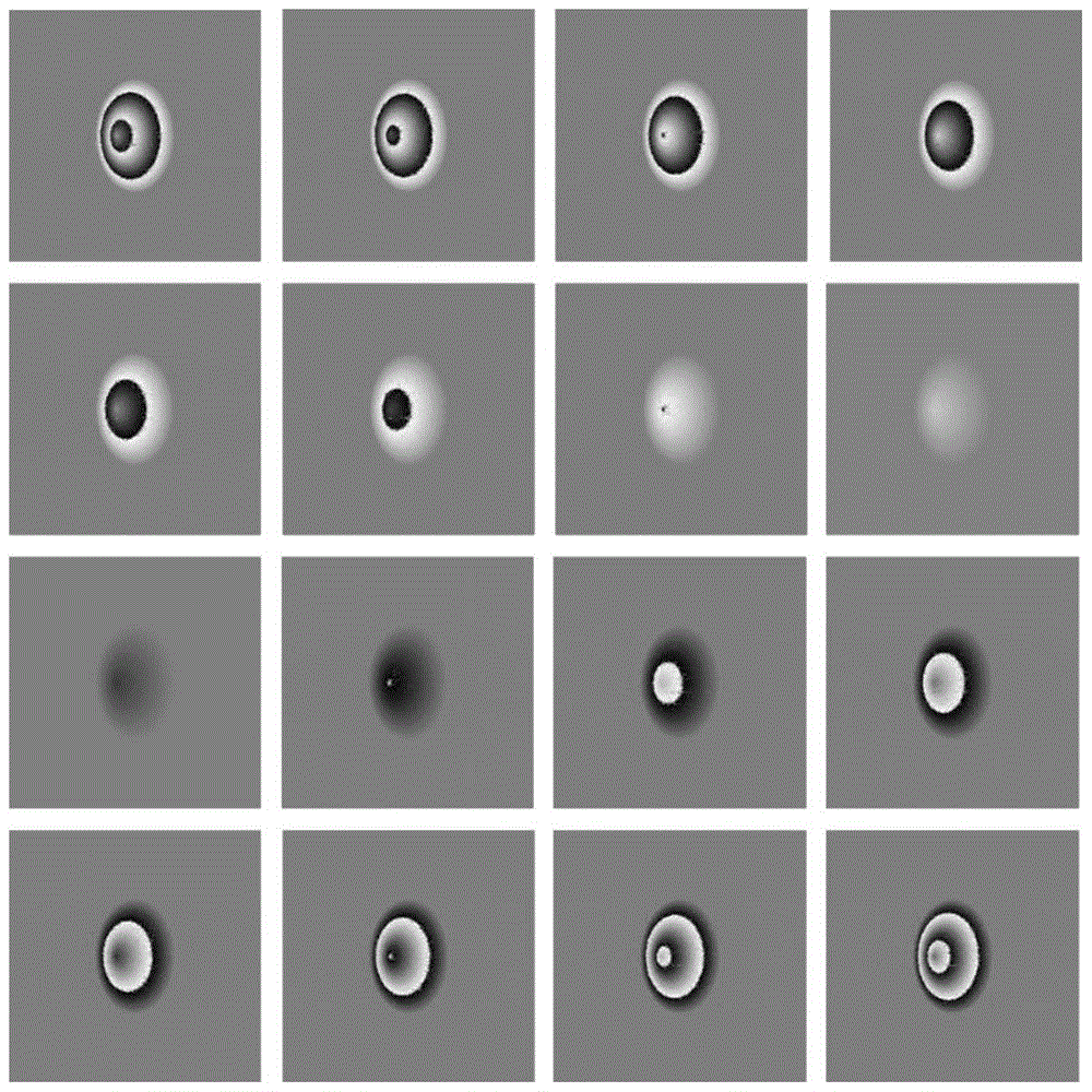
[0081] Step 1: Generate K+1=17 SAR images by simulation. In the center of the scene in the SAR image, there is a conical mountain peak with a diameter of 700m. Its height increases at a rate of 0.01m per year. The initial height is 119.96m. The elevation of other points in the scene is always zero except for the mountain peak. The SAR image sequence is generated at a sampling interval of 0.5 years, and the SAR image of the 4.5th year is selected as the main image, at this time the peak height is 120m, and the rest of the images are used as auxiliary images. Register each auxiliary image with the main image, and perform interference calculation, remove the reference plane phase and terrain phase, and obtain K differential interferometric phase images, such as figure 2 shown. ...
PUM
 Abstract
Description
Claims
Application Information
 - R&D
- Intellectual Property
- Life Sciences
- Materials
- Tech Scout
- Unparalleled Data Quality
- Higher Quality Content
- 60% Fewer Hallucinations
Browse by: Latest US Patents, China's latest patents, Technical Efficacy Thesaurus, Application Domain, Technology Topic, Popular Technical Reports.
© 2025 PatSnap. All rights reserved.Legal|Privacy policy|Modern Slavery Act Transparency Statement|Sitemap|About US| Contact US: help@patsnap.com


