A method and system for extending gis data structure based on ip address

A technology of IP address and data structure, which is applied in the field of Internet communication, can solve the problems of insufficient positioning and measurement methods of virtual space objects, and the inability to realize dynamic connection between cyberspace and real space, and achieve the effect of realizing dynamic connection and increasing network dimension

Active Publication Date: 2017-06-13
深圳华科育成科技开发有限公司
View PDF3 Cites 0 Cited by
  • Summary
  • Abstract
  • Description
  • Claims
  • Application Information

AI Technical Summary

Problems solved by technology

[0003] The embodiment of the present invention provides a method and system for expanding GIS data structure based on IP address, aiming at solving the problem of traditional GIS data structure and algorithm, the lack of positioning and measurement means for virtual space objects, and the inability to realize the dynamic connection between network space and real space The problem

Method used


Image

  • A method and system for extending gis data structure based on ip address
  • A method and system for extending gis data structure based on ip address
  • A method and system for extending gis data structure based on ip address

Examples


Embodiment Construction

[0024] In order to make the object, technical solution and advantages of the present invention clearer, the present invention will be further described in detail below in conjunction with the accompanying drawings and embodiments. It should be understood that what is described here is only a part of the embodiments of the present invention, rather than all the embodiments. Based on the embodiments of the present invention, all other embodiments obtained by persons of ordinary skill in the art without making creative efforts belong to the protection scope of the present invention.

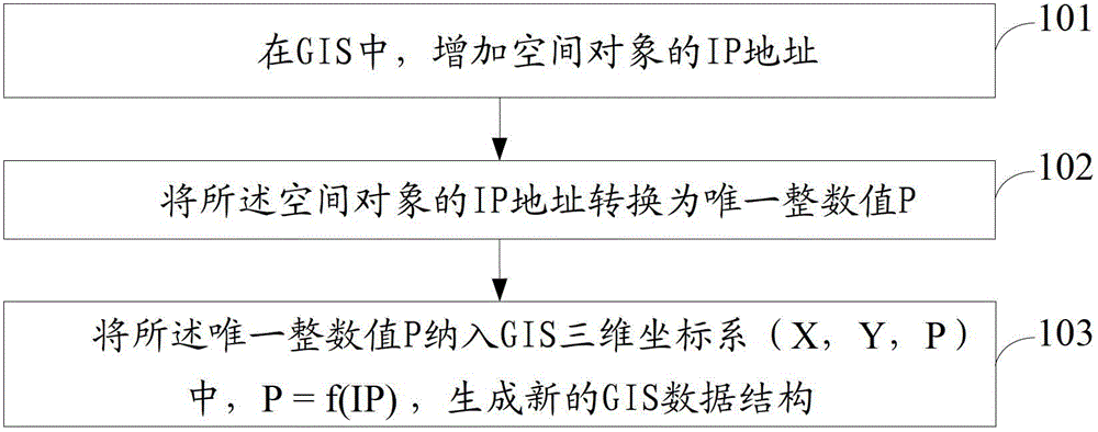
[0025] figure 1 It is a flow chart of the method for extending the GIS data structure based on the IP address provided by the embodiment of the present invention. For the convenience of description, only the parts related to the embodiment of the present invention are shown.

[0026] Such as figure 1 As shown, the method includes the following steps:

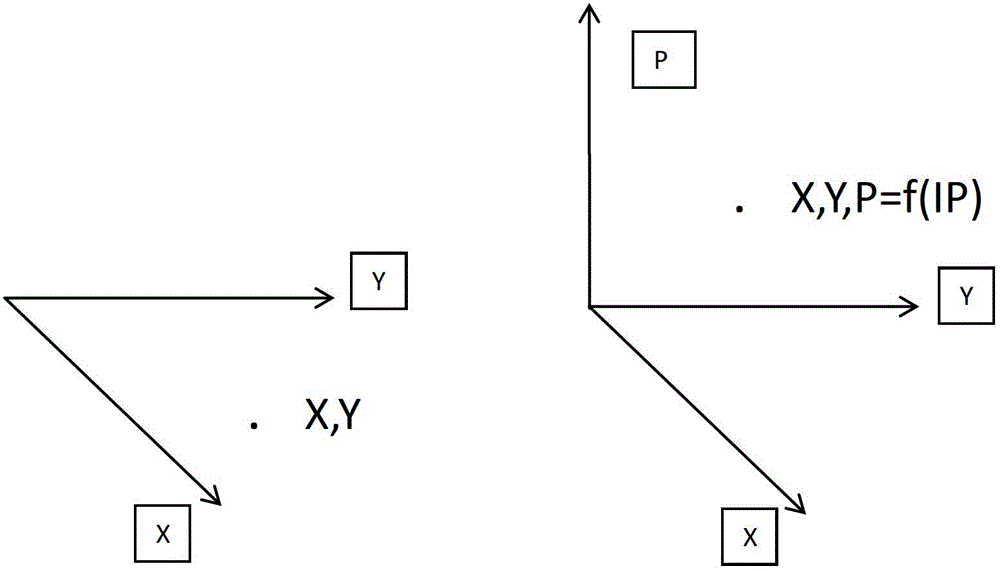
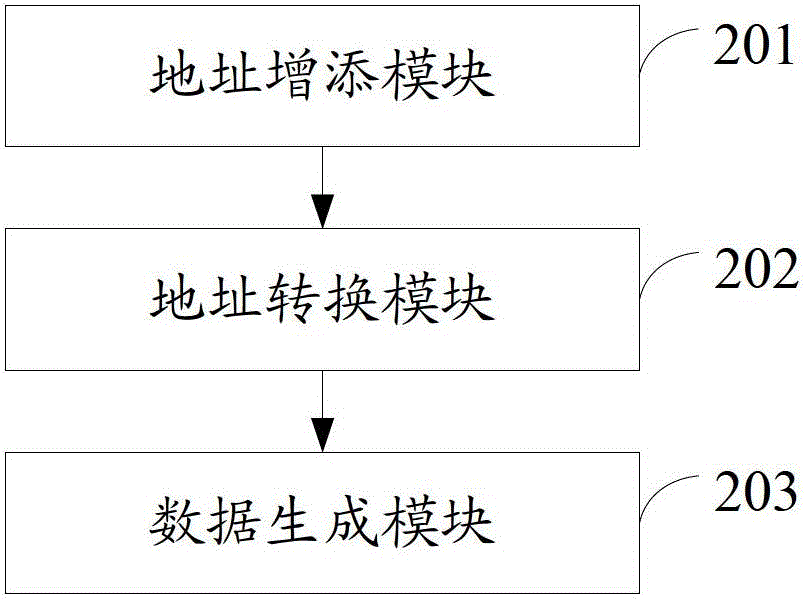
[0027] Step 101, in GIS, add the IP address ...


PUM


Abstract

The invention is applicable to the field of Internet communication, and provides a method for expanding a GIS (Geographic Information System) data structure on the basis of an IP (Internet Protocol) address. The method comprises the following steps that: in a GIS, the IP address of a spatial object is added; the IP address of the spatial object is converted into a unique integer value P; the unique integer value P is brought into a GIS three-dimensional coordinate system (X, Y, P), wherein P=f(IP); and a novel GIS data structure is generated. The method has the advantages that the converted IP address is used as the third dimension; the GIS data structure is expanded; the network dimensions are increased; and the dynamic connection between a network space and a real space is realized.

Description

technical field [0001] The invention belongs to the field of Internet communication, and in particular relates to a method and system for expanding GIS data structure based on IP addresses. Background technique [0002] Traditional GIS (Geographic Information System, Geographic Information System) data structures and algorithms are derived from real space and tangible entities. Although there are types of expansions that combine complex geographic objects, the positioning and measurement of virtual space objects is still in the exploratory stage. In the face of the interweaving and combination of "virtual-real" space on the Internet, relevant extensions should be made on top of traditional GIS data functions, and the key is to solve the mapping of network behavior in real space. IP is the basic dimension (network space coordinates) for the existence of all network objects. Accurately recording IP addresses in real space is equivalent to establishing a bridge corresponding to...

Claims


Application Information

Patent Timeline
Patent Type & Authority Patents(China)
IPC IPC(8): G06F17/30
CPCG06F16/29G06F16/9537H04L61/10
Inventor 修文群
Owner 深圳华科育成科技开发有限公司
Why Eureka
Try Eureka