Surveying and mapping method for ancient architecture by matching digital camera with measuring tool

A digital camera and matching measurement technology, applied in surveying and navigation, photogrammetry/video metrology, measuring devices, etc., can solve the cumbersome and time-consuming steps of setting up instruments, moving stations, and leveling instruments, and expensive measurement cameras , The instrument is inconvenient to carry and other problems, to achieve the effect of reducing costs, light tools, and easy to carry

Active Publication Date: 2014-03-19
徐州市勘察测绘研究院有限公司
View PDF6 Cites 7 Cited by
  • Summary
  • Abstract
  • Description
  • Claims
  • Application Information

AI Technical Summary

Problems solved by technology

[0004] ①Using single-point acquisition methods such as tape measure plus electronic theodolite or total station is slow and inefficient, and the instrument is inconvenient to carry, and the steps of setting up the instrument, moving the station, and leveling the instrument are cumbersome and time-consuming
[0005] ②Measurement camera adopts beam method for strict adjustment surveying and mapping, the internal orientation is known, fewer control points are required, the theory is more rigorous, and the solution accuracy is high, but the measurement camera is expensive
[0006] Therefore, in the surveying and mapping work, the single-point acquisition method or the measurement camera surveying and mapping have great limitations.

Method used


Image

  • Surveying and mapping method for ancient architecture by matching digital camera with measuring tool
  • Surveying and mapping method for ancient architecture by matching digital camera with measuring tool
  • Surveying and mapping method for ancient architecture by matching digital camera with measuring tool

Examples


Embodiment Construction

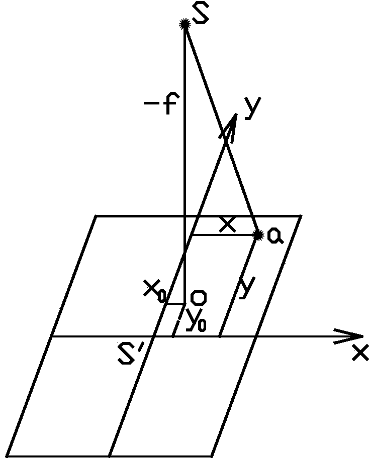
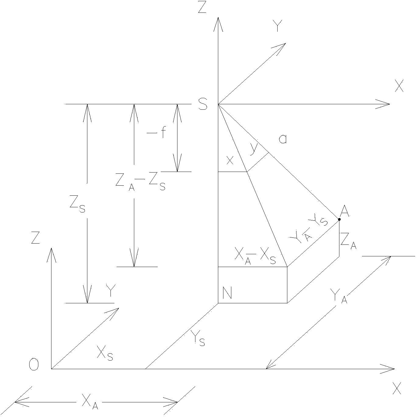
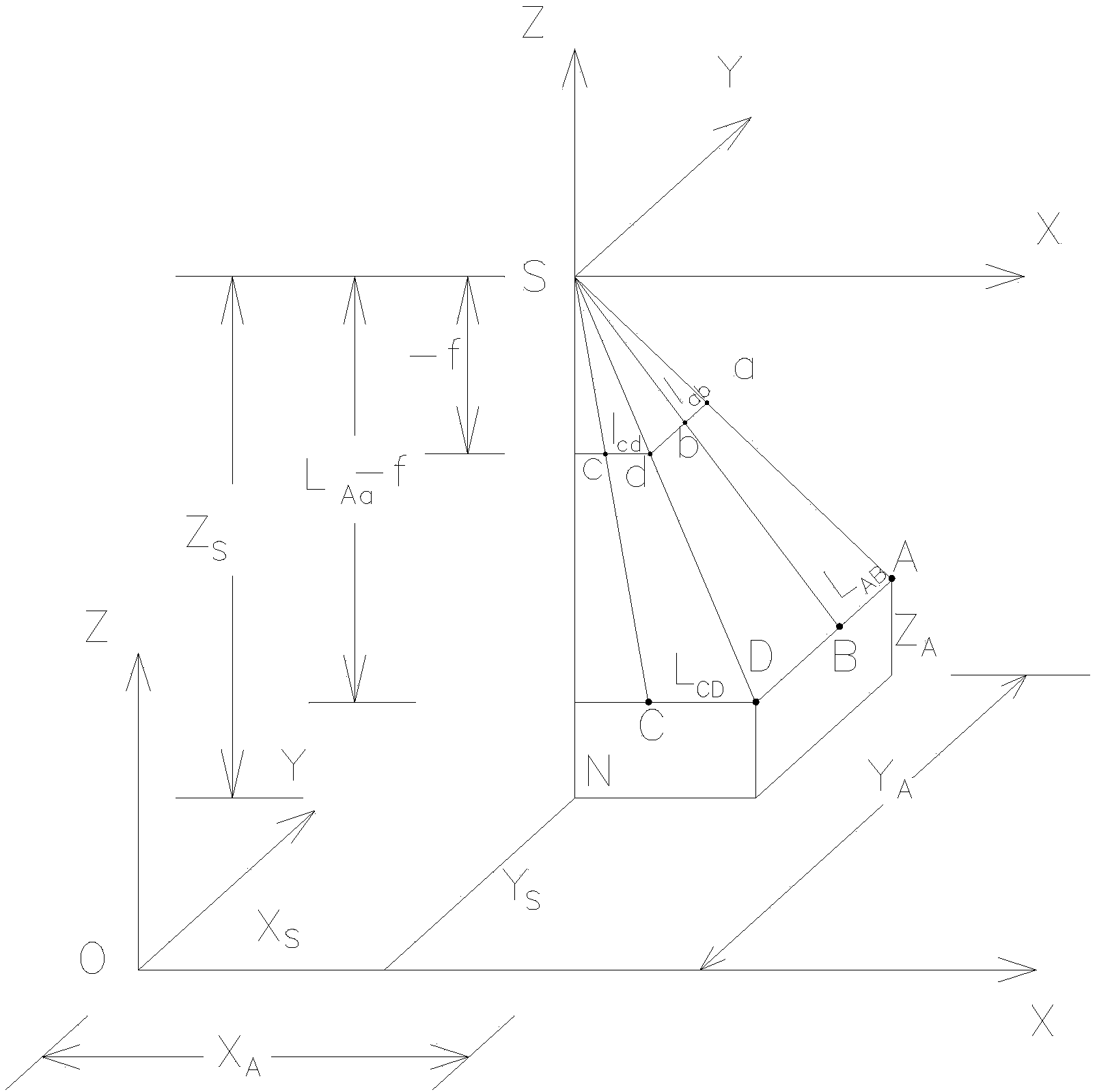
[0023] 1. Inner Orientation Elements

[0024] To use the photogrammetry method to study the spatial position and shape of the subject, the relationship between the object and the photograph must be known. The parameters describing the position and attitude of the photographic center and the photograph in the spatial coordinates set on the ground are called photographs. orientation elements. These orientation elements can be divided into inner orientation elements and outer orientation elements.

[0025] The inner orientation element is a parameter indicating the relative position between the photographic center and the photo, including three parameters, namely the vertical distance f (main distance) from the photographic center S to the photo and the coordinates of the principal point o in the image plane coordinate system x 0 、y 0 . x 0 、y 0 Also known as the inner directional element, it is used to restore the shape of the beam during central photography.

[0026] lik...


PUM


Abstract

The invention discloses a surveying and mapping method for an ancient architecture by matching a digital camera with a measuring tool. The digital camera and the measuring tool are taken as tools to measure vertical-face dimension of an architecture in a single-image mode under a condition that elements of interior orientation are not known and elements of exterior orientation are known or measurable; the surveying and mapping method specifically comprises the following steps: measuring a vertical distance between a photographing point and an external vertical face of the architecture by using the measuring tool; fixing horizontal and vertical standard rulers on the external vertical face of the architecture; keeping the digital camera in a horizontal state for photographing to obtain photos of a to-be-measured area, obtaining image space dimensions of the standard rulers by virtue of the photos; determining a scale value of the image space dimensions and an object space dimension in the horizontal direction and the vertical direction by utilizing proportional relation of similar triangles according to the image space dimension of the standard rulers; respectively obtaining the dimension of each part of the external vertical face of the architecture in the horizontal direction and the vertical direction according to the scale value of the image space dimensions and an object space dimension in the horizontal direction and the vertical direction. The method disclosed by the invention can simply and quickly measure the vertical face dimension of the architecture, and improves surveying and mapping precision and the working efficiency.

Description

technical field [0001] The invention relates to a method for surveying and mapping buildings by digital close-range photography, in particular to a method for surveying and mapping ancient buildings with digital cameras and measuring tools. Background technique [0002] Ancient architectural surveying and mapping is the basic link of protection, excavation, arrangement and effective development of ancient excellent architectural heritage. In the surveying and mapping of the front elevation, side elevation, and back elevation of a single building, because there is no frame, it is impossible to go up to the building to measure the height with a leather tape, or the artificial measurement behavior will cause certain damage to the building , so this type of elevation must be measured with the help of auxiliary tools, generally using single-point acquisition methods such as tape measure plus electronic theodolite or total station. [0003] Recently, close-range photogrammetry te...

Claims


Application Information

Patent Timeline
Patent Type & Authority Applications(China)
IPC IPC(8): G01C11/00
CPCG01C11/00G01C11/30
Inventor 宣卫红刘志峰陈晓洪陈育志陈斌戴军
Owner 徐州市勘察测绘研究院有限公司
Why Eureka
Try Eureka