An Elevation Inversion Method for Synthetic Aperture Radar Interferometry in Geosynchronous Orbit
A technology of synthetic aperture radar and geosynchronous orbit, which is applied in the direction of radio wave reflection/re-radiation, re-radiation, and measurement devices, and can solve the problems of target scene elevation error, interference model failure, and large difference
- Summary
- Abstract
- Description
- Claims
- Application Information
AI Technical Summary
Problems solved by technology
Method used
Image
Examples
Embodiment Construction
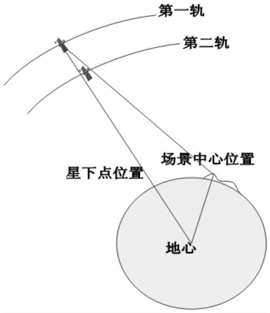
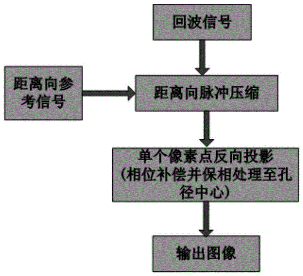
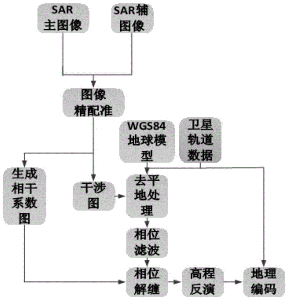
[0047] Combine below Figure 1 to Figure 10 The present invention is discussed in detail. The height inversion method of the geosynchronous orbit synthetic aperture radar interference of the present invention specifically includes the following steps:
[0048] Step 1. Select the orbit from which the GEO SAR obtains the interference data, and collect the interference data on the orbit.
[0049] Considering that the present invention uses interference processing for elevation inversion, it is necessary to use SAR image data obtained by GEO satellites for processing under a suitable orbit. Therefore, before performing the elevation inversion on the GEO SAR interference model in the present invention, the selection of the orbit of the GEO SAR to obtain the interference data is performed first, and the specific method is as follows:
[0050] Such as figure 1 As shown, first select the aperture center position of the first track according to the requirements, determine the latitude and lo...
PUM
 Abstract
Description
Claims
Application Information
 - Generate Ideas
- Intellectual Property
- Life Sciences
- Materials
- Tech Scout
- Unparalleled Data Quality
- Higher Quality Content
- 60% Fewer Hallucinations
Browse by: Latest US Patents, China's latest patents, Technical Efficacy Thesaurus, Application Domain, Technology Topic, Popular Technical Reports.
© 2025 PatSnap. All rights reserved.Legal|Privacy policy|Modern Slavery Act Transparency Statement|Sitemap|About US| Contact US: help@patsnap.com


