
Space remote sensing load imaging geometric distortion three-dimensional visualization simulation method

A technology of spaceflight remote sensing and geometric distortion, applied in the field of spaceflight remote sensing imaging, which can solve problems involving little or no imaging geometric distortion principle research and simulation implementation.

Active Publication Date: 2013-09-18
AEROSPACE INFORMATION RES INST CAS
View PDF2 Cites 0 Cited by
  • Summary
  • Abstract
  • Description
  • Claims
  • Application Information

AI Technical Summary

Problems solved by technology

However, the simulation of imaging geometric distortion of aerospace remote sensing sensors is less involved, and the principle of imaging geometric distortion at the probe level has not been studied and simulated.

Method used


Image

  • Space remote sensing load imaging geometric distortion three-dimensional visualization simulation method
  • Space remote sensing load imaging geometric distortion three-dimensional visualization simulation method
  • Space remote sensing load imaging geometric distortion three-dimensional visualization simulation method

Examples


Embodiment Construction

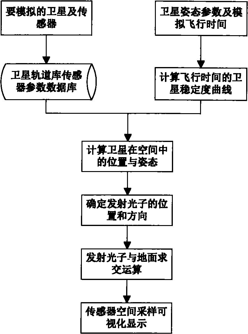
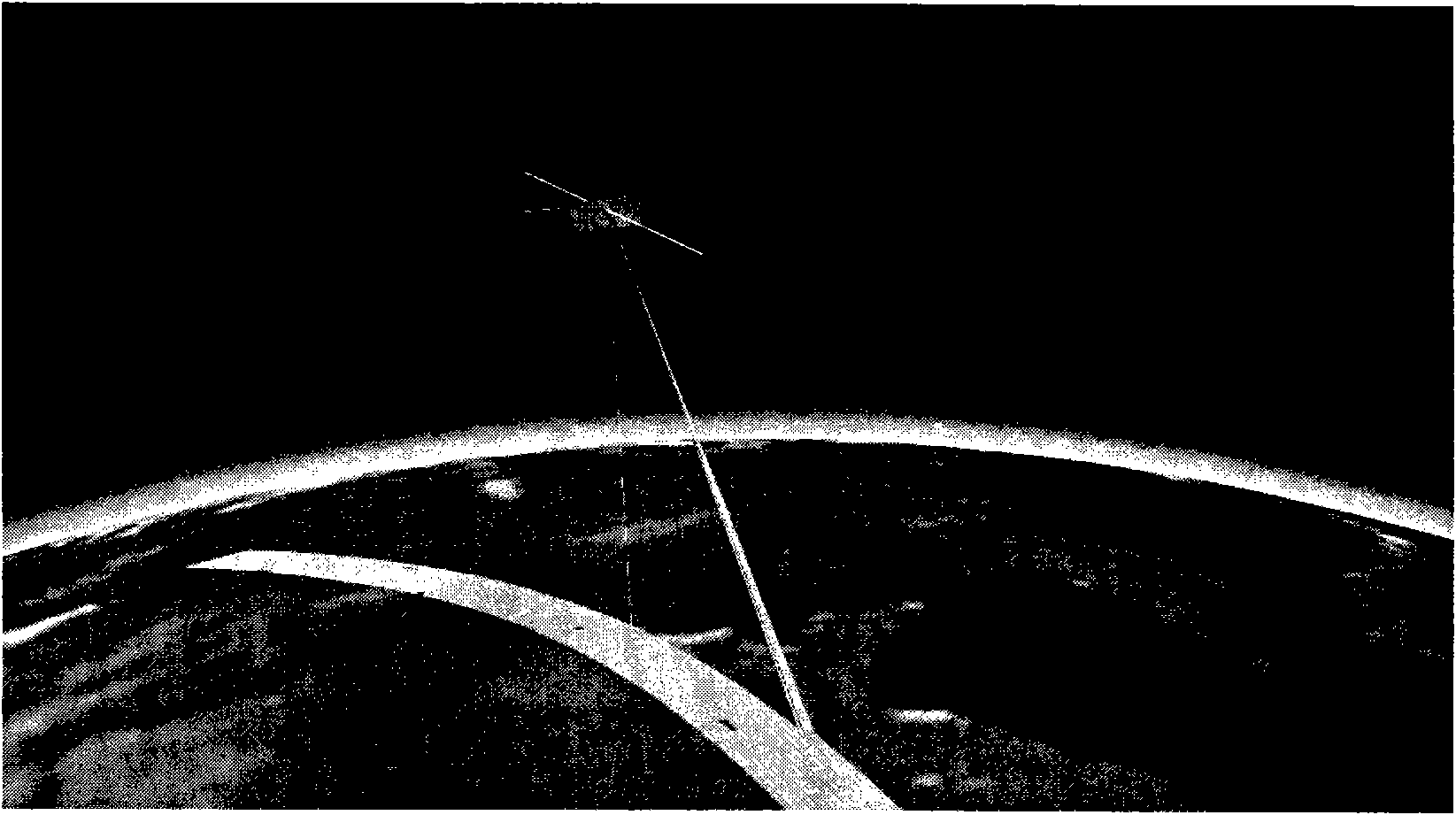
[0026] The three-dimensional visual simulation method of geometric distortion of aerospace remote sensing payload imaging of the present invention is based on the principle of aerospace remote sensing imaging and ray tracing technology, combined with coordinate conversion and projection conversion algorithms in computer graphics, it can simulate the light emitted by the sensor probe on the space platform in the DEM The ground position and range that can be photographed in the three-dimensional scene, and then obtain the geometric deformation of the remote sensing image due to the attitude change of the space platform, the sensor tilt and the terrain fluctuation.

[0027] The simulation flow chart of geometric distortion simulation of aerospace remote sensing payload imaging is as follows: figure 1 As shown, a three-dimensional earth model is constructed in the space Cartesian coordinate system, and DEM data is loaded to simulate different surface fluctuations; according to the ...


PUM


Abstract

The invention discloses a space remote sensing load imaging geometric distortion three-dimensional visualization simulation method which specifically comprises the steps that: (1) a three-dimensional earth model is constructed under a space right-angle coordinate system; (2) a space platform is constructed in the three-dimensional earth model according to the parameters of the space platform; (3) the spatial position and the direction of the light emitted by a sensor are determined according to the parameters of the sensor on the space platform; (4) intersection calculation is carried out on the light emitted by the sensors on a three-dimensional terrain scene and the space platform, and the image geometric distortion of a space remote sensing image in a topographic state; and (5) a result is re-displayed in a virtual environment of a computer through a 3D graphic visualization technology. By the space remote sensing load imaging geometric distortion three-dimensional visualization simulation method, the cause for geometric distortion when the image is captured during the flying process of the space remote sensing platform is analyzed, so that the physical phenomenon in which the geometric distortion of the space remote sensing image is produced is disclosed with an effective graphic. And the space remote sensing load imaging geometric distortion three-dimensional visualization simulation method supports the research on a space remote sensing imaging mechanism through man-machine data and graphic interaction.

Description

technical field [0001] The invention relates to the field of aerospace remote sensing imaging, in particular to a three-dimensional visualization simulation method for geometric distortion of aerospace remote sensing payload imaging. Background technique [0002] With the in-depth development of computer graphics and virtual reality technology, 3D visualization technology has been widely used in many fields. By using 3D graphics to display the simulation process and simulation results interactively in real time, it can provide users with more comprehensive and intuitive information. And provide a platform for experts in different fields to communicate and exchange with each other. my country's aerospace remote sensing has developed to the present, and the visual simulation technology of remote sensing imaging is also required, that is, by applying various parameters of satellites and sensors to computer graphics and image processing technology. [0003] In "Space Visual Sim...

Claims


Application Information

Patent Timeline
Patent Type & Authority Patents(China)
IPC IPC(8): G06T17/00G06T17/05
Inventor 顾行发余涛臧文乾胡新礼郭红周珂赖积保谢东海
Owner AEROSPACE INFORMATION RES INST CAS
Learn More