Navigation method and navigation equipment
A navigation method and technology of navigation equipment, applied in the field of vehicle navigation, can solve problems such as easy errors in congested road sections, easy errors in judging whether the road section ahead is congested, etc., and achieve the effect of saving user time or economic costs and high-quality navigation services
- Summary
- Abstract
- Description
- Claims
- Application Information
AI Technical Summary
Problems solved by technology
Method used
Image
Examples
Embodiment 1
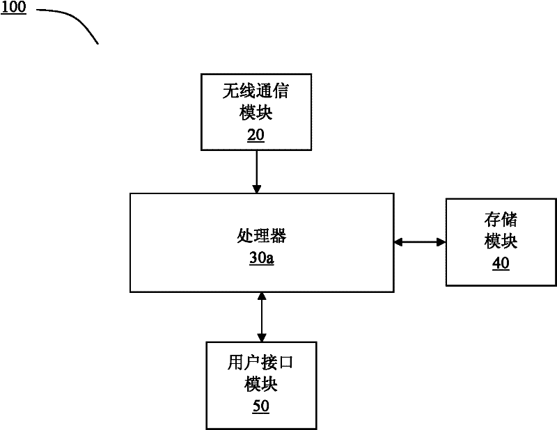
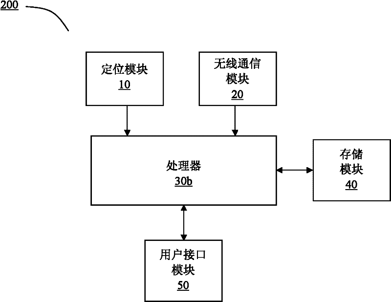
[0117] Step 1. The location service terminal obtains the location information of the current terminal in real time by receiving satellite navigation data, and obtains real-time traffic information at a certain time interval (for example, 5 minutes). Ways to obtain real-time traffic information include: receiving traffic information channel (TMC) information through FM fixed frequency band; receiving TMC information through China Mobile Multimedia Broadcasting (CMMB) receiving channel; obtaining TMC information through GPRS network.
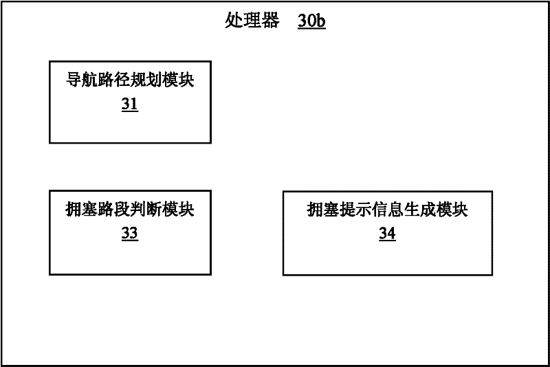
[0118] Step 2. The location service terminal plans the navigation route according to the current location and the destination information input by the user. The newly acquired real-time traffic information is taken into consideration when planning the route. length, if the length of the congested road section exceeds a certain value (for example, 500m), the congested road section will be avoided when planning the route.
Embodiment 2
[0120] Step 1. The location service terminal obtains the location information of the current terminal in real time by receiving satellite navigation data, and obtains real-time traffic information at a certain time interval (such as 5 minutes), and at the same time, the location service terminal provides navigation services for the user according to the pre-planned route ( vehicle driving guidance);
[0121] Step 2. Each time the location service terminal obtains real-time traffic information, it checks whether there is a congested path ahead of the currently planned path;
[0122] Step 3. If it is found that there is a congested road section on the route ahead according to the latest real-time traffic information, and then obtain the length of the congested road section, if the length of the congested road section exceeds a certain value (for example, 500m), then ask the user whether to divert or Automatically plan new paths for users.
Embodiment 3
[0124] Step 1. The location service terminal obtains the location information of the current terminal in real time by receiving satellite navigation data, and obtains real-time traffic information at a certain time interval (such as 5 minutes), and at the same time, the location service terminal provides navigation services for the user according to the pre-planned route ( vehicle driving guidance);
[0125] Step 2, the location service terminal detects whether there is a congested road section within a certain distance (for example 5km) ahead of the path according to the latest acquired TMC information at a certain time interval (for example 2 minutes or 3 minutes);
[0126] Step 3. If it is found that there is a congested road section on the route ahead according to the latest real-time traffic information, and then obtain the length of the congested road section, if the length of the congested road section exceeds a certain value (for example, 500m), then ask the user whethe...
PUM
 Abstract
Description
Claims
Application Information
 - Generate Ideas
- Intellectual Property
- Life Sciences
- Materials
- Tech Scout
- Unparalleled Data Quality
- Higher Quality Content
- 60% Fewer Hallucinations
Browse by: Latest US Patents, China's latest patents, Technical Efficacy Thesaurus, Application Domain, Technology Topic, Popular Technical Reports.
© 2025 PatSnap. All rights reserved.Legal|Privacy policy|Modern Slavery Act Transparency Statement|Sitemap|About US| Contact US: help@patsnap.com


