Method for measuring surface temperature field of gangue mountain based on total station and thermal infrared imager
A technology of infrared thermal imager and surface temperature, which is applied in the fields of surveying and mapping and environmental monitoring, and can solve problems such as the inability to determine the spatial position and the inability to obtain spatial information
- Summary
- Abstract
- Description
- Claims
- Application Information
AI Technical Summary
Problems solved by technology
Method used
Image
Examples
Embodiment Construction
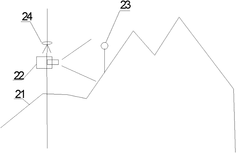
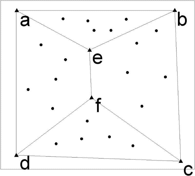
[0030] A method for measuring the surface temperature field of coal gangue hills based on a total station and an infrared thermal imager proposed by the present invention is described in detail in conjunction with the accompanying drawings and embodiments as follows:
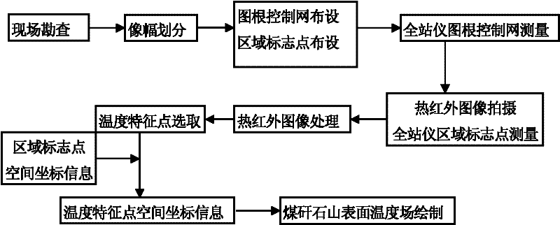
[0031] A method for measuring the surface temperature field of coal gangue hills based on a total station and an infrared thermal imager according to the present invention is as follows: figure 1 shown, including the following steps;
[0032] 1) Region and image division: Conduct on-site surveys to determine the surface area and topographical characteristics of the coal gangue hill, and divide the coal gangue into several regions according to the size of the infrared thermal imaging camera’s image, and each region corresponds to one of the infrared thermal imaging cameras. From this, the number of gangue hill areas and the number of infrared imaging images can be calculated. In order to ensure the accuracy, the...
PUM
 Abstract
Description
Claims
Application Information
 - R&D
- Intellectual Property
- Life Sciences
- Materials
- Tech Scout
- Unparalleled Data Quality
- Higher Quality Content
- 60% Fewer Hallucinations
Browse by: Latest US Patents, China's latest patents, Technical Efficacy Thesaurus, Application Domain, Technology Topic, Popular Technical Reports.
© 2025 PatSnap. All rights reserved.Legal|Privacy policy|Modern Slavery Act Transparency Statement|Sitemap|About US| Contact US: help@patsnap.com


