
Best fit map searching

a map and best fit technology, applied in the field of best fit map search, can solve the problems of difficult to take in the displayed information, visual overlay and information loss, disorienting users, undesirable, etc., and achieve the effect of optimizing the display of maps, minimizing or avoiding graphical results

Active Publication Date: 2011-11-15
R2 SOLUTIONS
View PDF9 Cites 20 Cited by
  • Summary
  • Abstract
  • Description
  • Claims
  • Application Information

AI Technical Summary

Benefits of technology

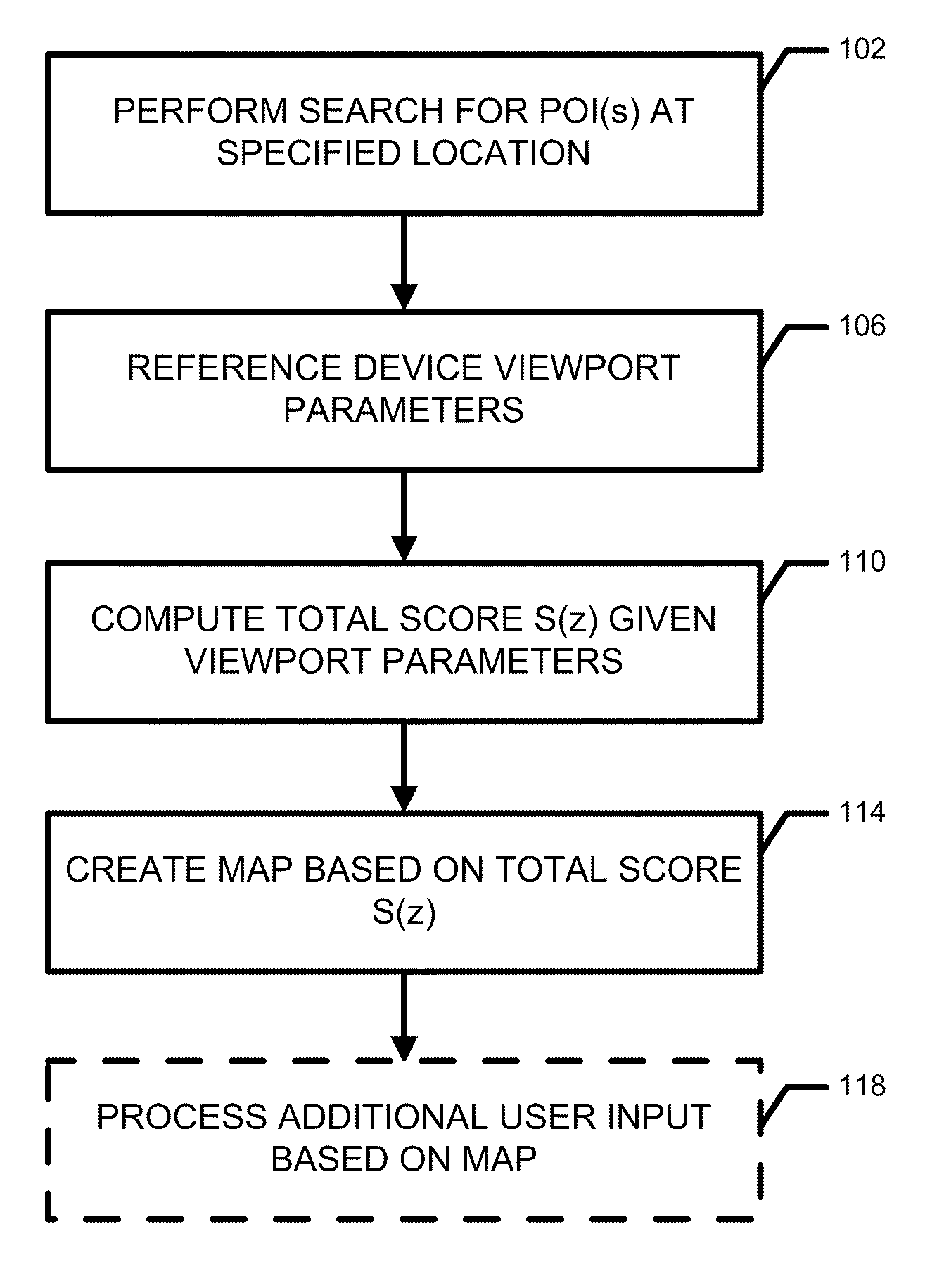
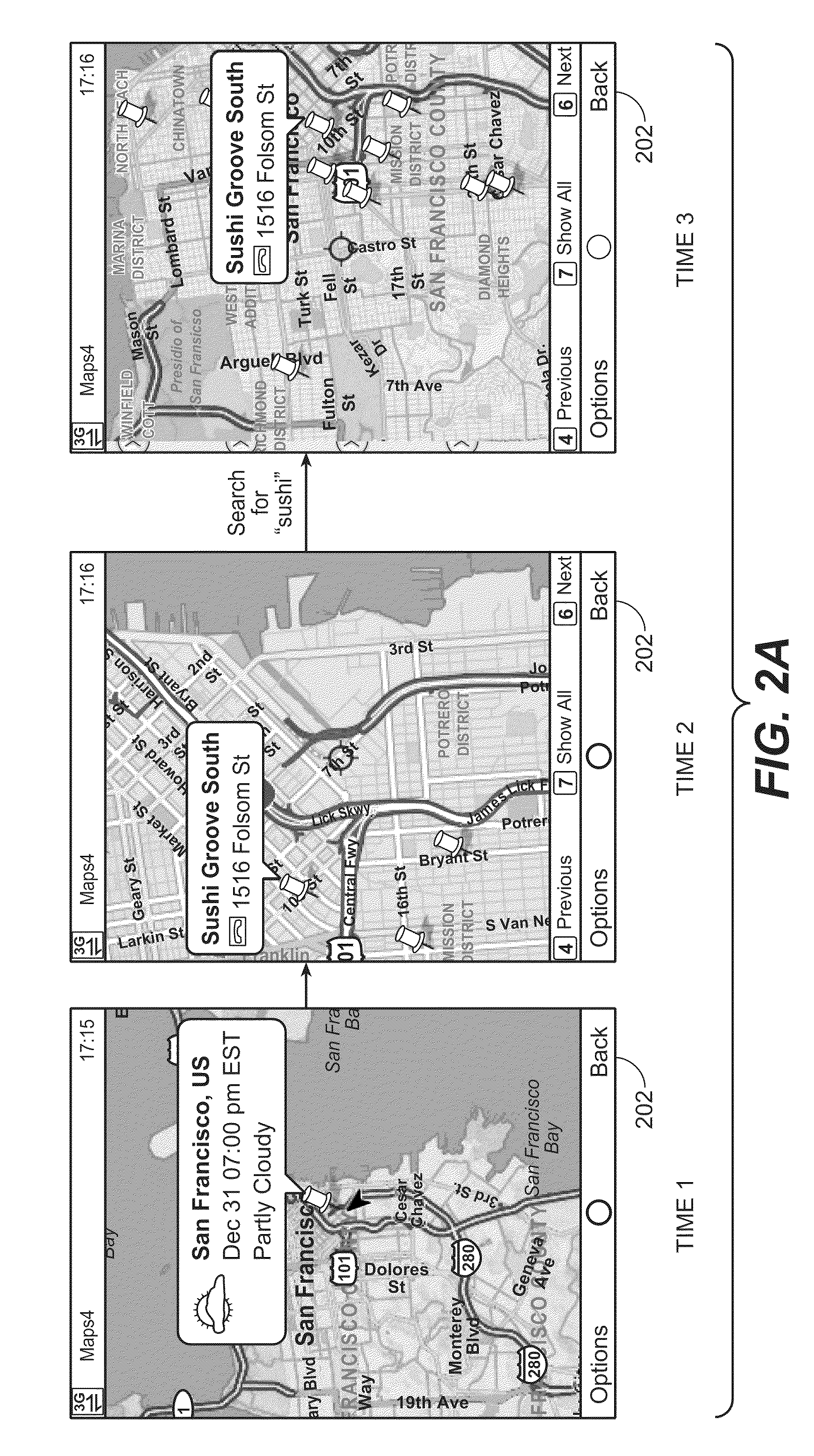
[0005]Embodiments of the invention produce an optimized display of maps especially useful in mobile handheld devices with comparatively small screens. The systems and methods factor in scoring functions, visibility, and empirical data on readability and / or user preference of map levels to provide optimal map based results to users. This minimizes or avoids graphical results that overlap each other.

Problems solved by technology

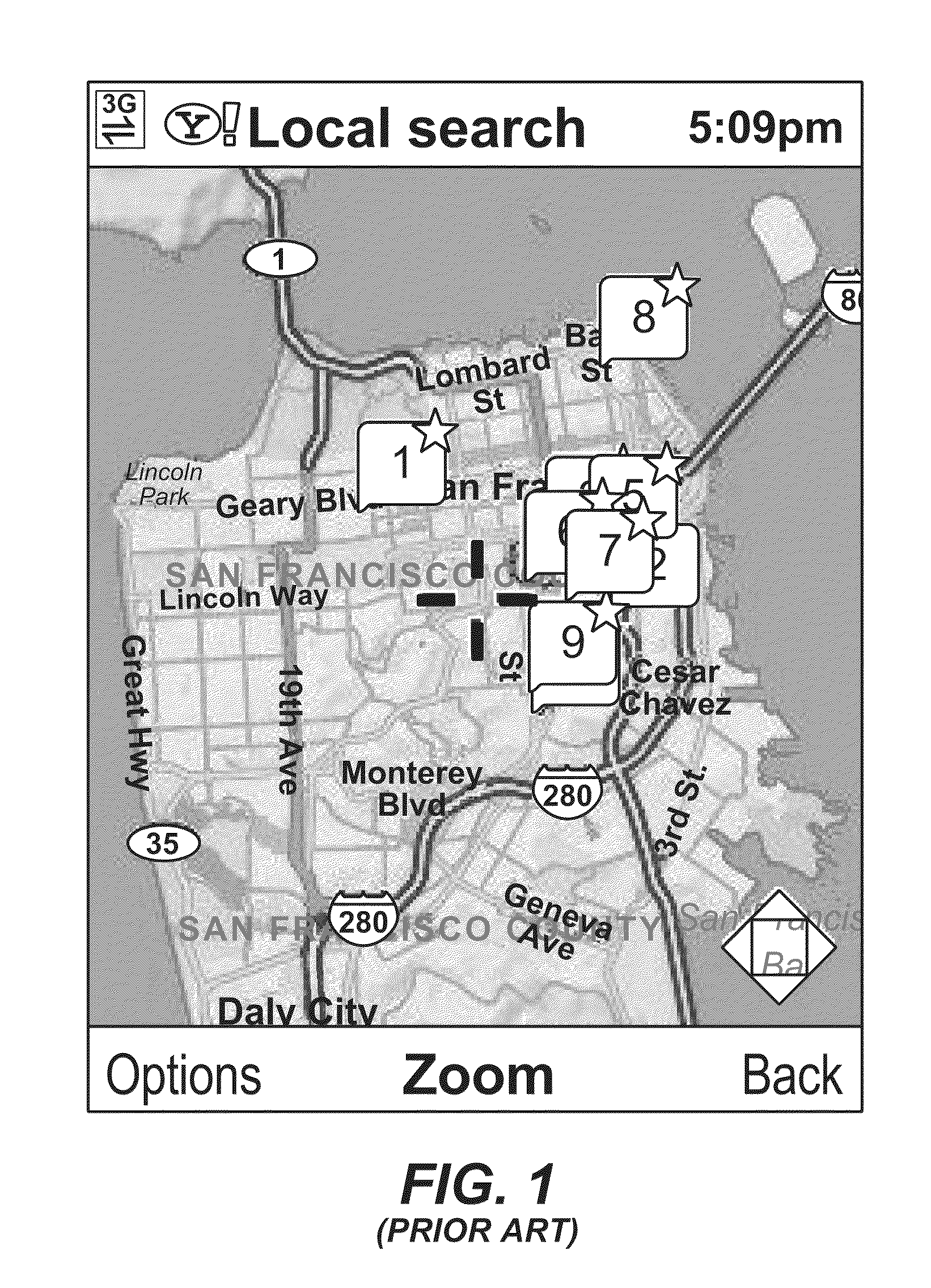
This makes taking in the displayed information rather difficult.
In particular, it suffers from the following drawbacks: 1) the zoom level may be too high resulting in loss of location context; 2.) if panning occurs in addition to a zoom change, further loss of location context results; and 3.) if there are outlier results, some outlier results, bunching of results in closer proximity to the desired location will result in visual overlay and information loss.
Other prior solutions may result in a better distribution, but move the center of the displayed map in order to do so, which is disorienting to users and undesirable.

Method used


Image

  • Best fit map searching
  • Best fit map searching
  • Best fit map searching

Examples


examples

[0058]The tables in FIGS. 3A and 3B illustrate examples of the best fit technique as used in a search to determine the best fit for results of a search for sushi at a first location, and for a McDonalds at a second location, respectively. The score in the right hand column is the total score S(z), as shown in equation (1) above, reproduced below for convenience:

S(z)=((F1+ . . . +Fn)*V(z, Point[Pz])*G(z)) / n,   (1)

[0059]For each zoom level 1-8 (9-17 not shown) G(z), one scoring function (F1) and V(z) are shown, along with the resulting total score S(z).

[0060]In FIG. 3A, the sushi search was done to find sushi at latitude / longitude 37.77916, −122.420067. Each of zoom levels 4 and 5 achieved a total score S(z) of 0.2, the highest of any of the levels. In this example, either level 4 or 5 would be used as the best fit for the particular search results. In other words, either of these levels would, at the original map center of latitude / longitude 37.77916, −122.420067, most clearly displa...


PUM


Abstract

A search engine computer system is configured to produce an optimized display of maps especially useful in mobile handheld devices with comparatively small screens. The system factors in scoring functions, visibility, and empirical data on map levels to provide optimal map based results to users. This minimizes or avoids graphical results that overlap each other.

Description

CROSS REFERENCE TO RELATED APPLICATION[0001]This application claims the benefit of provisional application No. 61 / 152,667 to Ghanekar, Cheng and Hänikel, filed on Feb. 13, 2009, which is hereby incorporated by reference in the entirety.BACKGROUND OF THE INVENTION[0002]This invention relates generally to searching and to maps, and more specifically to organization and display of a map containing information relevant to a search.[0003]FIG. 1 shows one prior technique and device for displaying search results on a map. In this technique, all the results up to a certain number are displayed. This makes taking in the displayed information rather difficult. In particular, it suffers from the following drawbacks: 1) the zoom level may be too high resulting in loss of location context; 2.) if panning occurs in addition to a zoom change, further loss of location context results; and 3.) if there are outlier results, some outlier results, bunching of results in closer proximity to the desired ...

Claims


Application Information

Patent Timeline
Patent Type & Authority Patents(United States)
IPC IPC(8): G06F3/048G06F17/30
CPCG06F17/30241H04M1/27455H04M1/72572G06F16/29H04M1/27475H04M1/72457Y10S707/921
Inventor GHANEKAR, JOYCHENG, JERRYHANIKEL, DENIS
Owner R2 SOLUTIONS
Learn More