
System and method for accurately computing the position of wireless devices inside high-rise buildings

a wireless device and position accuracy technology, applied in the field of system and method for deploying a network of wireless devices, can solve the problems of unsuitability of gps technique for terrestrial-based networks operating in the environment, and the gps technique is very susceptible to measurement errors

Active Publication Date: 2007-04-10
ARRIS ENTERPRISES LLC
View PDF147 Cites 77 Cited by
  • Summary
  • Abstract
  • Description
  • Claims
  • Application Information

AI Technical Summary

Benefits of technology

The present invention provides a system and method for deploying a network of wireless devices in a three-dimensional deployment structure, allowing for communication, identification, and position calculations regardless of building structure. The system includes Mobile Terminals, Wireless Routers, and Controllers, which can be deployed in random positions within the structure. Communication and position calculations are provided at each level or floor by Horizontal and Vertical Routers, with the Vertical Routers being used to communicate between levels. The system also includes Intelligent Access Points for communication between Routers and Controllers, as well as a map database for downloading, maintaining, and updating. Overall, the invention allows for efficient and effective deployment of wireless devices in complex structures.

Problems solved by technology

Despite the fact that the GPS technique has been in use for a considerable period of time and most of the world's navigation relies on this technique, the GPS technique is very susceptible to errors in measurement.
Certain other tests also demonstrate that the GPS technique is unsuitable for those terrestrial-based networks operating in environment where the number of available satellites is too small for providing good precision as in underground tunnels, inside buildings, under dense foliage or in urban “canyons”.

Method used


Image

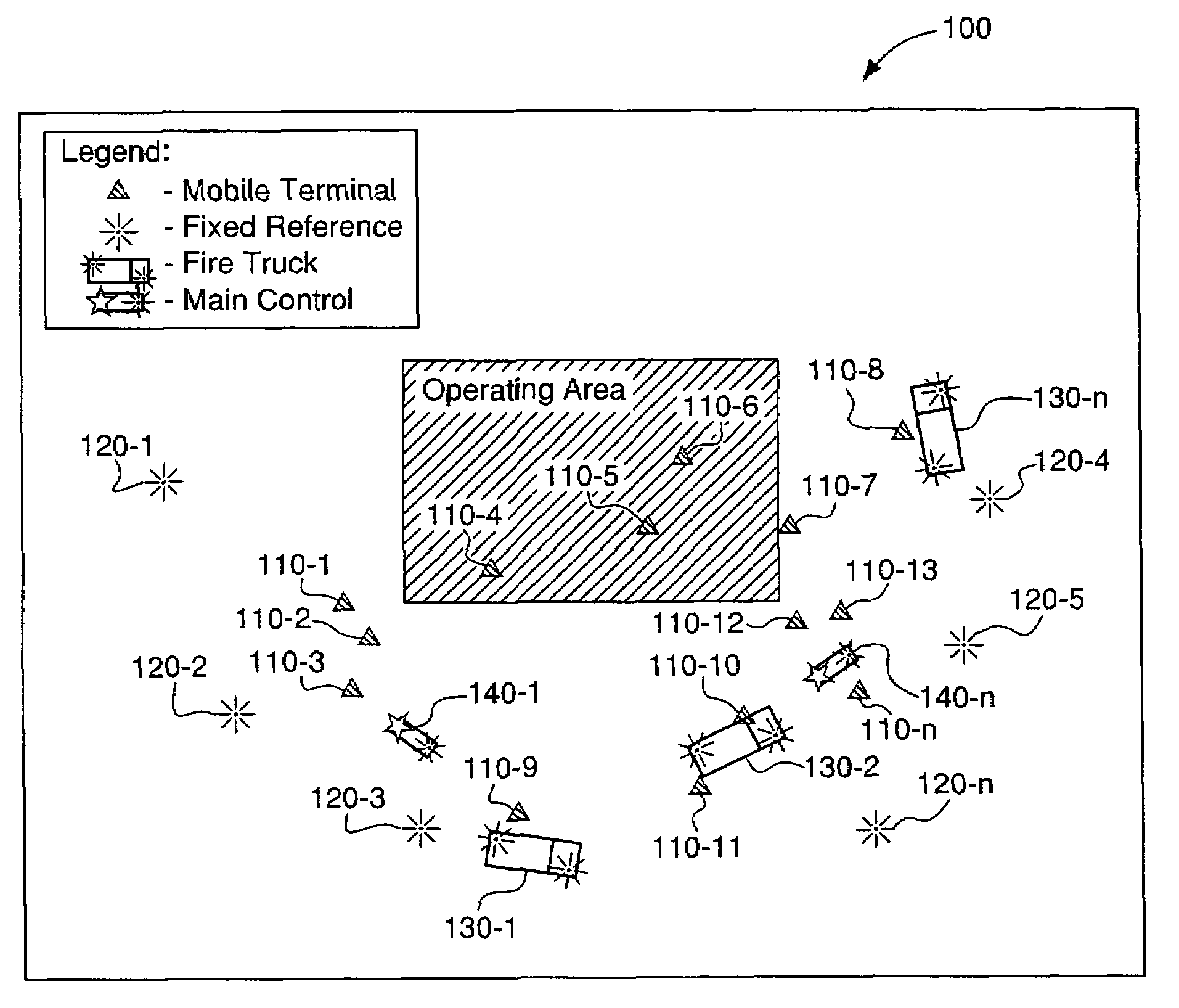
  • System and method for accurately computing the position of wireless devices inside high-rise buildings
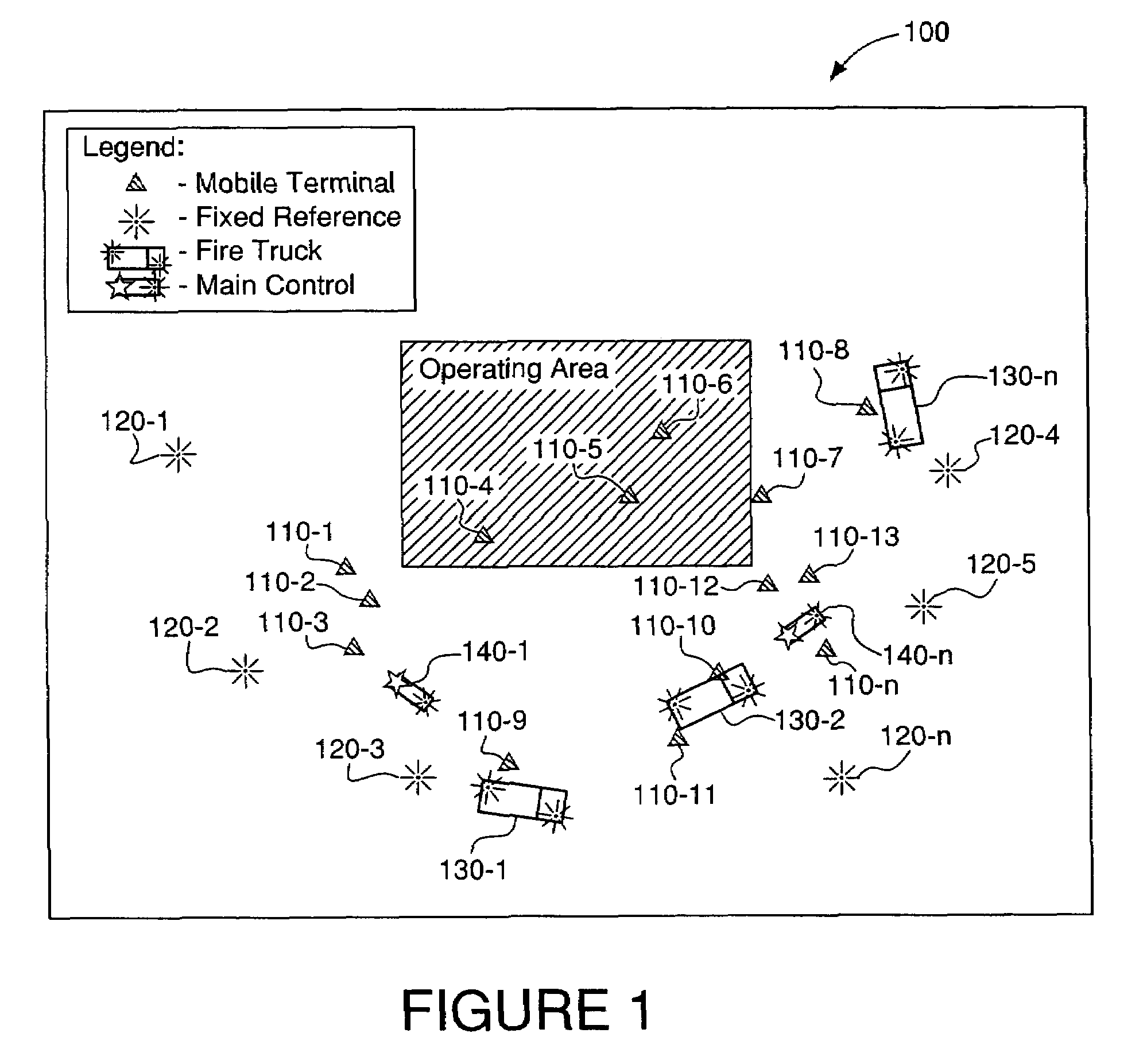
  • System and method for accurately computing the position of wireless devices inside high-rise buildings
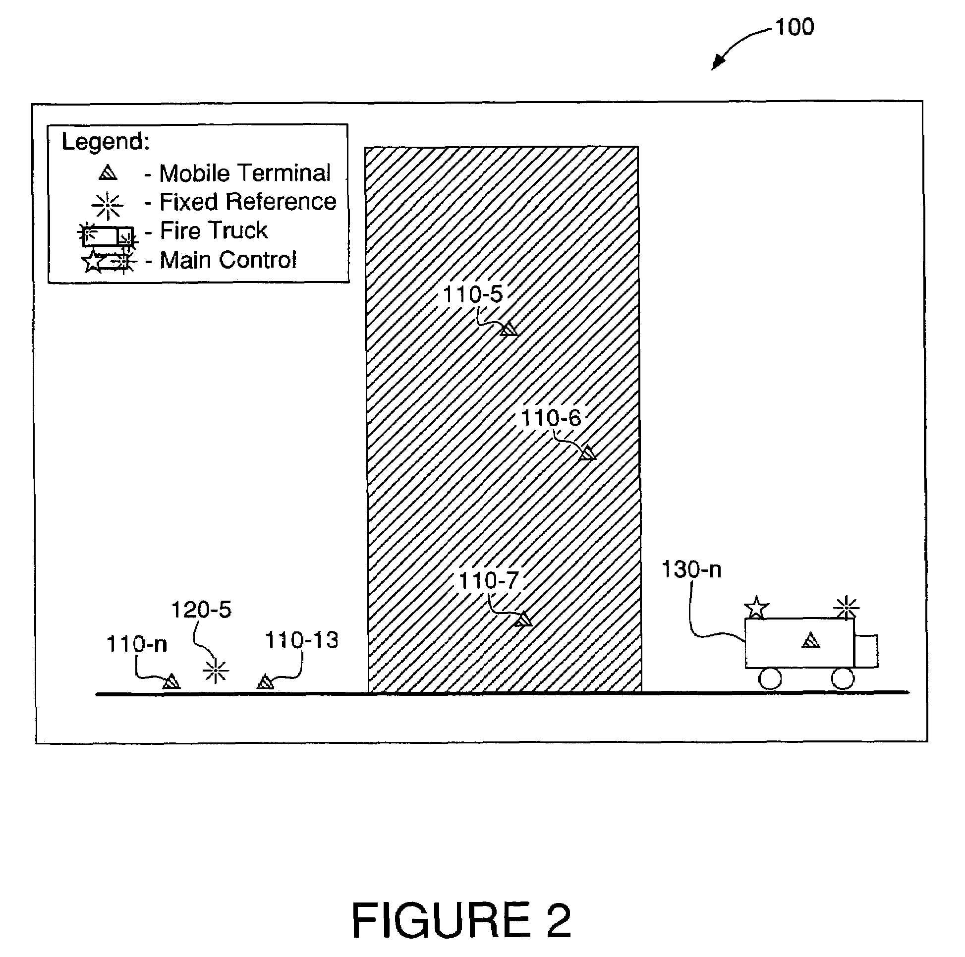
  • System and method for accurately computing the position of wireless devices inside high-rise buildings

Examples


Embodiment Construction

[0030]The embodiments of the present invention described below each include a system and method for accurately computing the position of wireless devices in a three-dimensional network, such as a network distributed throughout a high-rise building using specific nodes, such as wireless routers. The system and method described below can provide very precise indoor location of mobile devices, such as MEA™ devices, that are located in three-dimensional networks. The functionality of the system and method is broader than a communication system having location capabilities, and serves primarily as a location system with communications capabilities. This allows the embodiments described below to incorporate predefined routing, which almost eliminates the need for exchanging routing messages, while supporting the exchange of a very large number of location specific messages that contributes to the increased precision of computation.

[0031]As noted above, the location of personnel operating ...


PUM


Abstract

A system and method for providing a network of wireless devices including Mobile Terminals, Wireless Routers and a Local Control within a high rise building or other three dimensional deployment structure, such that communication, identification and position calculations can be achieved regardless of environment nature. Mobile Terminals are deployed to assume any random positions within a three dimensional deployment structure. Communication and position calculations are provided at each level, or floor of the building, by Horizontal and Vertical Routers, where Vertical Routers are further used to successfully communicate between levels, or floors. The Vertical Routers provide communication links with the Local Controller via one or more Intelligent Access Points. The infrastructure of Vertical and Horizontal routers, the Intelligent Access Points and the Local Control are elements of an infrastructure deployed before a fire incident or other emergency happens. In emergency situations the infrastructure emerges with ad-hoc deployed elements creating a system that assures stable communication, identification and accurate computation of location for all participants to emergency action.

Description

[0001]The present application claims benefit under 35 U.S.C. § 119(e) from a U.S. Provisional Patent Application of John M. Belcea et al. entitled “System and Method for Identifying the Floor Number Where a Firefighter in Need of Help is Located Using Received Signal Strength Indicator and Signal Propagation Time”, Ser. No. 60 / 546,942, filed on Feb. 24, 2004, from a U.S. Provisional Patent Application of John M. Belcea, entitled “System and Method for Accurately Computing the Position of Wireless Devices Inside High-Rise Buildings”, Ser. No. 60 / 476,167, filed on Jun. 6, 2003, and from a U.S. Provisional Patent Application of John M. Belcea, entitled “MAC Protocol for Accurately Computing the Position of Wireless Devices Inside Buildings”, Ser. No. 60 / 476,232, filed on Jun. 6, 2003, the entire contents of each application being incorporated herein by reference.BACKGROUND OF THE INVENTION[0002]1. Field of the Invention[0003]The present invention relates to a system and method for depl...

Claims


Application Information

Patent Timeline
Patent Type & Authority Patents(United States)
IPC IPC(8): H04Q7/20G01S5/02G06FH04B7/005H04B7/212H04L12/28H04L12/56H04L29/08H04W24/00H04W40/00H04W52/46H04W64/00H04W74/04H04W84/18H04W92/18
CPCG01S5/0252H04W52/46H04L67/18H04L67/12H04W64/00H04W24/00H04W40/00H04W74/04H04W84/18H04W92/18H04L67/52G01S5/0278H04W4/02
Inventor BELCEA, JOHN M.
Owner ARRIS ENTERPRISES LLC
Learn More